Property Record
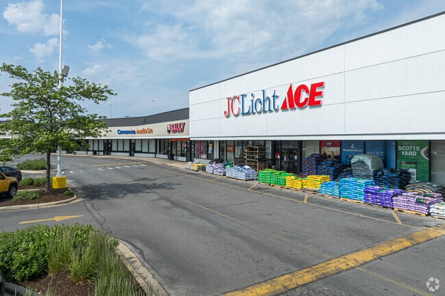
3145 S Ashland Ave, Chicago, IL 60608

NEARBY LISTINGS FOR SALE OR LEASE
Property Detail
3145 S Ashland Ave
Chicago-Naperville-Elgin, IL-IN-WI
Assessors Divn Of Pt Nw & Wh Ne Sec32
17-32-100-012-0000
(DECREETS) SUB OF LTS21-23 IN A LYNCHS SUB OF THE SOU TH PT OF NH WH NW SEC 32-39-14
Regionalshoppingcenterormallwithanchorstore
Cook
A
Illinois
17031C0508J
21-23
2023
11.35 AC
2024
South Chicago
843200
Chicago
169,435 SF
DEMOGRAPHICS near 3145 S Ashland Ave
1 Mile
3 Mile
5 Mile
2024 Total Population
25,080
308,287
885,982
2029 Population
23,260
289,472
846,441
Pop Growth 2024-2029
(7.26%)
(6.10%)
(4.46%)
Average Age
38
37
37
2024 Total Households
9,291
119,209
377,126
HH Growth 2024-2029
(7.70%)
(5.86%)
(3.94%)
Median Household Inc
$66,376
$57,023
$67,471
Avg Household Size
2.60
2.40
2.20
2024 Avg HH Vehicles
1.00
1.00
1.00
Median Home Value
$330,671
$315,629
$332,482
Median Year Built
1947
1956
1963
Nearby Places
Map Layers
Map Styles
 Street
 Aerial
- Restaurants
- Banks
- Shops
- Fitness
- Groceries
PUBLIC TRANSPORTATION
TRANSIT/SUBWAY
Ashland Station (Orange Line) (Orange Line - Chicago Transit Authority "L" Trains (The "L"))
DRIVE
WALK
Distance
Ashland Station (Orange Line) (Orange Line - Chicago Transit Authority "L" Trains (The "L"))
1 min
5 min
0.3 mi
COMMUTER RAIL
35Th St. - Lou Jones (Rock Island - Metra)
DRIVE
WALK
Distance
35Th St. - Lou Jones (Rock Island - Metra)
6 min
2.4 mi
Western Avenue Station (Bnsf) (Burlington Northern-Santa Fe Railway Line - Northeast Illinois Regional Commuter Railroad (Metra))
DRIVE
WALK
Distance
Western Avenue Station (Bnsf) (Burlington Northern-Santa Fe Railway Line - Northeast Illinois Regional Commuter Railroad (Metra))
6 min
2.5 mi
AIRPORT
Chicago Midway International
DRIVE
WALK
Distance
Chicago Midway International
12 min
6.8 mi
Chicago O'Hare International
DRIVE
WALK
Distance
Chicago O'Hare International
33 min
20.1 mi
Freight Ports
Port Milwaukee
DRIVE
WALK
Distance
Port Milwaukee
111 min
88.4 mi
SALE & LEASE HISTORY
LISTING DATE
SALE/LEASE

May 08, 2017
For Lease
Jan 23, 2017
For Lease
Apr 23, 2021
For Lease
Nearby Properties
Address
Land Use
TOTAL SIZE
Lot Size
Zoning
Address
Land Use
TOTAL SIZE
Lot Size
Zoning
2,750,656 SF
6.29 AC
PD 1065
Address
Land Use
TOTAL SIZE
Lot Size
Zoning
1,215,367 SF
3.76 AC
PD 675
Address
Land Use
TOTAL SIZE
Lot Size
Zoning
1.44 AC
PD 30
Address
Land Use
TOTAL SIZE
Lot Size
Zoning
1,252,885 SF
0.99 AC
PD 499
Address
Land Use
TOTAL SIZE
Lot Size
Zoning
474,979 SF
29.67 AC
PD 553
Address
Land Use
TOTAL SIZE
Lot Size
Zoning
979,674 SF
6.01 AC
PD 924
Address
Land Use
TOTAL SIZE
Lot Size
Zoning
662,088 SF
4.91 AC
PD 504
Address
Land Use
TOTAL SIZE
Lot Size
Zoning
590,844 SF
0.80 AC
PD 26
Address
Land Use
TOTAL SIZE
Lot Size
Zoning
626,055 SF
1.86 AC
PD 523
Address
Land Use
TOTAL SIZE
Lot Size
Zoning
408,203 SF
2.02 AC
DS-5
Address
Land Use
TOTAL SIZE
Lot Size
Zoning
0.85 AC
DS-3
Address
Land Use
TOTAL SIZE
Lot Size
Zoning
717,953 SF
1.37 AC
DX-16
Address
Land Use
TOTAL SIZE
Lot Size
Zoning
325,558 SF
Address
Land Use
TOTAL SIZE
Lot Size
Zoning
587,125 SF
1.10 AC
PD 1298
Address
Land Use
TOTAL SIZE
Lot Size
Zoning
496,992 SF
1.86 AC
PD 523
Address
Land Use
TOTAL SIZE
Lot Size
Zoning
4.11 AC
M2-3
Address
Land Use
TOTAL SIZE
Lot Size
Zoning
611,160 SF
2.36 AC
PD 523
Address
Land Use
TOTAL SIZE
Lot Size
Zoning
134,800 SF
2.53 AC
PD 1273
Address
Land Use
TOTAL SIZE
Lot Size
Zoning
728,610 SF
PD 225
Address
Land Use
TOTAL SIZE
Lot Size
Zoning
0.35 AC
PD 1317
Address
Land Use
TOTAL SIZE
Lot Size
Zoning
548,210 SF
1.11 AC
PD 681
Address
Land Use
TOTAL SIZE
Lot Size
Zoning
508,816 SF
1.11 AC
DX-7,PD 49
Address
Land Use
TOTAL SIZE
Lot Size
Zoning
24,100 SF
0.31 AC
DX-12
Address
Land Use
TOTAL SIZE
Lot Size
Zoning
111,322 SF
1 AC
DS-5
Address
Land Use
TOTAL SIZE
Lot Size
Zoning
4.85 AC
PD 1505
Address
Land Use
TOTAL SIZE
Lot Size
Zoning
1.82 AC
PD 30
Address
Land Use
TOTAL SIZE
Lot Size
Zoning
1,000 SF
0.33 AC
PD 1326
Address
Land Use
TOTAL SIZE
Lot Size
Zoning
250,040 SF
15.70 AC
PD 1169
Address
Land Use
TOTAL SIZE
Lot Size
Zoning
542,503 SF
7.78 AC
PD 523
Address
Land Use
TOTAL SIZE
Lot Size
Zoning
13.54 AC
The World's #1 Commercial Real Estate Marketplace
Connect with us
© 2025 CoStar Group
The information above has been obtained from sources believed reliable. While we do not doubt its accuracy we have not verified it and make no guarantee, warranty or representation about it. It is your responsibility to independently confirm its accuracy and completeness. Any projections, opinions, assumptions, or estimates used are for example only and do not represent the current or future performance of the property. The value of this transaction to you depends on tax and other factors which should be evaluated by your tax, financial, and legal advisors. You and your advisors should conduct a careful, independent investigation of the property to determine to your satisfaction the suitability of the property for your needs.