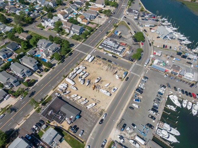
Property Record
315 Broadway, Point Pleasant Beach, NJ 08742

NEARBY LISTINGS FOR SALE OR LEASE
Property Detail
315 Broadway
New York-Jersey City-White Plains, NY-NJ
Borough/Point Pleasant Beach
26-00167-0000-00011
65X80
Vacantlandnec
Ocean
AE
New Jersey
34029C0206G
11
2024
0.12 AC
2025
Ocean County
710101
Northern New Jersey
DEMOGRAPHICS near 315 Broadway
1 Mile
3 Mile
5 Mile
2024 Total Population
8,102
55,438
111,469
2029 Population
8,754
58,325
117,076
Pop Growth 2024-2029
+ 8.05%
+ 5.21%
+ 5.03%
Average Age
45
44
44
2024 Total Households
3,499
22,446
45,375
HH Growth 2024-2029
+ 7.95%
+ 5.11%
+ 4.78%
Median Household Inc
$118,647
$120,018
$105,624
Avg Household Size
2.30
2.40
2.40
2024 Avg HH Vehicles
2.00
2.00
2.00
Median Home Value
$694,270
$621,329
$489,140
Median Year Built
1958
1966
1971
Nearby Places
Map Layers
Map Styles
 Street
 Aerial
- Restaurants
- Banks
- Shops
- Fitness
- Groceries
PUBLIC TRANSPORTATION
COMMUTER RAIL
Point Pleasant Beach (North Jersey Coast Line - NJ Transit Commuter Rail (NJ Transit))
DRIVE
WALK
Distance
Point Pleasant Beach (North Jersey Coast Line - NJ Transit Commuter Rail (NJ Transit))
2 min
14 min
0.7 mi
Manasquan (North Jersey Coast Line - NJ Transit Commuter Rail (NJ Transit))
DRIVE
WALK
Distance
Manasquan (North Jersey Coast Line - NJ Transit Commuter Rail (NJ Transit))
4 min
2.0 mi
Freight Ports
New York Container Terminal
DRIVE
WALK
Distance
New York Container Terminal
64 min
49.3 mi
SALE & LEASE HISTORY
LISTING DATE
SALE/LEASE

Dec 27, 2022
For Sale
Nearby Properties
Address
Land Use
TOTAL SIZE
Lot Size
Zoning
Address
Land Use
TOTAL SIZE
Lot Size
Zoning
22,660 SF
164.35 AC
4
Address
Land Use
TOTAL SIZE
Lot Size
Zoning
50.10 AC
C
Address
Land Use
TOTAL SIZE
Lot Size
Zoning
4,078 SF
0.01 AC
3
Address
Land Use
TOTAL SIZE
Lot Size
Zoning
21,850 SF
30.98 AC
R-1A
Address
Land Use
TOTAL SIZE
Lot Size
Zoning
3.46 AC
3
Address
Land Use
TOTAL SIZE
Lot Size
Zoning
5,000 SF
22.50 AC
R-4
Address
Land Use
TOTAL SIZE
Lot Size
Zoning
17.66 AC
1E
Address
Land Use
TOTAL SIZE
Lot Size
Zoning
34,337 SF
99.30 AC
R-1
Address
Land Use
TOTAL SIZE
Lot Size
Zoning
64,757 SF
11.81 AC
MLHB
Address
Land Use
TOTAL SIZE
Lot Size
Zoning
84,297 SF
42.37 AC
CR40
Address
Land Use
TOTAL SIZE
Lot Size
Zoning
49,170 SF
8.38 AC
HB80
Address
Land Use
TOTAL SIZE
Lot Size
Zoning
3,792 SF
7.64 AC
R-1A
Address
Land Use
TOTAL SIZE
Lot Size
Zoning
5.53 AC
R-5
Address
Land Use
TOTAL SIZE
Lot Size
Zoning
10.52 AC
R-5
Address
Land Use
TOTAL SIZE
Lot Size
Zoning
15.94 AC
R-2
Address
Land Use
TOTAL SIZE
Lot Size
Zoning
63,136 SF
10.31 AC
R-1A
Address
Land Use
TOTAL SIZE
Lot Size
Zoning
13.21 AC
HD12
Address
Land Use
TOTAL SIZE
Lot Size
Zoning
18,058 SF
6.09 AC
R-50
Address
Land Use
TOTAL SIZE
Lot Size
Zoning
2,408 SF
4.84 AC
B-2
Address
Land Use
TOTAL SIZE
Lot Size
Zoning
320 SF
1.55 AC
1E
Address
Land Use
TOTAL SIZE
Lot Size
Zoning
2.40 AC
R-2
Address
Land Use
TOTAL SIZE
Lot Size
Zoning
75,697 SF
12.46 AC
R-3
Address
Land Use
TOTAL SIZE
Lot Size
Zoning
21 AC
ROS
Address
Land Use
TOTAL SIZE
Lot Size
Zoning
1.20 AC
3
Address
Land Use
TOTAL SIZE
Lot Size
Zoning
1.13 AC
3
Address
Land Use
TOTAL SIZE
Lot Size
Zoning
128,164 SF
12.94 AC
OR-5
Address
Land Use
TOTAL SIZE
Lot Size
Zoning
30,646 SF
2.36 AC
C50
Address
Land Use
TOTAL SIZE
Lot Size
Zoning
5,798 SF
1.10 AC
RC
Address
Land Use
TOTAL SIZE
Lot Size
Zoning
36,000 SF
10.15 AC
H200
Address
Land Use
TOTAL SIZE
Lot Size
Zoning
2.73 AC
RC
The World's #1 Commercial Real Estate Marketplace
Connect with us
© 2025 CoStar Group
The information above has been obtained from sources believed reliable. While we do not doubt its accuracy we have not verified it and make no guarantee, warranty or representation about it. It is your responsibility to independently confirm its accuracy and completeness. Any projections, opinions, assumptions, or estimates used are for example only and do not represent the current or future performance of the property. The value of this transaction to you depends on tax and other factors which should be evaluated by your tax, financial, and legal advisors. You and your advisors should conduct a careful, independent investigation of the property to determine to your satisfaction the suitability of the property for your needs.