Property Record
315 Chestnut St, Atlantic, IA 50022


NEARBY LISTINGS FOR SALE OR LEASE
-
-
View all Atlantic listings for sale on LoopNet.com
Property Detail
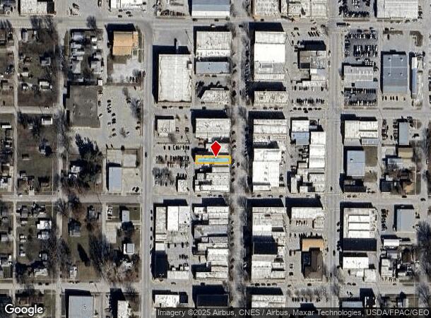
315 Chestnut St
303005134001000
Atlantic
Storebuilding
LOT 7 BLK 13 LOT 7 BLK 13
X
Cass
19029C0170E
Iowa
2024
7
2024
0.08 AC
190500
Iowa West Area
7,000 SF
Other Market Areas
DEMOGRAPHICS near 315 Chestnut St
1 Mile
3 Mile
5 Mile
2024 Total Population
4,619
7,203
7,554
2029 Population
4,623
7,192
7,537
Pop Growth 2024-2029
+ 0.09%
(0.15%)
(0.23%)
Average Age
42
43
43
2024 Total Households
2,103
3,279
3,429
HH Growth 2024-2029
0.00%
(0.21%)
(0.26%)
Median Household Inc
$46,476
$52,309
$52,653
Avg Household Size
2.10
2.10
2.10
2024 Avg HH Vehicles
2.00
2.00
2.00
Median Home Value
$126,958
$138,721
$138,598
Median Year Built
1954
1959
1959
Nearby Places
Map Layers
Map Styles
 Street
 Aerial
- Restaurants
- Banks
- Shops
- Fitness
- Groceries
SALE & LEASE HISTORY
LISTING DATE
SALE/LEASE

Mar 13, 2024
For Sale
Nearby Properties
Address
Land Use
TOTAL SIZE
Lot Size
Zoning
Address
Land Use
TOTAL SIZE
Lot Size
Zoning
1,200 SF
63.89 AC
Address
Land Use
TOTAL SIZE
Lot Size
Zoning
6,022 SF
38.65 AC
Address
Land Use
TOTAL SIZE
Lot Size
Zoning
157,769 SF
24.86 AC
Address
Land Use
TOTAL SIZE
Lot Size
Zoning
11,584 SF
1.84 AC
Address
Land Use
TOTAL SIZE
Lot Size
Zoning
1,296 SF
5.08 AC
Address
Land Use
TOTAL SIZE
Lot Size
Zoning
22,392 SF
1.75 AC
Address
Land Use
TOTAL SIZE
Lot Size
Zoning
6,682 SF
14.49 AC
Address
Land Use
TOTAL SIZE
Lot Size
Zoning
Address
Land Use
TOTAL SIZE
Lot Size
Zoning
3,520 SF
30.70 AC
Address
Land Use
TOTAL SIZE
Lot Size
Zoning
221,120 SF
7.46 AC
Address
Land Use
TOTAL SIZE
Lot Size
Zoning
7,120 SF
2.95 AC
Address
Land Use
TOTAL SIZE
Lot Size
Zoning
31,919 SF
2.06 AC
Address
Land Use
TOTAL SIZE
Lot Size
Zoning
2,640 SF
1.43 AC
Address
Land Use
TOTAL SIZE
Lot Size
Zoning
12,600 SF
3.93 AC
Address
Land Use
TOTAL SIZE
Lot Size
Zoning
22,188 SF
0.32 AC
Address
Land Use
TOTAL SIZE
Lot Size
Zoning
7,098 SF
0.31 AC
Address
Land Use
TOTAL SIZE
Lot Size
Zoning
13,771 SF
Address
Land Use
TOTAL SIZE
Lot Size
Zoning
15,486 SF
2.05 AC
Address
Land Use
TOTAL SIZE
Lot Size
Zoning
6,844 SF
2.34 AC
Address
Land Use
TOTAL SIZE
Lot Size
Zoning
27,456 SF
23 AC
Address
Land Use
TOTAL SIZE
Lot Size
Zoning
33,776 SF
2.87 AC
Address
Land Use
TOTAL SIZE
Lot Size
Zoning
10,855 SF
0.58 AC
Address
Land Use
TOTAL SIZE
Lot Size
Zoning
23,904 SF
0.52 AC
Address
Land Use
TOTAL SIZE
Lot Size
Zoning
5,160 SF
0.52 AC
Address
Land Use
TOTAL SIZE
Lot Size
Zoning
14,604 SF
3.04 AC
Address
Land Use
TOTAL SIZE
Lot Size
Zoning
4,560 SF
2.31 AC
Address
Land Use
TOTAL SIZE
Lot Size
Zoning
11,200 SF
0.48 AC
Address
Land Use
TOTAL SIZE
Lot Size
Zoning
7,567 SF
0.32 AC
Address
Land Use
TOTAL SIZE
Lot Size
Zoning
8,616 SF
1.35 AC
Address
Land Use
TOTAL SIZE
Lot Size
Zoning
40,696 SF
3.88 AC
The World's #1 Commercial Real Estate Marketplace
Connect with us
© 2025 CoStar Group
The information above has been obtained from sources believed reliable. While we do not doubt its accuracy we have not verified it and make no guarantee, warranty or representation about it. It is your responsibility to independently confirm its accuracy and completeness. Any projections, opinions, assumptions, or estimates used are for example only and do not represent the current or future performance of the property. The value of this transaction to you depends on tax and other factors which should be evaluated by your tax, financial, and legal advisors. You and your advisors should conduct a careful, independent investigation of the property to determine to your satisfaction the suitability of the property for your needs.