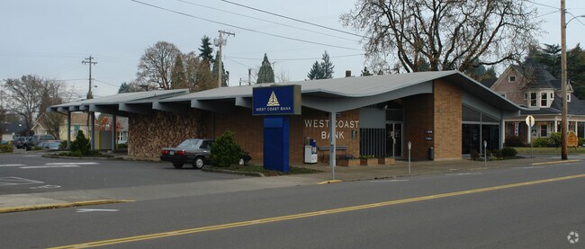
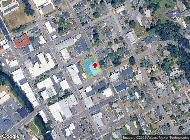
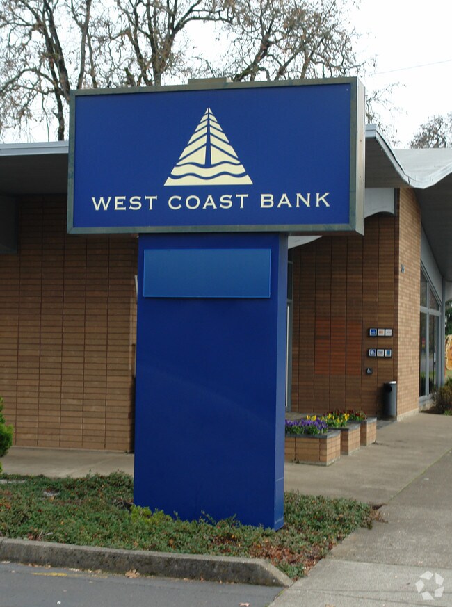
Property Record
315 E Main St, Silverton, OR 97381
Property Detail
315 E Main St
Salem, OR
Silverton Townplat (North And South Of M
102961
SILVERTON TOWNPLAT (NORTH AND SOUTH OF MAIN THE LOT #S START WITH #1) LOT 4 & 11 ACRES .50
Officebuilding
Marion
X
Oregon
41005C0750D
4,11
2024
0.50 AC
2025
Marion County
010502
Portland
3,330 SF
NEARBY LISTINGS FOR SALE OR LEASE
DEMOGRAPHICS near 315 E Main St
1 mile
3 mile
5 mile
2024 Total Population
9,214
13,581
19,355
2029 Population
9,384
13,769
19,569
Pop Growth 2024-2029
+ 1.85%
+ 1.38%
+ 1.11%
Average Age
40
40
41
2024 Total Households
3,433
5,018
6,947
HH Growth 2024-2029
+ 1.89%
+ 1.47%
+ 1.21%
Median Household Inc
$73,421
$74,999
$73,374
Avg Household Size
2.70
2.70
2.70
2024 Avg HH Vehicles
2.00
2.00
2.00
Median Home Value
$408,965
$433,458
$433,935
Median Year Built
1978
1978
1977
Nearby Places
Map Layers
Map Styles
 Street
 Aerial
Transit
 Traffic
 Biking
Places
Listings with unknown addresses are not visible on the map
- Restaurants
- Banks
- Shops
- Fitness
- Groceries
Nearby Properties
Address
Land Use
TOTAL SIZE
Lot Size
Zoning
Address
Land Use
TOTAL SIZE
Lot Size
Zoning
91,721 SF
4.66 AC
P
Address
Land Use
TOTAL SIZE
Lot Size
Zoning
39,543 SF
126.95 AC
P
Address
Land Use
TOTAL SIZE
Lot Size
Zoning
67,729 SF
11.01 AC
P
Address
Land Use
TOTAL SIZE
Lot Size
Zoning
90,019 SF
4.67 AC
RM-10
Address
Land Use
TOTAL SIZE
Lot Size
Zoning
176,475 SF
19.12 AC
IP
Address
Land Use
TOTAL SIZE
Lot Size
Zoning
20,618 SF
18.17 AC
P
Address
Land Use
TOTAL SIZE
Lot Size
Zoning
Address
Land Use
TOTAL SIZE
Lot Size
Zoning
63,408 SF
3.47 AC
RM-20
Address
Land Use
TOTAL SIZE
Lot Size
Zoning
42,184 SF
3.21 AC
GC
Address
Land Use
TOTAL SIZE
Lot Size
Zoning
84,423 SF
4.39 AC
LI
Address
Land Use
TOTAL SIZE
Lot Size
Zoning
5.41 AC
IP
Address
Land Use
TOTAL SIZE
Lot Size
Zoning
35,357 SF
3.81 AC
GC
Address
Land Use
TOTAL SIZE
Lot Size
Zoning
9,297 SF
17.24 AC
C
Address
Land Use
TOTAL SIZE
Lot Size
Zoning
20,676 SF
2.37 AC
R-5
Address
Land Use
TOTAL SIZE
Lot Size
Zoning
19,800 SF
2.31 AC
GC
Address
Land Use
TOTAL SIZE
Lot Size
Zoning
49,188 SF
4.12 AC
GC
Address
Land Use
TOTAL SIZE
Lot Size
Zoning
17,128 SF
1.31 AC
GC
Address
Land Use
TOTAL SIZE
Lot Size
Zoning
21,722 SF
0.96 AC
RM-10
Address
Land Use
TOTAL SIZE
Lot Size
Zoning
38,311 SF
5.50 AC
R-5
Address
Land Use
TOTAL SIZE
Lot Size
Zoning
Address
Land Use
TOTAL SIZE
Lot Size
Zoning
183,706 SF
59.49 AC
EFU
Address
Land Use
TOTAL SIZE
Lot Size
Zoning
42,400 SF
6.90 AC
IP
Address
Land Use
TOTAL SIZE
Lot Size
Zoning
68,144 SF
4.05 AC
IP
Address
Land Use
TOTAL SIZE
Lot Size
Zoning
2,960,217 SF
224.60 AC
EFU
Address
Land Use
TOTAL SIZE
Lot Size
Zoning
21,182 SF
2.92 AC
R-1
Address
Land Use
TOTAL SIZE
Lot Size
Zoning
Address
Land Use
TOTAL SIZE
Lot Size
Zoning
20,034 SF
2.40 AC
GC
Address
Land Use
TOTAL SIZE
Lot Size
Zoning
Address
Land Use
TOTAL SIZE
Lot Size
Zoning
24,933 SF
3.06 AC
IP
Address
Land Use
TOTAL SIZE
Lot Size
Zoning
9.78 AC
I
The World's #1 Commercial Real Estate Marketplace
Connect with us
© 2026 CoStar Group
The information above has been obtained from sources believed reliable. While we do not doubt its accuracy we have not verified it and make no guarantee, warranty or representation about it. It is your responsibility to independently confirm its accuracy and completeness. Any projections, opinions, assumptions, or estimates used are for example only and do not represent the current or future performance of the property. The value of this transaction to you depends on tax and other factors which should be evaluated by your tax, financial, and legal advisors. You and your advisors should conduct a careful, independent investigation of the property to determine to your satisfaction the suitability of the property for your needs.