Property Record
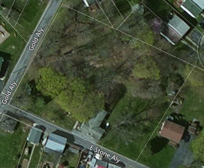
315 E Stone Aly, Alburtis, PA 18011


NEARBY LISTINGS FOR SALE OR LEASE
Property Detail
315 E Stone Aly
Allentown-Bethlehem-Easton, PA-NJ
R O W Easement Exhibit Stone Alley Apart
546366216238-1
LOTS: 037
Multifamilydwelling
Lehigh
X
Pennsylvania
42011C0250G
37
2025
1.11 AC
2025
Outer Northwestern Lehigh County
006302
Philadelphia
6,148 SF
DEMOGRAPHICS near 315 E Stone Aly
1 Mile
3 Mile
5 Mile
2024 Total Population
3,356
33,157
67,075
2029 Population
3,348
33,370
67,450
Pop Growth 2024-2029
(0.24%)
+ 0.64%
+ 0.56%
Average Age
37
40
41
2024 Total Households
1,227
12,394
25,484
HH Growth 2024-2029
(0.24%)
+ 0.65%
+ 0.55%
Median Household Inc
$97,525
$94,921
$95,312
Avg Household Size
2.70
2.60
2.60
2024 Avg HH Vehicles
2.00
2.00
2.00
Median Home Value
$253,488
$293,238
$311,570
Median Year Built
1988
1995
1989
Nearby Places
Map Layers
Map Styles
 Street
 Aerial
- Restaurants
- Banks
- Shops
- Fitness
- Groceries
PUBLIC TRANSPORTATION
AIRPORT
Lehigh Valley International
DRIVE
WALK
Distance
Lehigh Valley International
25 min
18.2 mi
SALE & LEASE HISTORY
LISTING DATE
SALE/LEASE

Sep 26, 2017
For Sale
Sep 26, 2017
For Sale
Feb 03, 2017
For Sale
Nearby Properties
Address
Land Use
TOTAL SIZE
Lot Size
Zoning
Address
Land Use
TOTAL SIZE
Lot Size
Zoning
1,200,000 SF
77.38 AC
HI-S
Address
Land Use
TOTAL SIZE
Lot Size
Zoning
1,099,800 SF
70 AC
HI-S
Address
Land Use
TOTAL SIZE
Lot Size
Zoning
1,088,000 SF
70.68 AC
HI-S
Address
Land Use
TOTAL SIZE
Lot Size
Zoning
927,980 SF
58.81 AC
HI-S
Address
Land Use
TOTAL SIZE
Lot Size
Zoning
199,343 SF
48.68 AC
O
Address
Land Use
TOTAL SIZE
Lot Size
Zoning
651,393 SF
71.96 AC
HI-S
Address
Land Use
TOTAL SIZE
Lot Size
Zoning
698,350 SF
42.82 AC
O
Address
Land Use
TOTAL SIZE
Lot Size
Zoning
4,037 SF
30.51 AC
R5
Address
Land Use
TOTAL SIZE
Lot Size
Zoning
7,132 SF
21.72 AC
C
Address
Land Use
TOTAL SIZE
Lot Size
Zoning
535,000 SF
39.49 AC
O
Address
Land Use
TOTAL SIZE
Lot Size
Zoning
580,000 SF
38.42 AC
I
Address
Land Use
TOTAL SIZE
Lot Size
Zoning
2,310 SF
163.66 AC
R5
Address
Land Use
TOTAL SIZE
Lot Size
Zoning
5,762 SF
31.01 AC
U
Address
Land Use
TOTAL SIZE
Lot Size
Zoning
493,200 SF
41.29 AC
O
Address
Land Use
TOTAL SIZE
Lot Size
Zoning
77,506 SF
24.65 AC
C
Address
Land Use
TOTAL SIZE
Lot Size
Zoning
32,500 SF
147.04 AC
I
Address
Land Use
TOTAL SIZE
Lot Size
Zoning
400,000 SF
26.46 AC
I
Address
Land Use
TOTAL SIZE
Lot Size
Zoning
123,836 SF
256.94 AC
Address
Land Use
TOTAL SIZE
Lot Size
Zoning
314,704 SF
24.70 AC
O
Address
Land Use
TOTAL SIZE
Lot Size
Zoning
271,080 SF
33.88 AC
HI-S
Address
Land Use
TOTAL SIZE
Lot Size
Zoning
85,585 SF
24.47 AC
SR
Address
Land Use
TOTAL SIZE
Lot Size
Zoning
76,537 SF
20 AC
R3
Address
Land Use
TOTAL SIZE
Lot Size
Zoning
61,779 SF
4.49 AC
R-1
Address
Land Use
TOTAL SIZE
Lot Size
Zoning
269,089 SF
19.49 AC
O
Address
Land Use
TOTAL SIZE
Lot Size
Zoning
210,000 SF
20.53 AC
I
Address
Land Use
TOTAL SIZE
Lot Size
Zoning
15,472 SF
10.40 AC
R-7.
Address
Land Use
TOTAL SIZE
Lot Size
Zoning
41,877 SF
14 AC
C-SC
Address
Land Use
TOTAL SIZE
Lot Size
Zoning
96,073 SF
14.96 AC
HC
Address
Land Use
TOTAL SIZE
Lot Size
Zoning
11,584 SF
9.96 AC
U
Address
Land Use
TOTAL SIZE
Lot Size
Zoning
113,137 SF
10.72 AC
C
The World's #1 Commercial Real Estate Marketplace
Connect with us
© 2025 CoStar Group
The information above has been obtained from sources believed reliable. While we do not doubt its accuracy we have not verified it and make no guarantee, warranty or representation about it. It is your responsibility to independently confirm its accuracy and completeness. Any projections, opinions, assumptions, or estimates used are for example only and do not represent the current or future performance of the property. The value of this transaction to you depends on tax and other factors which should be evaluated by your tax, financial, and legal advisors. You and your advisors should conduct a careful, independent investigation of the property to determine to your satisfaction the suitability of the property for your needs.