Property Record
315 E Superior St, Alma, MI 48801


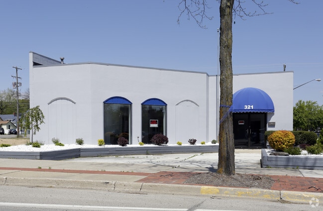
Property Detail
315 E Superior St
Alma, MI
ORIGINAL TOWN, LOTS 12,13,14,AND 15, BLOCK 19. COMBINED FOR TAX YEAR 2021 FROM 29 51 344 621 00, 29 51 344 622 00;
51-344-621-10
GRATIOT
Commercialacreage
Michigan
AE The base floodplain where base flood elevations are provided. AE Zones are now used on new format FIRMs instead of A1-A30 Zones.
12-14
2023
0.32 AC
2026
Michigan North Central Area
000500
Other Market Areas
NEARBY LISTINGS FOR SALE OR LEASE
DEMOGRAPHICS near 315 E Superior St
1 mile
3 mile
5 mile
2025 Total Population
7,034
12,980
18,217
2030 Population
6,991
12,879
18,094
Pop Growth 2025-2030
(0.61%)
(0.78%)
(0.68%)
Average Age
37
38
39
2025 Total Households
2,627
4,747
6,647
HH Growth 2025-2030
(0.72%)
(0.88%)
(0.77%)
Median Household Inc
$51,615
$53,119
$55,263
Avg Household Size
2.30
2.30
2.30
2025 Avg HH Vehicles
2.00
2.00
2.00
Median Home Value
$114,310
$131,861
$142,347
Median Year Built
1960
1963
1964
Nearby Places
Map Layers
Map Styles
 Street
 Aerial
Layers
 Traffic
 Biking
Places
Listings with unknown addresses are not visible on the map
- Restaurants
- Banks
- Shops
- Fitness
- Groceries
Nearby Properties
Address
Land Use
TOTAL SIZE
Lot Size
Zoning
Address
Land Use
TOTAL SIZE
Lot Size
Zoning
27.30 AC
Address
Land Use
TOTAL SIZE
Lot Size
Zoning
Address
Land Use
TOTAL SIZE
Lot Size
Zoning
48.50 AC
Address
Land Use
TOTAL SIZE
Lot Size
Zoning
Address
Land Use
TOTAL SIZE
Lot Size
Zoning
33.43 AC
Address
Land Use
TOTAL SIZE
Lot Size
Zoning
Address
Land Use
TOTAL SIZE
Lot Size
Zoning
18.62 AC
Address
Land Use
TOTAL SIZE
Lot Size
Zoning
6.19 AC
Address
Land Use
TOTAL SIZE
Lot Size
Zoning
6.85 AC
Address
Land Use
TOTAL SIZE
Lot Size
Zoning
16.85 AC
Address
Land Use
TOTAL SIZE
Lot Size
Zoning
13.20 AC
Address
Land Use
TOTAL SIZE
Lot Size
Zoning
Address
Land Use
TOTAL SIZE
Lot Size
Zoning
1.49 AC
Address
Land Use
TOTAL SIZE
Lot Size
Zoning
Address
Land Use
TOTAL SIZE
Lot Size
Zoning
22.70 AC
Address
Land Use
TOTAL SIZE
Lot Size
Zoning
13.12 AC
Address
Land Use
TOTAL SIZE
Lot Size
Zoning
Address
Land Use
TOTAL SIZE
Lot Size
Zoning
Address
Land Use
TOTAL SIZE
Lot Size
Zoning
Address
Land Use
TOTAL SIZE
Lot Size
Zoning
5.46 AC
Address
Land Use
TOTAL SIZE
Lot Size
Zoning
Address
Land Use
TOTAL SIZE
Lot Size
Zoning
32.34 AC
Address
Land Use
TOTAL SIZE
Lot Size
Zoning
3.90 AC
Address
Land Use
TOTAL SIZE
Lot Size
Zoning
199.50 AC
Address
Land Use
TOTAL SIZE
Lot Size
Zoning
Address
Land Use
TOTAL SIZE
Lot Size
Zoning
Address
Land Use
TOTAL SIZE
Lot Size
Zoning
0.41 AC
Address
Land Use
TOTAL SIZE
Lot Size
Zoning
6.89 AC
Address
Land Use
TOTAL SIZE
Lot Size
Zoning
238.72 AC
Address
Land Use
TOTAL SIZE
Lot Size
Zoning
3.69 AC
The World's #1 Commercial Real Estate Marketplace
Connect with us
© 2026 CoStar Group
The information above has been obtained from sources believed reliable. While we do not doubt its accuracy we have not verified it and make no guarantee, warranty or representation about it. It is your responsibility to independently confirm its accuracy and completeness. Any projections, opinions, assumptions, or estimates used are for example only and do not represent the current or future performance of the property. The value of this transaction to you depends on tax and other factors which should be evaluated by your tax, financial, and legal advisors. You and your advisors should conduct a careful, independent investigation of the property to determine to your satisfaction the suitability of the property for your needs.