Property Record
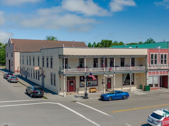
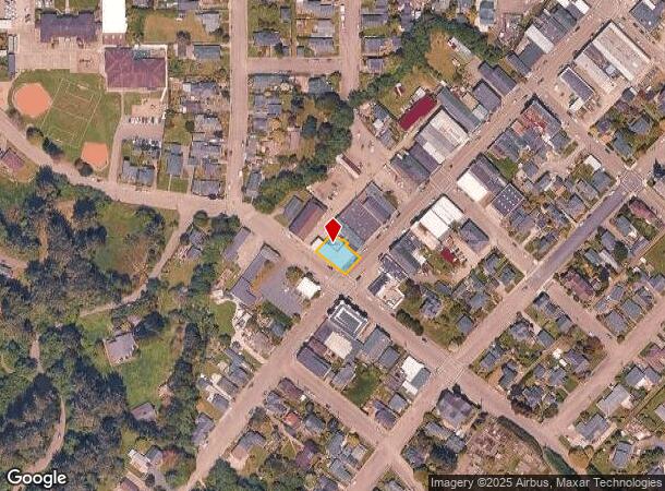
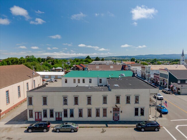
315 Main St, Ferndale, CA 95536
NEARBY LISTINGS FOR SALE OR LEASE
-
-
View all Ferndale listings for sale on LoopNet.com
Property Detail
315 Main St
031-083-021-000
L6* B14 /B5P80 M FRANCIS DIVISIONRNE OF0600601085B071982C 86C 00000000 N
Commercialnec
Humboldt
X
California
06023C1184F
6
2024
0.13 AC
2025
California North Rural Area
011200
Other Market Areas
8,642 SF
Eureka-Arcata, CA
DEMOGRAPHICS near 315 Main St
1 mile
3 mile
5 mile
2024 Total Population
963
1,765
2,586
2029 Population
894
1,634
2,408
Pop Growth 2024-2029
(7.17%)
(7.42%)
(6.88%)
Average Age
45
46
45
2024 Total Households
417
752
1,081
HH Growth 2024-2029
(7.19%)
(7.58%)
(7.03%)
Median Household Inc
$60,568
$63,940
$66,375
Avg Household Size
2.30
2.30
2.40
2024 Avg HH Vehicles
2.00
2.00
2.00
Median Home Value
$446,190
$473,652
$477,122
Median Year Built
1948
1953
1957
Nearby Places
Map Layers
Map Styles
 Street
 Aerial
Transit
 Traffic
 Biking
Places
Listings with unknown addresses are not visible on the map
- Restaurants
- Banks
- Shops
- Fitness
- Groceries
PUBLIC TRANSPORTATION
AIRPORT
California Redwood Coast-Humboldt County
Drive
Walk
Distance
California Redwood Coast-Humboldt County
55 min
36.3 mi
SALE & LEASE HISTORY
LISTING DATE
SALE/LEASE

May 13, 2024
For Sale
Nearby Properties
Address
Land Use
TOTAL SIZE
Lot Size
Zoning
Address
Land Use
TOTAL SIZE
Lot Size
Zoning
5.35 AC
C-AG-D-Q
Address
Land Use
TOTAL SIZE
Lot Size
Zoning
1.20 AC
C-1-D-Q
Address
Land Use
TOTAL SIZE
Lot Size
Zoning
5,362 SF
24.03 AC
U
Address
Land Use
TOTAL SIZE
Lot Size
Zoning
1.99 AC
A-E
Address
Land Use
TOTAL SIZE
Lot Size
Zoning
9.69 AC
AE-60/F,R
Address
Land Use
TOTAL SIZE
Lot Size
Zoning
80.79 AC
AE-60/F,R
Address
Land Use
TOTAL SIZE
Lot Size
Zoning
20 AC
AE-60/F,R
Address
Land Use
TOTAL SIZE
Lot Size
Zoning
136 AC
AE-60/F,R
Address
Land Use
TOTAL SIZE
Lot Size
Zoning
77 AC
AE-60/F,R
Address
Land Use
TOTAL SIZE
Lot Size
Zoning
87 AC
AE-60/F,R
Address
Land Use
TOTAL SIZE
Lot Size
Zoning
174 AC
AE-60/A,F
Address
Land Use
TOTAL SIZE
Lot Size
Zoning
3,564 SF
AE-60/F,R
Address
Land Use
TOTAL SIZE
Lot Size
Zoning
38.50 AC
AE-60/F,R
Address
Land Use
TOTAL SIZE
Lot Size
Zoning
570 AC
AE-60/W,F
Address
Land Use
TOTAL SIZE
Lot Size
Zoning
2,172 SF
23 AC
AE-60/F,R
Address
Land Use
TOTAL SIZE
Lot Size
Zoning
74.06 AC
Address
Land Use
TOTAL SIZE
Lot Size
Zoning
2,016 SF
21.50 AC
U
Address
Land Use
TOTAL SIZE
Lot Size
Zoning
80 AC
AE-60/F,R
Address
Land Use
TOTAL SIZE
Lot Size
Zoning
1,650 SF
50.90 AC
AE-60/F,R
Address
Land Use
TOTAL SIZE
Lot Size
Zoning
30 AC
AE-60/F
Address
Land Use
TOTAL SIZE
Lot Size
Zoning
3,711 SF
1.50 AC
R-S-B-5
Address
Land Use
TOTAL SIZE
Lot Size
Zoning
1,440 SF
40 AC
AE-60/F;AE
Address
Land Use
TOTAL SIZE
Lot Size
Zoning
6,111 SF
1.10 AC
C-2-D
Address
Land Use
TOTAL SIZE
Lot Size
Zoning
69 AC
AE-60/F,R
Address
Land Use
TOTAL SIZE
Lot Size
Zoning
86.59 AC
AE-60/F,R
Address
Land Use
TOTAL SIZE
Lot Size
Zoning
84.86 AC
AE-60/F,R
Address
Land Use
TOTAL SIZE
Lot Size
Zoning
1,912 SF
5.50 AC
AE-60/F,R
Address
Land Use
TOTAL SIZE
Lot Size
Zoning
3,579 SF
1.75 AC
AE-60/F
Address
Land Use
TOTAL SIZE
Lot Size
Zoning
16 AC
AE-60/F,R
Address
Land Use
TOTAL SIZE
Lot Size
Zoning
3,014 SF
127.62 AC
AE-60/F,R
The World's #1 Commercial Real Estate Marketplace
Connect with us
© 2026 CoStar Group
The information above has been obtained from sources believed reliable. While we do not doubt its accuracy we have not verified it and make no guarantee, warranty or representation about it. It is your responsibility to independently confirm its accuracy and completeness. Any projections, opinions, assumptions, or estimates used are for example only and do not represent the current or future performance of the property. The value of this transaction to you depends on tax and other factors which should be evaluated by your tax, financial, and legal advisors. You and your advisors should conduct a careful, independent investigation of the property to determine to your satisfaction the suitability of the property for your needs.