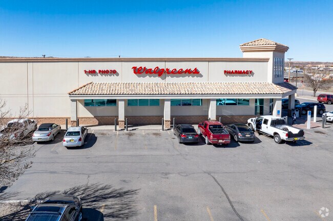
Property Record
315 N Main St, Belen, NM 87002


NEARBY LISTINGS FOR SALE OR LEASE
Property Detail
315 N Main St
1-007-028-135-383-000000
Central Townsite Company's Addition No
Realpropertynec
SUBD CENTRAL TOWNSITE COMPANY'S ADDITION NO. 1 BLOCK 13 TRACT A S 18 T 5N R 2E 1.55 ACRES PLAT L-220
A
Valencia
35061C0395E
New Mexico
2025
1.56 AC
2025
Los Lunas Corridor
970800
Albuquerque
14,259 SF
Albuquerque, NM
DEMOGRAPHICS near 315 N Main St
1 Mile
3 Mile
5 Mile
2024 Total Population
6,217
13,271
21,433
2029 Population
6,681
14,215
22,811
Pop Growth 2024-2029
+ 7.46%
+ 7.11%
+ 6.43%
Average Age
41
42
43
2024 Total Households
2,511
5,303
8,512
HH Growth 2024-2029
+ 7.73%
+ 7.43%
+ 6.72%
Median Household Inc
$37,335
$38,229
$41,352
Avg Household Size
2.40
2.40
2.50
2024 Avg HH Vehicles
2.00
2.00
2.00
Median Home Value
$139,928
$141,590
$151,671
Median Year Built
1978
1982
1983
Nearby Places
Map Layers
Map Styles
 Street
 Aerial
- Restaurants
- Banks
- Shops
- Fitness
- Groceries
PUBLIC TRANSPORTATION
COMMUTER RAIL
Belen (Rail Runner Express - New Mexico Rail Runner Express)
DRIVE
WALK
Distance
Belen (Rail Runner Express - New Mexico Rail Runner Express)
3 min
19 min
1.0 mi
DRIVE
WALK
Distance
3 min
20 min
1.0 mi
AIRPORT
Albuquerque International Sunport
DRIVE
WALK
Distance
Albuquerque International Sunport
51 min
32.4 mi
SALE & LEASE HISTORY
LISTING DATE
SALE/LEASE

Sep 24, 2016
For Sale
Oct 13, 2021
For Sale
Aug 21, 2017
For Sale
Nearby Properties
Address
Land Use
TOTAL SIZE
Lot Size
Zoning
Address
Land Use
TOTAL SIZE
Lot Size
Zoning
Address
Land Use
TOTAL SIZE
Lot Size
Zoning
Address
Land Use
TOTAL SIZE
Lot Size
Zoning
32.43 AC
Address
Land Use
TOTAL SIZE
Lot Size
Zoning
8.10 AC
Address
Land Use
TOTAL SIZE
Lot Size
Zoning
203,441 SF
21.25 AC
Address
Land Use
TOTAL SIZE
Lot Size
Zoning
16.30 AC
Address
Land Use
TOTAL SIZE
Lot Size
Zoning
Address
Land Use
TOTAL SIZE
Lot Size
Zoning
2.50 AC
Address
Land Use
TOTAL SIZE
Lot Size
Zoning
8.76 AC
Address
Land Use
TOTAL SIZE
Lot Size
Zoning
61,667 SF
3.44 AC
Address
Land Use
TOTAL SIZE
Lot Size
Zoning
18,356 SF
9.31 AC
Address
Land Use
TOTAL SIZE
Lot Size
Zoning
4.76 AC
Address
Land Use
TOTAL SIZE
Lot Size
Zoning
10.11 AC
Address
Land Use
TOTAL SIZE
Lot Size
Zoning
4.62 AC
Address
Land Use
TOTAL SIZE
Lot Size
Zoning
0.07 AC
Address
Land Use
TOTAL SIZE
Lot Size
Zoning
1.95 AC
Address
Land Use
TOTAL SIZE
Lot Size
Zoning
3.42 AC
Address
Land Use
TOTAL SIZE
Lot Size
Zoning
22.51 AC
Address
Land Use
TOTAL SIZE
Lot Size
Zoning
Address
Land Use
TOTAL SIZE
Lot Size
Zoning
0.49 AC
Address
Land Use
TOTAL SIZE
Lot Size
Zoning
1.26 AC
Address
Land Use
TOTAL SIZE
Lot Size
Zoning
3.13 AC
Address
Land Use
TOTAL SIZE
Lot Size
Zoning
0.98 AC
Address
Land Use
TOTAL SIZE
Lot Size
Zoning
0.32 AC
Address
Land Use
TOTAL SIZE
Lot Size
Zoning
24,002 SF
7.05 AC
Address
Land Use
TOTAL SIZE
Lot Size
Zoning
18,926 SF
3.68 AC
Address
Land Use
TOTAL SIZE
Lot Size
Zoning
Address
Land Use
TOTAL SIZE
Lot Size
Zoning
9,540 SF
6.18 AC
Address
Land Use
TOTAL SIZE
Lot Size
Zoning
27,000 SF
3.49 AC
Address
Land Use
TOTAL SIZE
Lot Size
Zoning
3.34 AC
The World's #1 Commercial Real Estate Marketplace
Connect with us
© 2026 CoStar Group
The information above has been obtained from sources believed reliable. While we do not doubt its accuracy we have not verified it and make no guarantee, warranty or representation about it. It is your responsibility to independently confirm its accuracy and completeness. Any projections, opinions, assumptions, or estimates used are for example only and do not represent the current or future performance of the property. The value of this transaction to you depends on tax and other factors which should be evaluated by your tax, financial, and legal advisors. You and your advisors should conduct a careful, independent investigation of the property to determine to your satisfaction the suitability of the property for your needs.