Property Record
315 N Main St, Corbin, KY 40701

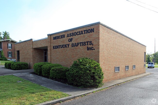
Property Detail
315 N Main St
137-32-13-007.01
1 ST BRK BLDG & TRT 1 @ N MAIN ST
Storebuilding
WHITLEY
COMMERCIAL
Kentucky
B and X Area of moderate flood hazard, usually the area between the limits of the 100-year and 500-year floods.
0.08 AC
2025
Corbin/London Area
2025
Other Market Areas
920100
Corbin, KY
2,029 SF
NEARBY LISTINGS FOR SALE OR LEASE
-
-
View all Corbin listings for sale on LoopNet.com
DEMOGRAPHICS near 315 N Main St
1 mile
3 mile
5 mile
2025 Total Population
5,618
17,960
29,026
2030 Population
5,672
18,186
29,336
Pop Growth 2025-2030
+ 0.96%
+ 1.26%
+ 1.07%
Average Age
40
40
41
2025 Total Households
2,389
7,352
11,616
HH Growth 2025-2030
+ 0.96%
+ 1.31%
+ 1.12%
Median Household Inc
$51,004
$45,350
$46,461
Avg Household Size
2.30
2.40
2.40
2025 Avg HH Vehicles
2.00
2.00
2.00
Median Home Value
$164,893
$176,512
$168,635
Median Year Built
1974
1982
1986
Nearby Places
Map Layers
Map Styles
 Street
 Aerial
Layers
 Traffic
 Biking
Places
Listings with unknown addresses are not visible on the map
- Restaurants
- Banks
- Shops
- Fitness
- Groceries
SALE & LEASE HISTORY
LISTING DATE
SALE/LEASE

Apr 29, 2019
For Sale
Nearby Properties
Address
Land Use
TOTAL SIZE
Lot Size
Zoning
Address
Land Use
TOTAL SIZE
Lot Size
Zoning
84 AC
OTHER
Address
Land Use
TOTAL SIZE
Lot Size
Zoning
3.62 AC
RESIDENTIA
Address
Land Use
TOTAL SIZE
Lot Size
Zoning
8,800 SF
RESIDENTIA
Address
Land Use
TOTAL SIZE
Lot Size
Zoning
120,330 SF
30.64 AC
Address
Land Use
TOTAL SIZE
Lot Size
Zoning
183,211 SF
23.69 AC
R-1
Address
Land Use
TOTAL SIZE
Lot Size
Zoning
OTHER
Address
Land Use
TOTAL SIZE
Lot Size
Zoning
144.26 AC
Address
Land Use
TOTAL SIZE
Lot Size
Zoning
16,016 SF
11.80 AC
Address
Land Use
TOTAL SIZE
Lot Size
Zoning
40.03 AC
RESIDENTIA
Address
Land Use
TOTAL SIZE
Lot Size
Zoning
39.38 AC
Address
Land Use
TOTAL SIZE
Lot Size
Zoning
Address
Land Use
TOTAL SIZE
Lot Size
Zoning
124,134 SF
17.26 AC
R-1
Address
Land Use
TOTAL SIZE
Lot Size
Zoning
13.62 AC
R-1
Address
Land Use
TOTAL SIZE
Lot Size
Zoning
84,782 SF
6.37 AC
Address
Land Use
TOTAL SIZE
Lot Size
Zoning
2.35 AC
R-1
Address
Land Use
TOTAL SIZE
Lot Size
Zoning
38,750 SF
9.35 AC
Address
Land Use
TOTAL SIZE
Lot Size
Zoning
RESIDENTIA
Address
Land Use
TOTAL SIZE
Lot Size
Zoning
124,760 SF
9.97 AC
Address
Land Use
TOTAL SIZE
Lot Size
Zoning
1.21 AC
B2
Address
Land Use
TOTAL SIZE
Lot Size
Zoning
1,792 SF
0.41 AC
Address
Land Use
TOTAL SIZE
Lot Size
Zoning
1,600 SF
4.72 AC
R-1
Address
Land Use
TOTAL SIZE
Lot Size
Zoning
6,600 SF
59.41 AC
R-1
Address
Land Use
TOTAL SIZE
Lot Size
Zoning
1.45 AC
COMMERCIAL
Address
Land Use
TOTAL SIZE
Lot Size
Zoning
12,720 SF
22 AC
R-1
Address
Land Use
TOTAL SIZE
Lot Size
Zoning
16.97 AC
OTHER
Address
Land Use
TOTAL SIZE
Lot Size
Zoning
30,180 SF
1.19 AC
C-1
Address
Land Use
TOTAL SIZE
Lot Size
Zoning
7,970 SF
3.51 AC
R-1
Address
Land Use
TOTAL SIZE
Lot Size
Zoning
7.60 AC
RESIDENTIA
Address
Land Use
TOTAL SIZE
Lot Size
Zoning
Address
Land Use
TOTAL SIZE
Lot Size
Zoning
65.70 AC
R-1
The World's #1 Commercial Real Estate Marketplace
Connect with us
© 2026 CoStar Group
The information above has been obtained from sources believed reliable. While we do not doubt its accuracy we have not verified it and make no guarantee, warranty or representation about it. It is your responsibility to independently confirm its accuracy and completeness. Any projections, opinions, assumptions, or estimates used are for example only and do not represent the current or future performance of the property. The value of this transaction to you depends on tax and other factors which should be evaluated by your tax, financial, and legal advisors. You and your advisors should conduct a careful, independent investigation of the property to determine to your satisfaction the suitability of the property for your needs.