Property Record
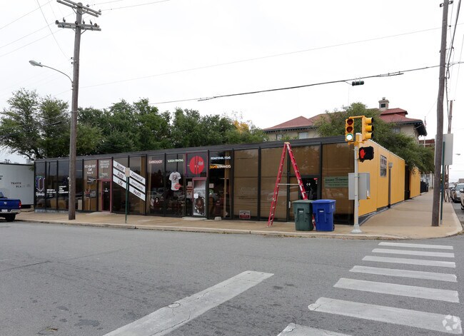
315 N Travis St, Sherman, TX 75090


Property Detail
315 N Travis St
Sherman-Denison, TX
SHANNON T J SUPPLEMENT, BLOCK A, LOT 1, 2, & N 25 3, 125X150 (C) 18750 SF, ACRES .4304
161985
Grayson
Commercialnec
Texas
B and X Area of moderate flood hazard, usually the area between the limits of the 100-year and 500-year floods.
1,2
2024
0.43 AC
2025
Sherman
002000
Other Market Areas
14,224 SF
NEARBY LISTINGS FOR SALE OR LEASE
-
-
-
No Photo
-
-
-
-
-
View all Sherman listings for lease on LoopNet.com
DEMOGRAPHICS near 315 N Travis St
1 mile
3 mile
5 mile
2025 Total Population
9,968
43,247
52,087
2030 Population
10,826
46,955
56,653
Pop Growth 2025-2030
+ 8.61%
+ 8.57%
+ 8.77%
Average Age
36
38
38
2025 Total Households
3,332
16,463
19,963
HH Growth 2025-2030
+ 8.70%
+ 8.63%
+ 8.82%
Median Household Inc
$53,158
$56,171
$58,432
Avg Household Size
2.60
2.50
2.50
2025 Avg HH Vehicles
2.00
2.00
2.00
Median Home Value
$196,746
$240,158
$257,032
Median Year Built
1960
1977
1981
Nearby Places
Map Layers
Map Styles
 Street
 Aerial
Layers
 Traffic
 Biking
Places
Listings with unknown addresses are not visible on the map
- Restaurants
- Banks
- Shops
- Fitness
- Groceries
SALE & LEASE HISTORY
LISTING DATE
SALE/LEASE

Nov 23, 2016
For Lease
Nearby Properties
Address
Land Use
TOTAL SIZE
Lot Size
Zoning
Address
Land Use
TOTAL SIZE
Lot Size
Zoning
Address
Land Use
TOTAL SIZE
Lot Size
Zoning
Address
Land Use
TOTAL SIZE
Lot Size
Zoning
476,941 SF
29.79 AC
Address
Land Use
TOTAL SIZE
Lot Size
Zoning
304,650 SF
10.61 AC
Address
Land Use
TOTAL SIZE
Lot Size
Zoning
253,076 SF
36.13 AC
Address
Land Use
TOTAL SIZE
Lot Size
Zoning
227,312 SF
11.72 AC
Address
Land Use
TOTAL SIZE
Lot Size
Zoning
Address
Land Use
TOTAL SIZE
Lot Size
Zoning
142,834 SF
9.85 AC
Address
Land Use
TOTAL SIZE
Lot Size
Zoning
61,660 SF
6.50 AC
Address
Land Use
TOTAL SIZE
Lot Size
Zoning
214,784 SF
15.05 AC
Address
Land Use
TOTAL SIZE
Lot Size
Zoning
81,100 SF
1.13 AC
Address
Land Use
TOTAL SIZE
Lot Size
Zoning
170,359 SF
9.64 AC
Address
Land Use
TOTAL SIZE
Lot Size
Zoning
78,278 SF
8.21 AC
Address
Land Use
TOTAL SIZE
Lot Size
Zoning
136,640 SF
4.04 AC
Address
Land Use
TOTAL SIZE
Lot Size
Zoning
151,714 SF
9.13 AC
Address
Land Use
TOTAL SIZE
Lot Size
Zoning
39,850 SF
5.32 AC
Address
Land Use
TOTAL SIZE
Lot Size
Zoning
297,962 SF
51 AC
Address
Land Use
TOTAL SIZE
Lot Size
Zoning
186,834 SF
10.51 AC
Address
Land Use
TOTAL SIZE
Lot Size
Zoning
136,500 SF
6.42 AC
Address
Land Use
TOTAL SIZE
Lot Size
Zoning
316,318 SF
5.20 AC
Address
Land Use
TOTAL SIZE
Lot Size
Zoning
128,000 SF
11.23 AC
Address
Land Use
TOTAL SIZE
Lot Size
Zoning
69,115 SF
10.52 AC
Address
Land Use
TOTAL SIZE
Lot Size
Zoning
254,000 SF
12.61 AC
Address
Land Use
TOTAL SIZE
Lot Size
Zoning
160,592 SF
8.92 AC
Address
Land Use
TOTAL SIZE
Lot Size
Zoning
127,848 SF
9.60 AC
Address
Land Use
TOTAL SIZE
Lot Size
Zoning
34,135 SF
10 AC
Address
Land Use
TOTAL SIZE
Lot Size
Zoning
170,455 SF
22.78 AC
Address
Land Use
TOTAL SIZE
Lot Size
Zoning
204,000 SF
21.91 AC
Address
Land Use
TOTAL SIZE
Lot Size
Zoning
121,903 SF
10 AC
Address
Land Use
TOTAL SIZE
Lot Size
Zoning
137,904 SF
9.12 AC
The World's #1 Commercial Real Estate Marketplace
Connect with us
© 2026 CoStar Group
The information above has been obtained from sources believed reliable. While we do not doubt its accuracy we have not verified it and make no guarantee, warranty or representation about it. It is your responsibility to independently confirm its accuracy and completeness. Any projections, opinions, assumptions, or estimates used are for example only and do not represent the current or future performance of the property. The value of this transaction to you depends on tax and other factors which should be evaluated by your tax, financial, and legal advisors. You and your advisors should conduct a careful, independent investigation of the property to determine to your satisfaction the suitability of the property for your needs.