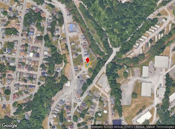
Property Record
313 Nolan St, Morgantown, WV 26501


This Property Is For Sale
NEARBY LISTINGS FOR SALE OR LEASE
Property Detail
313 Nolan St
Morgantown, WV
BL 15, LOT 22
10-35-00130000
Monongalia
Residentialacreage
West Virginia
AE
22
54061C0227F
0.05 AC
2025
West Virginia North Area
2025
Other Market Areas
011100
DEMOGRAPHICS near 313 Nolan St
1 Mile
3 Mile
5 Mile
2024 Total Population
14,226
56,442
83,224
2029 Population
14,744
57,987
85,343
Pop Growth 2024-2029
+ 3.64%
+ 2.74%
+ 2.55%
Average Age
34
34
35
2024 Total Households
6,037
24,112
35,472
HH Growth 2024-2029
+ 3.98%
+ 2.87%
+ 2.64%
Median Household Inc
$34,700
$41,717
$52,600
Avg Household Size
2.00
2.00
2.10
2024 Avg HH Vehicles
1.00
2.00
2.00
Median Home Value
$207,189
$220,393
$235,379
Median Year Built
1956
1980
1985
Nearby Places
- Restaurants
- Banks
- Shops
- Fitness
- Groceries
PUBLIC TRANSPORTATION
TRANSIT/SUBWAY
Walnut (BEE-WAL-BEE - West Virginia University Personal Rapid Transit, ENG-WAL-ENG - West Virginia University Personal Rapid Transit, HSC-WAL-HSC - West Virginia University Personal Rapid Transit, WAL-ENG-WAL - West Virginia University Personal Rapid Transit, WAL-HSC-WAL - West Virginia University Personal Rapid Transit)
DRIVE
WALK
Distance
Walnut (BEE-WAL-BEE - West Virginia University Personal Rapid Transit, ENG-WAL-ENG - West Virginia University Personal Rapid Transit, HSC-WAL-HSC - West Virginia University Personal Rapid Transit, WAL-ENG-WAL - West Virginia University Personal Rapid Transit, WAL-HSC-WAL - West Virginia University Personal Rapid Transit)
1 min
15 min
0.8 mi
AIRPORT
North Central West Virginia
DRIVE
WALK
Distance
North Central West Virginia
41 min
34.3 mi
Freight Ports
Port of Baltimore
DRIVE
WALK
Distance
Port of Baltimore
239 min
212.4 mi
Nearby Properties
Address
Land Use
TOTAL SIZE
Lot Size
Zoning
Address
Land Use
TOTAL SIZE
Lot Size
Zoning
23.86 AC
Address
Land Use
TOTAL SIZE
Lot Size
Zoning
5.15 AC
Address
Land Use
TOTAL SIZE
Lot Size
Zoning
14.68 AC
Address
Land Use
TOTAL SIZE
Lot Size
Zoning
137.68 AC
Address
Land Use
TOTAL SIZE
Lot Size
Zoning
75.75 AC
Address
Land Use
TOTAL SIZE
Lot Size
Zoning
31.67 AC
Address
Land Use
TOTAL SIZE
Lot Size
Zoning
109.09 AC
Address
Land Use
TOTAL SIZE
Lot Size
Zoning
3.07 AC
Address
Land Use
TOTAL SIZE
Lot Size
Zoning
35.17 AC
Address
Land Use
TOTAL SIZE
Lot Size
Zoning
Address
Land Use
TOTAL SIZE
Lot Size
Zoning
19.34 AC
Address
Land Use
TOTAL SIZE
Lot Size
Zoning
7.10 AC
Address
Land Use
TOTAL SIZE
Lot Size
Zoning
45.28 AC
Address
Land Use
TOTAL SIZE
Lot Size
Zoning
15.71 AC
Address
Land Use
TOTAL SIZE
Lot Size
Zoning
30.77 AC
Address
Land Use
TOTAL SIZE
Lot Size
Zoning
53.50 AC
Address
Land Use
TOTAL SIZE
Lot Size
Zoning
Address
Land Use
TOTAL SIZE
Lot Size
Zoning
Address
Land Use
TOTAL SIZE
Lot Size
Zoning
9.63 AC
Address
Land Use
TOTAL SIZE
Lot Size
Zoning
34.21 AC
Address
Land Use
TOTAL SIZE
Lot Size
Zoning
154.89 AC
Address
Land Use
TOTAL SIZE
Lot Size
Zoning
0.23 AC
Address
Land Use
TOTAL SIZE
Lot Size
Zoning
21.61 AC
Address
Land Use
TOTAL SIZE
Lot Size
Zoning
Address
Land Use
TOTAL SIZE
Lot Size
Zoning
22.71 AC
Address
Land Use
TOTAL SIZE
Lot Size
Zoning
Address
Land Use
TOTAL SIZE
Lot Size
Zoning
75.11 AC
Address
Land Use
TOTAL SIZE
Lot Size
Zoning
Address
Land Use
TOTAL SIZE
Lot Size
Zoning
9.94 AC
Address
Land Use
TOTAL SIZE
Lot Size
Zoning
61.24 AC
The World's #1 Commercial Real Estate Marketplace
Connect with us
© 2025 CoStar Group
The information above has been obtained from sources believed reliable. While we do not doubt its accuracy we have not verified it and make no guarantee, warranty or representation about it. It is your responsibility to independently confirm its accuracy and completeness. Any projections, opinions, assumptions, or estimates used are for example only and do not represent the current or future performance of the property. The value of this transaction to you depends on tax and other factors which should be evaluated by your tax, financial, and legal advisors. You and your advisors should conduct a careful, independent investigation of the property to determine to your satisfaction the suitability of the property for your needs.