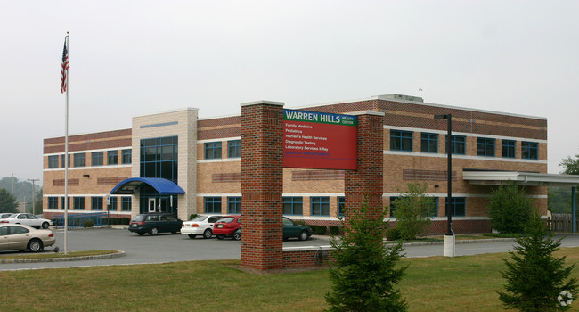
Property Record
315 State Route 31 S, Washington, NJ 07882

Save to a Folder
{{folder.Name}}
{{folder.ListingIds.length}} Properties
{{folder.ListingIds.length}} Property
Create a New Folder
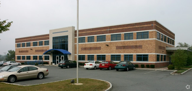
Property Detail
315 State Route 31 S
Allentown-Bethlehem-Easton, PA-NJ
ADDITIONAL LOTS: MEDICAL OFFICE BLDG
22-00064-0000-00016
Warren
Vacantlandnec
New Jersey
HC
16
B and X Area of moderate flood hazard, usually the area between the limits of the 100-year and 500-year floods.
1.70 AC
2025
Warren County
2026
Northern New Jersey
032000
NEARBY LISTINGS FOR SALE OR LEASE
DEMOGRAPHICS near 315 State Route 31 S
1 mile
3 mile
5 mile
2025 Total Population
1,618
17,952
27,639
2030 Population
1,708
18,346
28,250
Pop Growth 2025-2030
+ 5.56%
+ 2.19%
+ 2.21%
Average Age
46
43
44
2025 Total Households
621
7,144
10,826
HH Growth 2025-2030
+ 5.48%
+ 2.03%
+ 2.10%
Median Household Inc
$131,030
$101,977
$109,764
Avg Household Size
2.60
2.50
2.50
2025 Avg HH Vehicles
3.00
2.00
2.00
Median Home Value
$373,333
$353,772
$378,602
Median Year Built
1985
1971
1972
Nearby Places
Map Layers
Map Styles
 Street
 Aerial
Layers
 Traffic
 Biking
Places
Listings with unknown addresses are not visible on the map
- Restaurants
- Banks
- Shops
- Fitness
- Groceries
PUBLIC TRANSPORTATION
COMMUTER RAIL
High Bridge (Raritan Valley Line - NJ Transit Commuter Rail (NJ Transit))
Drive
Walk
Distance
High Bridge (Raritan Valley Line - NJ Transit Commuter Rail (NJ Transit))
13 min
8.5 mi
AIRPORT
Lehigh Valley International
Drive
Walk
Distance
Lehigh Valley International
49 min
29.0 mi
Trenton Mercer
Drive
Walk
Distance
Trenton Mercer
60 min
37.8 mi
Freight Ports
Maher Terminal
Drive
Walk
Distance
Maher Terminal
69 min
52.8 mi
Nearby Properties
Address
Land Use
TOTAL SIZE
Lot Size
Zoning
Address
Land Use
TOTAL SIZE
Lot Size
Zoning
52.10 AC
PCOS
Address
Land Use
TOTAL SIZE
Lot Size
Zoning
Address
Land Use
TOTAL SIZE
Lot Size
Zoning
Address
Land Use
TOTAL SIZE
Lot Size
Zoning
77.78 AC
ED
Address
Land Use
TOTAL SIZE
Lot Size
Zoning
46.85 AC
R-40
Address
Land Use
TOTAL SIZE
Lot Size
Zoning
29.81 AC
HC
Address
Land Use
TOTAL SIZE
Lot Size
Zoning
Address
Land Use
TOTAL SIZE
Lot Size
Zoning
32.90 AC
PL
Address
Land Use
TOTAL SIZE
Lot Size
Zoning
22.84 AC
HC
Address
Land Use
TOTAL SIZE
Lot Size
Zoning
17.20 AC
IP
Address
Land Use
TOTAL SIZE
Lot Size
Zoning
20.43 AC
R4
Address
Land Use
TOTAL SIZE
Lot Size
Zoning
6.24 AC
PVD
Address
Land Use
TOTAL SIZE
Lot Size
Zoning
3.98 AC
B-4
Address
Land Use
TOTAL SIZE
Lot Size
Zoning
Address
Land Use
TOTAL SIZE
Lot Size
Zoning
Address
Land Use
TOTAL SIZE
Lot Size
Zoning
15.80 AC
I
Address
Land Use
TOTAL SIZE
Lot Size
Zoning
1,280 SF
240.85 AC
PVD
Address
Land Use
TOTAL SIZE
Lot Size
Zoning
1.87 AC
PVD
Address
Land Use
TOTAL SIZE
Lot Size
Zoning
5.40 AC
OR
Address
Land Use
TOTAL SIZE
Lot Size
Zoning
5.50 AC
OR
Address
Land Use
TOTAL SIZE
Lot Size
Zoning
5.08 AC
HC
Address
Land Use
TOTAL SIZE
Lot Size
Zoning
25,752 SF
2.09 AC
RA
Address
Land Use
TOTAL SIZE
Lot Size
Zoning
9.50 AC
PL
Address
Land Use
TOTAL SIZE
Lot Size
Zoning
4.89 AC
R4
Address
Land Use
TOTAL SIZE
Lot Size
Zoning
6.04 AC
HC
Address
Land Use
TOTAL SIZE
Lot Size
Zoning
4,082 SF
9.58 AC
R2
Address
Land Use
TOTAL SIZE
Lot Size
Zoning
38,415 SF
4 AC
Address
Land Use
TOTAL SIZE
Lot Size
Zoning
36,544 SF
11.77 AC
VR
Address
Land Use
TOTAL SIZE
Lot Size
Zoning
1.98 AC
PVD
Address
Land Use
TOTAL SIZE
Lot Size
Zoning
2.61 AC
PI
The World's #1 Commercial Real Estate Marketplace
Connect with us
© 2026 CoStar Group
The information above has been obtained from sources believed reliable. While we do not doubt its accuracy we have not verified it and make no guarantee, warranty or representation about it. It is your responsibility to independently confirm its accuracy and completeness. Any projections, opinions, assumptions, or estimates used are for example only and do not represent the current or future performance of the property. The value of this transaction to you depends on tax and other factors which should be evaluated by your tax, financial, and legal advisors. You and your advisors should conduct a careful, independent investigation of the property to determine to your satisfaction the suitability of the property for your needs.