Property Record
315 W Oak St, Fort Collins, CO 80521
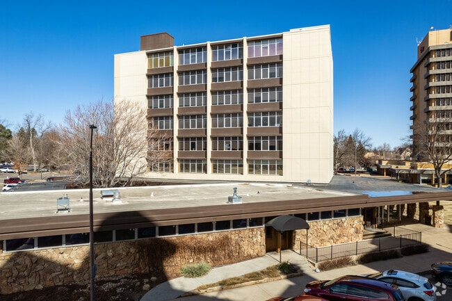

This Property Is For Sale
Property Detail
315 W Oak St
97114-17-001
PARCEL IN SE1/4 SEC 11-7-69; BEING PART BLK 92, CITY OF FT COLLINS: BEG AT NW COR OF BLK 92, TH 3 89 38 58 E 329.39 FT ALG N LN BLK 92; TH S 57 51 08 W 121.94 FT; TH N 89 41 52 W 26.87 FT; TH S 00 18 08 W 4.10 FT; TH N 89 41 52 W 15.52 FT; TH S
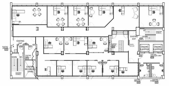
Officebuilding
Larimer
B and X Area of moderate flood hazard, usually the area between the limits of the 100-year and 500-year floods.
Colorado
2024
0.97 AC
2025
Fort Collins/Loveland
000100
Denver
49,953 SF
Fort Collins-Loveland, CO
NEARBY LISTINGS FOR SALE OR LEASE
DEMOGRAPHICS near 315 W Oak St
1 mile
3 mile
5 mile
2025 Total Population
17,074
96,523
164,277
2030 Population
17,641
100,312
169,974
Pop Growth 2025-2030
+ 3.32%
+ 3.93%
+ 3.47%
Average Age
32
34
37
2025 Total Households
6,340
38,765
66,873
HH Growth 2025-2030
+ 4.27%
+ 4.56%
+ 3.93%
Median Household Inc
$64,451
$63,062
$74,542
Avg Household Size
2.00
2.20
2.20
2025 Avg HH Vehicles
2.00
2.00
2.00
Median Home Value
$757,674
$569,241
$592,178
Median Year Built
1971
1982
1988
Nearby Places
Map Layers
Map Styles
 Street
 Aerial
Layers
 Traffic
 Biking
Places
Listings with unknown addresses are not visible on the map
- Restaurants
- Banks
- Shops
- Fitness
- Groceries
Nearby Properties
Address
Land Use
TOTAL SIZE
Lot Size
Zoning
Address
Land Use
TOTAL SIZE
Lot Size
Zoning
850,000 SF
21.76 AC
E
Address
Land Use
TOTAL SIZE
Lot Size
Zoning
1,096,874 SF
72 AC
CSU
Address
Land Use
TOTAL SIZE
Lot Size
Zoning
440,160 SF
29 AC
CSU
Address
Land Use
TOTAL SIZE
Lot Size
Zoning
333,130 SF
47.74 AC
Address
Land Use
TOTAL SIZE
Lot Size
Zoning
397,677 SF
28.87 AC
FA
Address
Land Use
TOTAL SIZE
Lot Size
Zoning
521,085 SF
80.60 AC
CSU
Address
Land Use
TOTAL SIZE
Lot Size
Zoning
283,141 SF
24 AC
RL
Address
Land Use
TOTAL SIZE
Lot Size
Zoning
180,030 SF
18.80 AC
Address
Land Use
TOTAL SIZE
Lot Size
Zoning
172,211 SF
1.92 AC
D
Address
Land Use
TOTAL SIZE
Lot Size
Zoning
281,945 SF
15.01 AC
NCL
Address
Land Use
TOTAL SIZE
Lot Size
Zoning
170,119 SF
12.83 AC
C
Address
Land Use
TOTAL SIZE
Lot Size
Zoning
337,566 SF
2.62 AC
Address
Land Use
TOTAL SIZE
Lot Size
Zoning
155,149 SF
3.67 AC
D
Address
Land Use
TOTAL SIZE
Lot Size
Zoning
98,518 SF
7.54 AC
MMN
Address
Land Use
TOTAL SIZE
Lot Size
Zoning
290,000 SF
3.67 AC
D
Address
Land Use
TOTAL SIZE
Lot Size
Zoning
227,180 SF
39 AC
E
Address
Land Use
TOTAL SIZE
Lot Size
Zoning
139,965 SF
8.62 AC
CSU
Address
Land Use
TOTAL SIZE
Lot Size
Zoning
191,673 SF
17.39 AC
I
Address
Land Use
TOTAL SIZE
Lot Size
Zoning
211,255 SF
20.73 AC
C
Address
Land Use
TOTAL SIZE
Lot Size
Zoning
71,244 SF
5.96 AC
C
Address
Land Use
TOTAL SIZE
Lot Size
Zoning
400,000 SF
1.31 AC
D
Address
Land Use
TOTAL SIZE
Lot Size
Zoning
97,130 SF
8.48 AC
Address
Land Use
TOTAL SIZE
Lot Size
Zoning
87,563 SF
3.15 AC
Address
Land Use
TOTAL SIZE
Lot Size
Zoning
110,700 SF
44.74 AC
FA
Address
Land Use
TOTAL SIZE
Lot Size
Zoning
107,170 SF
14.61 AC
Address
Land Use
TOTAL SIZE
Lot Size
Zoning
189,920 SF
6 AC
E
Address
Land Use
TOTAL SIZE
Lot Size
Zoning
116,589 SF
0.87 AC
Address
Land Use
TOTAL SIZE
Lot Size
Zoning
99,997 SF
10.47 AC
NC
The World's #1 Commercial Real Estate Marketplace
Connect with us
© 2026 CoStar Group
The information above has been obtained from sources believed reliable. While we do not doubt its accuracy we have not verified it and make no guarantee, warranty or representation about it. It is your responsibility to independently confirm its accuracy and completeness. Any projections, opinions, assumptions, or estimates used are for example only and do not represent the current or future performance of the property. The value of this transaction to you depends on tax and other factors which should be evaluated by your tax, financial, and legal advisors. You and your advisors should conduct a careful, independent investigation of the property to determine to your satisfaction the suitability of the property for your needs.