Property Record
3150 E Highway 34 E, Newnan, GA 30265

NEARBY LISTINGS FOR SALE OR LEASE
-
-
View all Newnan listings for lease on LoopNet.com
Property Detail
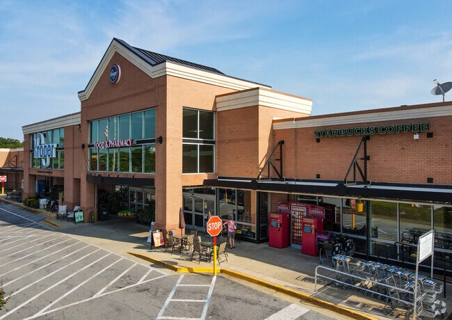
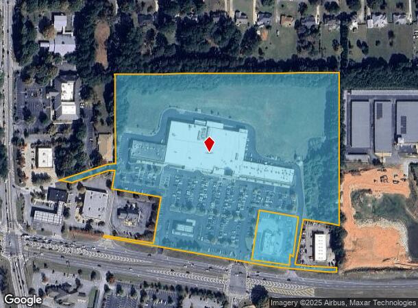
3150 E Highway 34 E
Atlanta-Sandy Springs-Roswell, GA
Alta/Acsm Land Title Mcw-Rc Ga
121-6059-002A
SHOPPING CENTER/ 18.8290 AC HWY 34 @ 154
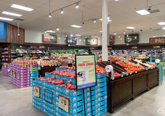
Supermarket
Coweta
X
Georgia
13077C0170D
59
2025
18.83 AC
2025
Coweta County
170404
Atlanta
103,594 SF
DEMOGRAPHICS near 3150 E Highway 34 E
1 Mile
3 Mile
5 Mile
2024 Total Population
2,602
22,360
65,893
2029 Population
2,895
24,804
72,508
Pop Growth 2024-2029
+ 11.26%
+ 10.93%
+ 10.04%
Average Age
43
42
41
2024 Total Households
947
8,014
24,305
HH Growth 2024-2029
+ 11.40%
+ 11.03%
+ 10.10%
Median Household Inc
$97,758
$107,529
$101,025
Avg Household Size
2.70
2.70
2.70
2024 Avg HH Vehicles
3.00
2.00
2.00
Median Home Value
$272,280
$279,095
$299,921
Median Year Built
1993
1996
1998
Nearby Places
Map Layers
Map Styles
 Street
 Aerial
- Restaurants
- Banks
- Shops
- Fitness
- Groceries
PUBLIC TRANSPORTATION
AIRPORT
Hartsfield - Jackson Atlanta International
DRIVE
WALK
Distance
Hartsfield - Jackson Atlanta International
36 min
26.9 mi
SALE & LEASE HISTORY
LISTING DATE
SALE/LEASE

Nov 16, 2021
For Lease
Aug 06, 2024
For Lease
Nearby Properties
Address
Land Use
TOTAL SIZE
Lot Size
Zoning
Address
Land Use
TOTAL SIZE
Lot Size
Zoning
1,079,000 SF
73.44 AC
M
Address
Land Use
TOTAL SIZE
Lot Size
Zoning
1,206,927 SF
109.06 AC
R1
Address
Land Use
TOTAL SIZE
Lot Size
Zoning
1,206,927 SF
109.06 AC
R1
Address
Land Use
TOTAL SIZE
Lot Size
Zoning
457,922 SF
45.16 AC
R1
Address
Land Use
TOTAL SIZE
Lot Size
Zoning
102,007 SF
18.92 AC
002
Address
Land Use
TOTAL SIZE
Lot Size
Zoning
215,344 SF
28.12 AC
R1
Address
Land Use
TOTAL SIZE
Lot Size
Zoning
117,354 SF
48.81 AC
ND
Address
Land Use
TOTAL SIZE
Lot Size
Zoning
134,417 SF
13.01 AC
R1
Address
Land Use
TOTAL SIZE
Lot Size
Zoning
216,250 SF
20.12 AC
R1
Address
Land Use
TOTAL SIZE
Lot Size
Zoning
108,138 SF
6.36 AC
002
Address
Land Use
TOTAL SIZE
Lot Size
Zoning
71,888 SF
23.48 AC
R1
Address
Land Use
TOTAL SIZE
Lot Size
Zoning
70,162 SF
12.32 AC
001
Address
Land Use
TOTAL SIZE
Lot Size
Zoning
47,598 SF
4.29 AC
C
Address
Land Use
TOTAL SIZE
Lot Size
Zoning
121,290 SF
11.74 AC
R1
Address
Land Use
TOTAL SIZE
Lot Size
Zoning
186,249 SF
17.99 AC
R1
Address
Land Use
TOTAL SIZE
Lot Size
Zoning
48,000 SF
4.65 AC
M
Address
Land Use
TOTAL SIZE
Lot Size
Zoning
63,876 SF
9.58 AC
ND
Address
Land Use
TOTAL SIZE
Lot Size
Zoning
186,695 SF
29.47 AC
R1
Address
Land Use
TOTAL SIZE
Lot Size
Zoning
80,630 SF
1.25 AC
002
Address
Land Use
TOTAL SIZE
Lot Size
Zoning
112,650 SF
5.70 AC
002
Address
Land Use
TOTAL SIZE
Lot Size
Zoning
53,968 SF
3.33 AC
M
Address
Land Use
TOTAL SIZE
Lot Size
Zoning
89,260 SF
10.26 AC
001
Address
Land Use
TOTAL SIZE
Lot Size
Zoning
90,474 SF
12.56 AC
C
Address
Land Use
TOTAL SIZE
Lot Size
Zoning
117,635 SF
20 AC
001
Address
Land Use
TOTAL SIZE
Lot Size
Zoning
28,753 SF
4.83 AC
R1
Address
Land Use
TOTAL SIZE
Lot Size
Zoning
25,372 SF
2.27 AC
001
Address
Land Use
TOTAL SIZE
Lot Size
Zoning
125,758 SF
10.77 AC
002
Address
Land Use
TOTAL SIZE
Lot Size
Zoning
215,323 SF
29.24 AC
003
Address
Land Use
TOTAL SIZE
Lot Size
Zoning
150,000 SF
10.47 AC
002
The World's #1 Commercial Real Estate Marketplace
Connect with us
© 2025 CoStar Group
The information above has been obtained from sources believed reliable. While we do not doubt its accuracy we have not verified it and make no guarantee, warranty or representation about it. It is your responsibility to independently confirm its accuracy and completeness. Any projections, opinions, assumptions, or estimates used are for example only and do not represent the current or future performance of the property. The value of this transaction to you depends on tax and other factors which should be evaluated by your tax, financial, and legal advisors. You and your advisors should conduct a careful, independent investigation of the property to determine to your satisfaction the suitability of the property for your needs.