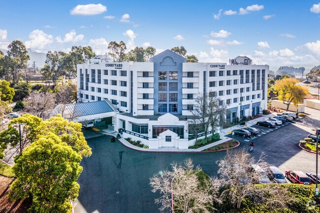
Property Record
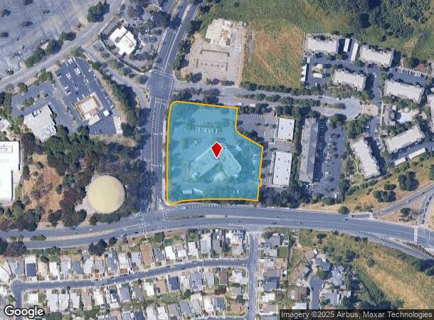
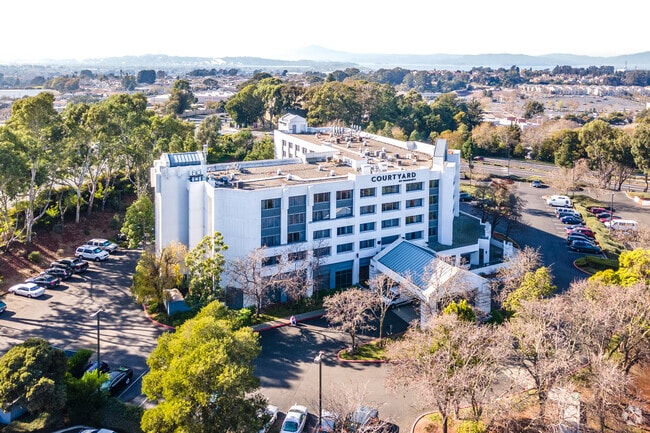
3150 Garrity Way, San Pablo, CA 94806

NEARBY LISTINGS FOR SALE OR LEASE
-
-
View all San Pablo listings for lease on LoopNet.com
Property Detail
3150 Garrity Way
405-290-053-9
Pm 137 47
Motel
PCL MAP 137 PG 47 PCL B
X
Contra Costa
06013C0227F
California
2025
3.47 AC
2025
Oakland Northeast/Concord
365003
East Bay/Oakland
72,927 SF
Oakland-Hayward-Berkeley, CA
DEMOGRAPHICS near 3150 Garrity Way
1 Mile
3 Mile
5 Mile
2024 Total Population
17,809
136,685
243,255
2029 Population
17,570
135,247
240,879
Pop Growth 2024-2029
(1.34%)
(1.05%)
(0.98%)
Average Age
40
40
40
2024 Total Households
6,399
44,397
81,060
HH Growth 2024-2029
(1.63%)
(1.12%)
(1.03%)
Median Household Inc
$80,025
$87,915
$90,363
Avg Household Size
2.60
3.00
2.90
2024 Avg HH Vehicles
2.00
2.00
2.00
Median Home Value
$679,713
$686,008
$716,416
Median Year Built
1974
1964
1967
Nearby Places
Map Layers
Map Styles
 Street
 Aerial
- Restaurants
- Banks
- Shops
- Fitness
- Groceries
PUBLIC TRANSPORTATION
COMMUTER RAIL
DRIVE
WALK
Distance
10 min
4.5 mi
DRIVE
WALK
Distance
14 min
9.5 mi
AIRPORT
Metro Oakland International
DRIVE
WALK
Distance
Metro Oakland International
33 min
24.0 mi
San Francisco International
DRIVE
WALK
Distance
San Francisco International
46 min
31.5 mi
Freight Ports
Port of Richmond
DRIVE
WALK
Distance
Port of Richmond
18 min
9.9 mi
SALE & LEASE HISTORY
LISTING DATE
SALE/LEASE

Oct 08, 2023
For Lease
Nearby Properties
Address
Land Use
TOTAL SIZE
Lot Size
Zoning
Address
Land Use
TOTAL SIZE
Lot Size
Zoning
892,224 SF
46.87 AC
Address
Land Use
TOTAL SIZE
Lot Size
Zoning
707,820 SF
44.29 AC
Address
Land Use
TOTAL SIZE
Lot Size
Zoning
481,487 SF
27.88 AC
P-1
Address
Land Use
TOTAL SIZE
Lot Size
Zoning
205,900 SF
20.70 AC
P1
Address
Land Use
TOTAL SIZE
Lot Size
Zoning
321,008 SF
47.36 AC
Address
Land Use
TOTAL SIZE
Lot Size
Zoning
252,714 SF
14.68 AC
C
Address
Land Use
TOTAL SIZE
Lot Size
Zoning
459,003 SF
21.30 AC
Address
Land Use
TOTAL SIZE
Lot Size
Zoning
179,961 SF
1.05 AC
Address
Land Use
TOTAL SIZE
Lot Size
Zoning
247,924 SF
14.36 AC
Address
Land Use
TOTAL SIZE
Lot Size
Zoning
245,680 SF
18.89 AC
Address
Land Use
TOTAL SIZE
Lot Size
Zoning
200,000 SF
14.95 AC
Address
Land Use
TOTAL SIZE
Lot Size
Zoning
70,250 SF
9.55 AC
Address
Land Use
TOTAL SIZE
Lot Size
Zoning
220,864 SF
11.10 AC
Address
Land Use
TOTAL SIZE
Lot Size
Zoning
190,471 SF
11.32 AC
Address
Land Use
TOTAL SIZE
Lot Size
Zoning
171,052 SF
12.06 AC
M3
Address
Land Use
TOTAL SIZE
Lot Size
Zoning
135,904 SF
7.12 AC
Address
Land Use
TOTAL SIZE
Lot Size
Zoning
113,346 SF
10.11 AC
Address
Land Use
TOTAL SIZE
Lot Size
Zoning
14,722 SF
5.69 AC
Address
Land Use
TOTAL SIZE
Lot Size
Zoning
41,400 SF
6.32 AC
Address
Land Use
TOTAL SIZE
Lot Size
Zoning
177,724 SF
63.32 AC
M-2
Address
Land Use
TOTAL SIZE
Lot Size
Zoning
118,658 SF
8.57 AC
Address
Land Use
TOTAL SIZE
Lot Size
Zoning
178,277 SF
58.72 AC
Address
Land Use
TOTAL SIZE
Lot Size
Zoning
131,693 SF
7.47 AC
Address
Land Use
TOTAL SIZE
Lot Size
Zoning
144,000 SF
7.64 AC
Address
Land Use
TOTAL SIZE
Lot Size
Zoning
61,875 SF
3.62 AC
Address
Land Use
TOTAL SIZE
Lot Size
Zoning
110,765 SF
2.67 AC
Address
Land Use
TOTAL SIZE
Lot Size
Zoning
60,196 SF
13.44 AC
Address
Land Use
TOTAL SIZE
Lot Size
Zoning
85,225 SF
8.34 AC
Address
Land Use
TOTAL SIZE
Lot Size
Zoning
61,403 SF
8.38 AC
Address
Land Use
TOTAL SIZE
Lot Size
Zoning
7.06 AC
P1
The World's #1 Commercial Real Estate Marketplace
Connect with us
© 2026 CoStar Group
The information above has been obtained from sources believed reliable. While we do not doubt its accuracy we have not verified it and make no guarantee, warranty or representation about it. It is your responsibility to independently confirm its accuracy and completeness. Any projections, opinions, assumptions, or estimates used are for example only and do not represent the current or future performance of the property. The value of this transaction to you depends on tax and other factors which should be evaluated by your tax, financial, and legal advisors. You and your advisors should conduct a careful, independent investigation of the property to determine to your satisfaction the suitability of the property for your needs.