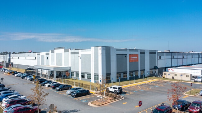
Property Record
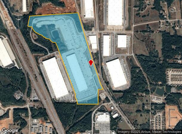
3150 Highway 42 S, Locust Grove, GA 30248
NEARBY LISTINGS FOR SALE OR LEASE
Property Detail
3150 Highway 42 S
0112-01-017-004
SPLIT 62+AC PER SWD 16049 / 1 OUT OF PRCL 112-1-17 /LAND LOT: 216 /LAND DISTRICT: 2; INDUSTRIAL
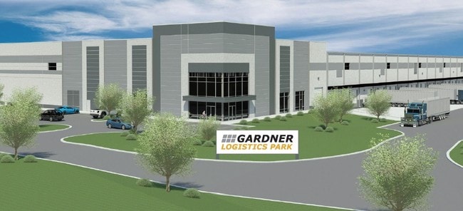
Distributionwarehouseregional
Henry
X
Georgia
13255C0085E
129.11 AC
2025
S Clayton/Henry Cnty
2025
Atlanta
070411
Atlanta-Sandy Springs-Roswell, GA
660,000 SF
DEMOGRAPHICS near 3150 Highway 42 S
1 Mile
3 Mile
5 Mile
2024 Total Population
517
17,074
51,613
2029 Population
575
18,947
56,877
Pop Growth 2024-2029
+ 11.22%
+ 10.97%
+ 10.20%
Average Age
37
36
36
2024 Total Households
171
5,882
17,495
HH Growth 2024-2029
+ 11.11%
+ 11.14%
+ 10.31%
Median Household Inc
$72,999
$66,716
$73,025
Avg Household Size
3.00
2.90
2.90
2024 Avg HH Vehicles
2.00
2.00
2.00
Median Home Value
$234,482
$207,497
$219,913
Median Year Built
2005
2005
2004
Nearby Places
Map Layers
Map Styles
 Street
 Aerial
- Restaurants
- Banks
- Shops
- Fitness
- Groceries
PUBLIC TRANSPORTATION
AIRPORT
Hartsfield - Jackson Atlanta International
DRIVE
WALK
Distance
Hartsfield - Jackson Atlanta International
40 min
30.4 mi
Freight Ports
Georgia Ports - Savannah
DRIVE
WALK
Distance
Georgia Ports - Savannah
241 min
214.8 mi
SALE & LEASE HISTORY
LISTING DATE
SALE/LEASE

Oct 03, 2018
For Lease
Nearby Properties
Address
Land Use
TOTAL SIZE
Lot Size
Zoning
Address
Land Use
TOTAL SIZE
Lot Size
Zoning
1,573,998 SF
84.31 AC
M2
Address
Land Use
TOTAL SIZE
Lot Size
Zoning
1,012,028 SF
98.01 AC
M1
Address
Land Use
TOTAL SIZE
Lot Size
Zoning
1,079,756 SF
92.38 AC
M1
Address
Land Use
TOTAL SIZE
Lot Size
Zoning
1,010,600 SF
78.40 AC
M1
Address
Land Use
TOTAL SIZE
Lot Size
Zoning
247,544 SF
43.30 AC
Address
Land Use
TOTAL SIZE
Lot Size
Zoning
4,307,236 SF
66.85 AC
M1
Address
Land Use
TOTAL SIZE
Lot Size
Zoning
765,316 SF
85.65 AC
M1
Address
Land Use
TOTAL SIZE
Lot Size
Zoning
7,005,327 SF
56.89 AC
M1
Address
Land Use
TOTAL SIZE
Lot Size
Zoning
415,997 SF
41.35 AC
Address
Land Use
TOTAL SIZE
Lot Size
Zoning
22,633 SF
31 AC
RM
Address
Land Use
TOTAL SIZE
Lot Size
Zoning
4,982 SF
34.62 AC
RM
Address
Land Use
TOTAL SIZE
Lot Size
Zoning
4,237,908 SF
44.42 AC
M
Address
Land Use
TOTAL SIZE
Lot Size
Zoning
351,848 SF
41.63 AC
C2
Address
Land Use
TOTAL SIZE
Lot Size
Zoning
6,101,324 SF
42.27 AC
M1
Address
Land Use
TOTAL SIZE
Lot Size
Zoning
297,736 SF
57.04 AC
M
Address
Land Use
TOTAL SIZE
Lot Size
Zoning
1,122,282 SF
39.20 AC
M2
Address
Land Use
TOTAL SIZE
Lot Size
Zoning
2,603,368 SF
49.23 AC
M1
Address
Land Use
TOTAL SIZE
Lot Size
Zoning
3,783,900 SF
43.09 AC
M1
Address
Land Use
TOTAL SIZE
Lot Size
Zoning
678,692 SF
47.81 AC
M1
Address
Land Use
TOTAL SIZE
Lot Size
Zoning
652,452 SF
55.99 AC
M2
Address
Land Use
TOTAL SIZE
Lot Size
Zoning
138,766 SF
14.46 AC
M1
Address
Land Use
TOTAL SIZE
Lot Size
Zoning
801,000 SF
22.34 AC
M1
Address
Land Use
TOTAL SIZE
Lot Size
Zoning
205,200 SF
16.25 AC
M1
Address
Land Use
TOTAL SIZE
Lot Size
Zoning
614,100 SF
22.72 AC
M1
Address
Land Use
TOTAL SIZE
Lot Size
Zoning
197,290 SF
22.14 AC
M1
Address
Land Use
TOTAL SIZE
Lot Size
Zoning
345,101 SF
45.55 AC
M2
Address
Land Use
TOTAL SIZE
Lot Size
Zoning
166,447 SF
66.49 AC
Address
Land Use
TOTAL SIZE
Lot Size
Zoning
405,620 SF
19.94 AC
M1
The World's #1 Commercial Real Estate Marketplace
Connect with us
© 2026 CoStar Group
The information above has been obtained from sources believed reliable. While we do not doubt its accuracy we have not verified it and make no guarantee, warranty or representation about it. It is your responsibility to independently confirm its accuracy and completeness. Any projections, opinions, assumptions, or estimates used are for example only and do not represent the current or future performance of the property. The value of this transaction to you depends on tax and other factors which should be evaluated by your tax, financial, and legal advisors. You and your advisors should conduct a careful, independent investigation of the property to determine to your satisfaction the suitability of the property for your needs.