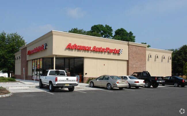
Property Record
3150 S Broad St, Trenton, NJ 08610


NEARBY LISTINGS FOR SALE OR LEASE
Property Detail
3150 S Broad St
03-02488-0000-00020
08171-
Storebuilding
Mercer
X
New Jersey
34021C0229F
20
2024
0.84 AC
2025
Trenton
002602
Northern New Jersey
6,944 SF
Trenton, NJ
DEMOGRAPHICS near 3150 S Broad St
1 Mile
3 Mile
5 Mile
2024 Total Population
10,313
101,378
210,644
2029 Population
10,180
99,844
208,372
Pop Growth 2024-2029
(1.29%)
(1.51%)
(1.08%)
Average Age
43
39
39
2024 Total Households
4,129
36,177
76,703
HH Growth 2024-2029
(1.50%)
(1.52%)
(1.12%)
Median Household Inc
$95,711
$71,352
$72,379
Avg Household Size
2.50
2.60
2.60
2024 Avg HH Vehicles
2.00
2.00
2.00
Median Home Value
$232,170
$227,072
$253,519
Median Year Built
1956
1955
1957
Nearby Places
Map Layers
Map Styles
 Street
 Aerial
- Restaurants
- Banks
- Shops
- Fitness
- Groceries
PUBLIC TRANSPORTATION
COMMUTER RAIL
Trenton Transit Center (Trenton Line - SEPTA)
DRIVE
WALK
Distance
Trenton Transit Center (Trenton Line - SEPTA)
8 min
3.7 mi
Trenton Transit Center (Njt) (Northeast Corridor Line - NJ Transit Commuter Rail (NJ Transit), R7 - NJ Transit Commuter Rail (NJ Transit), River LINE - NJ Transit Commuter Rail (NJ Transit))
DRIVE
WALK
Distance
Trenton Transit Center (Njt) (Northeast Corridor Line - NJ Transit Commuter Rail (NJ Transit), R7 - NJ Transit Commuter Rail (NJ Transit), River LINE - NJ Transit Commuter Rail (NJ Transit))
10 min
4.4 mi
AIRPORT
Trenton Mercer
DRIVE
WALK
Distance
Trenton Mercer
19 min
10.6 mi
Freight Ports
Port of Philadelphia
DRIVE
WALK
Distance
Port of Philadelphia
44 min
33.4 mi
Nearby Properties
Address
Land Use
TOTAL SIZE
Lot Size
Zoning
Address
Land Use
TOTAL SIZE
Lot Size
Zoning
561.91 AC
AG
Address
Land Use
TOTAL SIZE
Lot Size
Zoning
13.73 AC
Address
Land Use
TOTAL SIZE
Lot Size
Zoning
Address
Land Use
TOTAL SIZE
Lot Size
Zoning
43,715 SF
49.95 AC
Address
Land Use
TOTAL SIZE
Lot Size
Zoning
23.13 AC
RD
Address
Land Use
TOTAL SIZE
Lot Size
Zoning
35.83 AC
RB
Address
Land Use
TOTAL SIZE
Lot Size
Zoning
30.94 AC
Address
Land Use
TOTAL SIZE
Lot Size
Zoning
51.10 AC
Address
Land Use
TOTAL SIZE
Lot Size
Zoning
60.26 AC
RD
Address
Land Use
TOTAL SIZE
Lot Size
Zoning
44.82 AC
RD
Address
Land Use
TOTAL SIZE
Lot Size
Zoning
2,030 SF
45.57 AC
Address
Land Use
TOTAL SIZE
Lot Size
Zoning
Address
Land Use
TOTAL SIZE
Lot Size
Zoning
18.33 AC
Address
Land Use
TOTAL SIZE
Lot Size
Zoning
32.71 AC
HC
Address
Land Use
TOTAL SIZE
Lot Size
Zoning
9.63 AC
RD
Address
Land Use
TOTAL SIZE
Lot Size
Zoning
263,232 SF
39.16 AC
CI
Address
Land Use
TOTAL SIZE
Lot Size
Zoning
23.53 AC
AT
Address
Land Use
TOTAL SIZE
Lot Size
Zoning
27.50 AC
R7
Address
Land Use
TOTAL SIZE
Lot Size
Zoning
6.79 AC
R7
Address
Land Use
TOTAL SIZE
Lot Size
Zoning
15.80 AC
C
Address
Land Use
TOTAL SIZE
Lot Size
Zoning
Address
Land Use
TOTAL SIZE
Lot Size
Zoning
156,128 SF
6.33 AC
RB
Address
Land Use
TOTAL SIZE
Lot Size
Zoning
Address
Land Use
TOTAL SIZE
Lot Size
Zoning
17,500 SF
18.14 AC
HC
Address
Land Use
TOTAL SIZE
Lot Size
Zoning
Address
Land Use
TOTAL SIZE
Lot Size
Zoning
60,564 SF
18.37 AC
RD
Address
Land Use
TOTAL SIZE
Lot Size
Zoning
14,574 SF
20.23 AC
R10
Address
Land Use
TOTAL SIZE
Lot Size
Zoning
4.63 AC
MU
Address
Land Use
TOTAL SIZE
Lot Size
Zoning
2.89 AC
RD
Address
Land Use
TOTAL SIZE
Lot Size
Zoning
21.91 AC
R10
The World's #1 Commercial Real Estate Marketplace
Connect with us
© 2025 CoStar Group
The information above has been obtained from sources believed reliable. While we do not doubt its accuracy we have not verified it and make no guarantee, warranty or representation about it. It is your responsibility to independently confirm its accuracy and completeness. Any projections, opinions, assumptions, or estimates used are for example only and do not represent the current or future performance of the property. The value of this transaction to you depends on tax and other factors which should be evaluated by your tax, financial, and legal advisors. You and your advisors should conduct a careful, independent investigation of the property to determine to your satisfaction the suitability of the property for your needs.