Property Record
3151 W 20Th St, Greeley, CO 80634
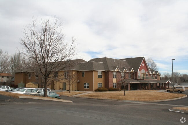


Property Detail
3151 W 20Th St
Greeley, CO
GR WC L1 WESTLAKE COMMONS MINOR SUB
R4966108
Weld
Apartment
Colorado
B and X Area of moderate flood hazard, usually the area between the limits of the 100-year and 500-year floods.
1
2024
1.91 AC
2025
Weld County
001202
Denver
45,175 SF
NEARBY LISTINGS FOR SALE OR LEASE
-
-
View all Greeley listings for sale on LoopNet.com
DEMOGRAPHICS near 3151 W 20Th St
1 mile
3 mile
5 mile
2024 Total Population
17,330
123,546
153,165
2029 Population
20,522
145,566
180,444
Pop Growth 2024-2029
+ 18.42%
+ 17.82%
+ 17.81%
Average Age
39
36
36
2024 Total Households
6,765
44,448
54,349
HH Growth 2024-2029
+ 18.92%
+ 18.57%
+ 18.54%
Median Household Inc
$70,245
$60,092
$65,272
Avg Household Size
2.50
2.60
2.70
2024 Avg HH Vehicles
2.00
2.00
2.00
Median Home Value
$352,384
$328,380
$345,005
Median Year Built
1976
1985
1989
Nearby Places
Map Layers
Map Styles
 Street
 Aerial
Transit
 Traffic
 Biking
Places
Listings with unknown addresses are not visible on the map
- Restaurants
- Banks
- Shops
- Fitness
- Groceries
Nearby Properties
Address
Land Use
TOTAL SIZE
Lot Size
Zoning
Address
Land Use
TOTAL SIZE
Lot Size
Zoning
1,682,342 SF
134.62 AC
Address
Land Use
TOTAL SIZE
Lot Size
Zoning
1,181,203 SF
23.26 AC
Address
Land Use
TOTAL SIZE
Lot Size
Zoning
689,580 SF
65.15 AC
Address
Land Use
TOTAL SIZE
Lot Size
Zoning
669,727 SF
180.71 AC
Address
Land Use
TOTAL SIZE
Lot Size
Zoning
280,000 SF
43.91 AC
Address
Land Use
TOTAL SIZE
Lot Size
Zoning
536,281 SF
33.91 AC
Address
Land Use
TOTAL SIZE
Lot Size
Zoning
237,575 SF
10.77 AC
Address
Land Use
TOTAL SIZE
Lot Size
Zoning
151,418 SF
16.96 AC
Address
Land Use
TOTAL SIZE
Lot Size
Zoning
113,715 SF
9.42 AC
Address
Land Use
TOTAL SIZE
Lot Size
Zoning
83,032 SF
9.23 AC
Address
Land Use
TOTAL SIZE
Lot Size
Zoning
146,843 SF
12.80 AC
Address
Land Use
TOTAL SIZE
Lot Size
Zoning
150,693 SF
20 AC
Address
Land Use
TOTAL SIZE
Lot Size
Zoning
118,663 SF
13.36 AC
Address
Land Use
TOTAL SIZE
Lot Size
Zoning
138,446 SF
14.40 AC
Address
Land Use
TOTAL SIZE
Lot Size
Zoning
88,284 SF
5.80 AC
Address
Land Use
TOTAL SIZE
Lot Size
Zoning
34,697 SF
55.28 AC
Address
Land Use
TOTAL SIZE
Lot Size
Zoning
219,178 SF
22.28 AC
Address
Land Use
TOTAL SIZE
Lot Size
Zoning
214,594 SF
22.70 AC
Address
Land Use
TOTAL SIZE
Lot Size
Zoning
289,203 SF
12.28 AC
Address
Land Use
TOTAL SIZE
Lot Size
Zoning
309,821 SF
13.55 AC
Address
Land Use
TOTAL SIZE
Lot Size
Zoning
122,023 SF
12.29 AC
Address
Land Use
TOTAL SIZE
Lot Size
Zoning
63,960 SF
3.67 AC
Address
Land Use
TOTAL SIZE
Lot Size
Zoning
105,705 SF
9.24 AC
Address
Land Use
TOTAL SIZE
Lot Size
Zoning
202,130 SF
25.35 AC
Address
Land Use
TOTAL SIZE
Lot Size
Zoning
405,388 SF
17.36 AC
Address
Land Use
TOTAL SIZE
Lot Size
Zoning
239,925 SF
6.06 AC
Address
Land Use
TOTAL SIZE
Lot Size
Zoning
127,822 SF
1.38 AC
Address
Land Use
TOTAL SIZE
Lot Size
Zoning
132,968 SF
1.24 AC
Address
Land Use
TOTAL SIZE
Lot Size
Zoning
82,759 SF
2.05 AC
Address
Land Use
TOTAL SIZE
Lot Size
Zoning
80,202 SF
6 AC
The World's #1 Commercial Real Estate Marketplace
Connect with us
© 2026 CoStar Group
The information above has been obtained from sources believed reliable. While we do not doubt its accuracy we have not verified it and make no guarantee, warranty or representation about it. It is your responsibility to independently confirm its accuracy and completeness. Any projections, opinions, assumptions, or estimates used are for example only and do not represent the current or future performance of the property. The value of this transaction to you depends on tax and other factors which should be evaluated by your tax, financial, and legal advisors. You and your advisors should conduct a careful, independent investigation of the property to determine to your satisfaction the suitability of the property for your needs.