Property Record
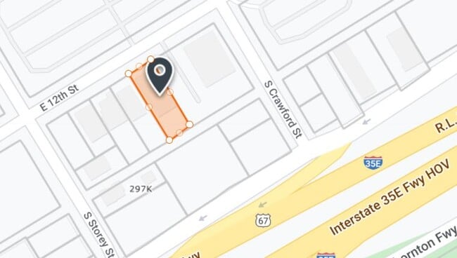
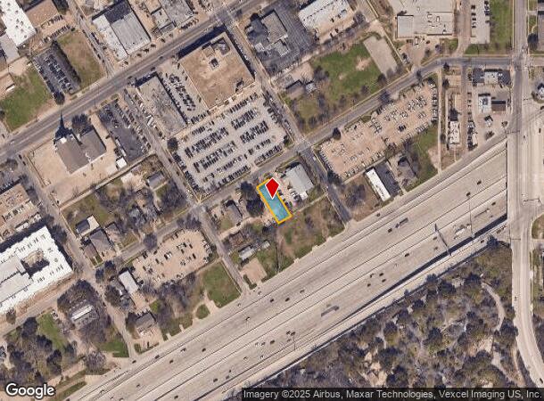
316 E 12Th St, Dallas, TX 75203
NEARBY LISTINGS FOR SALE OR LEASE
Property Detail
316 E 12Th St
Dallas-Fort Worth-Arlington, TX
Mendozas 12Th Street
003106012303A0000
MENDOZAS 12TH STREET BLK 123/3106 LT 3A ACS 0.1856 INT202200033799 DD01312022 CO-DC 3106 123 03A00 8DA3106 123
Apartment
Dallas
X
Texas
48113C0480K
3a
2024
0.19 AC
2025
Lake Cliff
004800
Dallas/Ft Worth
5,880 SF
DEMOGRAPHICS near 316 E 12Th St
1 mile
3 mile
5 mile
2024 Total Population
18,759
138,927
371,407
2029 Population
19,007
139,710
373,386
Pop Growth 2024-2029
+ 1.32%
+ 0.56%
+ 0.53%
Average Age
36
36
36
2024 Total Households
6,690
51,224
151,476
HH Growth 2024-2029
+ 1.09%
+ 0.95%
+ 0.77%
Median Household Inc
$43,875
$54,401
$56,683
Avg Household Size
2.70
2.50
2.30
2024 Avg HH Vehicles
2.00
2.00
2.00
Median Home Value
$253,707
$234,261
$215,985
Median Year Built
1960
1960
1981
Nearby Places
Map Layers
Map Styles
 Street
 Aerial
Transit
 Traffic
 Biking
Places
Listings with unknown addresses are not visible on the map
- Restaurants
- Banks
- Shops
- Fitness
- Groceries
PUBLIC TRANSPORTATION
TRANSIT/SUBWAY
Dallas Zoo (Red Line - Dallas Area Rapid Transit (DART))
Drive
Walk
Distance
Dallas Zoo (Red Line - Dallas Area Rapid Transit (DART))
3 min
15 min
0.8 mi
COMMUTER RAIL
Drive
Walk
Distance
7 min
4.4 mi
Drive
Walk
Distance
11 min
6.9 mi
AIRPORT
Dallas Love Field
Drive
Walk
Distance
Dallas Love Field
17 min
9.4 mi
Dallas-Fort Worth International
Drive
Walk
Distance
Dallas-Fort Worth International
31 min
23.5 mi
Nearby Properties
Address
Land Use
TOTAL SIZE
Lot Size
Zoning
Address
Land Use
TOTAL SIZE
Lot Size
Zoning
1,298,826 SF
33.16 AC
Z163
Address
Land Use
TOTAL SIZE
Lot Size
Zoning
1,308,710 SF
8.42 AC
Z21
Address
Land Use
TOTAL SIZE
Lot Size
Zoning
1,480,246 SF
1.86 AC
Z21
Address
Land Use
TOTAL SIZE
Lot Size
Zoning
1,424,070 SF
1.36 AC
Z21
Address
Land Use
TOTAL SIZE
Lot Size
Zoning
1,682,440 SF
1.44 AC
Z96
Address
Land Use
TOTAL SIZE
Lot Size
Zoning
784,725 SF
2.33 AC
Z239
Address
Land Use
TOTAL SIZE
Lot Size
Zoning
858,120 SF
2.21 AC
Z21
Address
Land Use
TOTAL SIZE
Lot Size
Zoning
1,912,762 SF
1.54 AC
Z21
Address
Land Use
TOTAL SIZE
Lot Size
Zoning
1,979,594 SF
1.81 AC
Z21
Address
Land Use
TOTAL SIZE
Lot Size
Zoning
307,597 SF
15.21 AC
Z116
Address
Land Use
TOTAL SIZE
Lot Size
Zoning
1,018,066 SF
1.20 AC
Z21
Address
Land Use
TOTAL SIZE
Lot Size
Zoning
741,673 SF
1.30 AC
Z21
Address
Land Use
TOTAL SIZE
Lot Size
Zoning
732,117 SF
5 AC
Z239
Address
Land Use
TOTAL SIZE
Lot Size
Zoning
724,888 SF
2.59 AC
Address
Land Use
TOTAL SIZE
Lot Size
Zoning
26,896 SF
3.56 AC
Z239
Address
Land Use
TOTAL SIZE
Lot Size
Zoning
316,447 SF
12.61 AC
Z164
Address
Land Use
TOTAL SIZE
Lot Size
Zoning
1,974,033 SF
1.67 AC
Z21
Address
Land Use
TOTAL SIZE
Lot Size
Zoning
510,277 SF
1.67 AC
Z239
Address
Land Use
TOTAL SIZE
Lot Size
Zoning
1,083,196 SF
6.13 AC
Z21
Address
Land Use
TOTAL SIZE
Lot Size
Zoning
179,370 SF
13.18 AC
Z248
Address
Land Use
TOTAL SIZE
Lot Size
Zoning
419,729 SF
3.62 AC
Z115
Address
Land Use
TOTAL SIZE
Lot Size
Zoning
452,834 SF
2.76 AC
Z21
Address
Land Use
TOTAL SIZE
Lot Size
Zoning
1,137,345 SF
0.83 AC
Z21
Address
Land Use
TOTAL SIZE
Lot Size
Zoning
506,299 SF
4.24 AC
Z116
Address
Land Use
TOTAL SIZE
Lot Size
Zoning
859,038 SF
0.92 AC
Z21
Address
Land Use
TOTAL SIZE
Lot Size
Zoning
381,448 SF
19.99 AC
Z151
Address
Land Use
TOTAL SIZE
Lot Size
Zoning
512,824 SF
0.47 AC
Z21
Address
Land Use
TOTAL SIZE
Lot Size
Zoning
646,211 SF
5.79 AC
Z239
Address
Land Use
TOTAL SIZE
Lot Size
Zoning
513,833 SF
0.17 AC
Z59
Address
Land Use
TOTAL SIZE
Lot Size
Zoning
100 SF
37.84 AC
Z115
The World's #1 Commercial Real Estate Marketplace
Connect with us
© 2026 CoStar Group
The information above has been obtained from sources believed reliable. While we do not doubt its accuracy we have not verified it and make no guarantee, warranty or representation about it. It is your responsibility to independently confirm its accuracy and completeness. Any projections, opinions, assumptions, or estimates used are for example only and do not represent the current or future performance of the property. The value of this transaction to you depends on tax and other factors which should be evaluated by your tax, financial, and legal advisors. You and your advisors should conduct a careful, independent investigation of the property to determine to your satisfaction the suitability of the property for your needs.