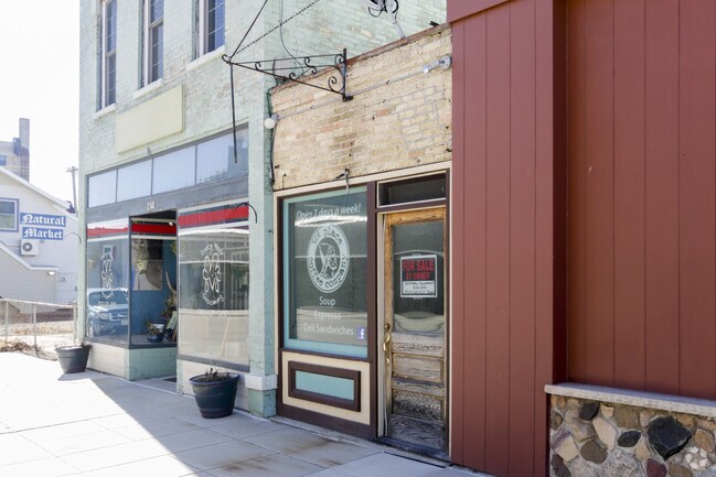
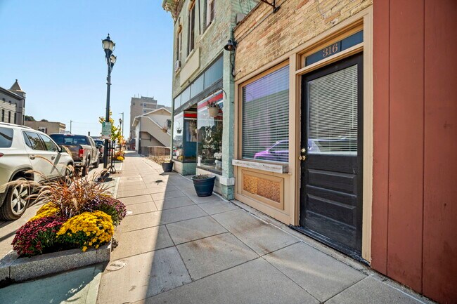
Property Record
316 N 8Th St, Manitowoc, WI 54220
NEARBY LISTINGS FOR SALE OR LEASE
Property Detail
316 N 8Th St
Manitowoc, WI
Original Plat In The City Of Manitowoc
052-000-155-021.00
NORTH 50 OF LOTS 1 & 2 BLK 155
Commercialnec
Manitowoc
X
Wisconsin
55071C0306D
1,2
2024
0.02 AC
2024
Wisconsin South Area
000400
Other Market Areas
486 SF
DEMOGRAPHICS near 316 N 8Th St
1 Mile
3 Mile
5 Mile
2024 Total Population
8,737
33,377
38,924
2029 Population
8,778
33,490
39,040
Pop Growth 2024-2029
+ 0.47%
+ 0.34%
+ 0.30%
Average Age
39
43
43
2024 Total Households
3,697
14,740
17,145
HH Growth 2024-2029
+ 0.49%
+ 0.34%
+ 0.30%
Median Household Inc
$45,276
$51,916
$53,173
Avg Household Size
2.20
2.20
2.20
2024 Avg HH Vehicles
2.00
2.00
2.00
Median Home Value
$113,411
$138,296
$145,830
Median Year Built
1946
1957
1961
Nearby Places
Map Layers
Map Styles
 Street
 Aerial
- Restaurants
- Banks
- Shops
- Fitness
- Groceries
PUBLIC TRANSPORTATION
AIRPORT
Green Bay/Austin Straubel International
DRIVE
WALK
Distance
Green Bay/Austin Straubel International
56 min
42.8 mi
SALE & LEASE HISTORY
LISTING DATE
SALE/LEASE

Oct 25, 2022
For Sale
Feb 23, 2017
For Sale
Nearby Properties
Address
Land Use
TOTAL SIZE
Lot Size
Zoning
Address
Land Use
TOTAL SIZE
Lot Size
Zoning
140,000 SF
5.63 AC
Address
Land Use
TOTAL SIZE
Lot Size
Zoning
36.16 AC
Address
Land Use
TOTAL SIZE
Lot Size
Zoning
74,004 SF
12.64 AC
Address
Land Use
TOTAL SIZE
Lot Size
Zoning
97,963 SF
12.33 AC
B3
Address
Land Use
TOTAL SIZE
Lot Size
Zoning
202,432 SF
20.27 AC
Address
Land Use
TOTAL SIZE
Lot Size
Zoning
105,564 SF
13.27 AC
Address
Land Use
TOTAL SIZE
Lot Size
Zoning
49.62 AC
Address
Land Use
TOTAL SIZE
Lot Size
Zoning
176,600 SF
18.79 AC
Address
Land Use
TOTAL SIZE
Lot Size
Zoning
45,901 SF
9.26 AC
Address
Land Use
TOTAL SIZE
Lot Size
Zoning
15,775 SF
1.64 AC
Address
Land Use
TOTAL SIZE
Lot Size
Zoning
66,328 SF
6.09 AC
Address
Land Use
TOTAL SIZE
Lot Size
Zoning
21.54 AC
Address
Land Use
TOTAL SIZE
Lot Size
Zoning
76,362 SF
7.83 AC
Address
Land Use
TOTAL SIZE
Lot Size
Zoning
150,045 SF
10.42 AC
Address
Land Use
TOTAL SIZE
Lot Size
Zoning
187,990 SF
12.45 AC
Address
Land Use
TOTAL SIZE
Lot Size
Zoning
677,161 SF
9.15 AC
Address
Land Use
TOTAL SIZE
Lot Size
Zoning
48,828 SF
0.65 AC
Address
Land Use
TOTAL SIZE
Lot Size
Zoning
18,483 SF
3.12 AC
Address
Land Use
TOTAL SIZE
Lot Size
Zoning
7.08 AC
Address
Land Use
TOTAL SIZE
Lot Size
Zoning
17.41 AC
Address
Land Use
TOTAL SIZE
Lot Size
Zoning
45,708 SF
5.66 AC
Address
Land Use
TOTAL SIZE
Lot Size
Zoning
59,680 SF
6.40 AC
Address
Land Use
TOTAL SIZE
Lot Size
Zoning
64,206 SF
3.76 AC
Address
Land Use
TOTAL SIZE
Lot Size
Zoning
30,576 SF
11.25 AC
Address
Land Use
TOTAL SIZE
Lot Size
Zoning
69,436 SF
18 AC
Address
Land Use
TOTAL SIZE
Lot Size
Zoning
10.25 AC
Address
Land Use
TOTAL SIZE
Lot Size
Zoning
67,095 SF
11 AC
Address
Land Use
TOTAL SIZE
Lot Size
Zoning
47,739 SF
8.34 AC
Address
Land Use
TOTAL SIZE
Lot Size
Zoning
316,810 SF
13.61 AC
Address
Land Use
TOTAL SIZE
Lot Size
Zoning
42,960 SF
19.20 AC
The World's #1 Commercial Real Estate Marketplace
Connect with us
© 2025 CoStar Group
The information above has been obtained from sources believed reliable. While we do not doubt its accuracy we have not verified it and make no guarantee, warranty or representation about it. It is your responsibility to independently confirm its accuracy and completeness. Any projections, opinions, assumptions, or estimates used are for example only and do not represent the current or future performance of the property. The value of this transaction to you depends on tax and other factors which should be evaluated by your tax, financial, and legal advisors. You and your advisors should conduct a careful, independent investigation of the property to determine to your satisfaction the suitability of the property for your needs.