Property Record
316 Sunnybrook Rd, Raleigh, NC 27610
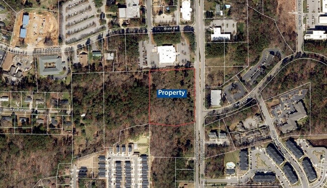


This Property Is For Sale
NEARBY LISTINGS FOR SALE OR LEASE
Property Detail
316 Sunnybrook Rd
Raleigh, NC
Wake
1723.06-37-3964-000
North Carolina
Sfr
4.91 AC
X
East Raleigh
3720172300K
Raleigh/Durham
1,424 SF
DEMOGRAPHICS near 316 Sunnybrook Rd
1 Mile
3 Mile
5 Mile
2024 Total Population
7,121
79,526
204,435
2029 Population
7,794
86,481
222,131
Pop Growth 2024-2029
+ 9.45%
+ 8.75%
+ 8.66%
Average Age
38
37
37
2024 Total Households
2,737
29,318
81,139
HH Growth 2024-2029
+ 9.50%
+ 9.01%
+ 8.95%
Median Household Inc
$41,599
$60,715
$68,575
Avg Household Size
2.50
2.50
2.40
2024 Avg HH Vehicles
2.00
2.00
2.00
Median Home Value
$215,112
$235,495
$270,214
Median Year Built
1976
1990
1992
Nearby Places
Map Layers
Map Styles
 Street
 Aerial
- Restaurants
- Banks
- Shops
- Fitness
- Groceries
PUBLIC TRANSPORTATION
COMMUTER RAIL
Raleigh Union Station (Piedmont - North Carolina by Train (NC Train))
DRIVE
WALK
Distance
Raleigh Union Station (Piedmont - North Carolina by Train (NC Train))
10 min
4.1 mi
AIRPORT
Raleigh-Durham International
DRIVE
WALK
Distance
Raleigh-Durham International
29 min
19.6 mi
Freight Ports
Port of Wilmington
DRIVE
WALK
Distance
Port of Wilmington
151 min
131.5 mi
Nearby Properties
Address
Land Use
TOTAL SIZE
Lot Size
Zoning
Address
Land Use
TOTAL SIZE
Lot Size
Zoning
2,660,245 SF
38.98 AC
CMP
Address
Land Use
TOTAL SIZE
Lot Size
Zoning
765,252 SF
1.72 AC
DX-20
Address
Land Use
TOTAL SIZE
Lot Size
Zoning
376,902 SF
189.85 AC
OX-3
Address
Land Use
TOTAL SIZE
Lot Size
Zoning
701,923 SF
64.64 AC
RX-5
Address
Land Use
TOTAL SIZE
Lot Size
Zoning
152,838 SF
8.88 AC
DX-30
Address
Land Use
TOTAL SIZE
Lot Size
Zoning
347,818 SF
32.02 AC
CX-3
Address
Land Use
TOTAL SIZE
Lot Size
Zoning
353,930 SF
6.75 AC
DX-12
Address
Land Use
TOTAL SIZE
Lot Size
Zoning
219,773 SF
3.99 AC
DX-12
Address
Land Use
TOTAL SIZE
Lot Size
Zoning
491,548 SF
81.90 AC
OX-7
Address
Land Use
TOTAL SIZE
Lot Size
Zoning
438,469 SF
50 AC
R-4
Address
Land Use
TOTAL SIZE
Lot Size
Zoning
358,520 SF
2.46 AC
CX-7
Address
Land Use
TOTAL SIZE
Lot Size
Zoning
108,480 SF
3.98 AC
OX-3
Address
Land Use
TOTAL SIZE
Lot Size
Zoning
1,749 SF
4.09 AC
DX-3
Address
Land Use
TOTAL SIZE
Lot Size
Zoning
211,289 SF
6.87 AC
CX-5
Address
Land Use
TOTAL SIZE
Lot Size
Zoning
433,221 SF
7.78 AC
CMP
Address
Land Use
TOTAL SIZE
Lot Size
Zoning
252,376 SF
2.06 AC
DX-5
Address
Land Use
TOTAL SIZE
Lot Size
Zoning
313,755 SF
22.44 AC
PD
Address
Land Use
TOTAL SIZE
Lot Size
Zoning
276,494 SF
58.90 AC
R-6
Address
Land Use
TOTAL SIZE
Lot Size
Zoning
234,353 SF
102.82 AC
IX-3
Address
Land Use
TOTAL SIZE
Lot Size
Zoning
2,916 SF
81 AC
R-6
Address
Land Use
TOTAL SIZE
Lot Size
Zoning
184,816 SF
4.76 AC
DX-30
Address
Land Use
TOTAL SIZE
Lot Size
Zoning
535,591 SF
32.35 AC
IX-3
Address
Land Use
TOTAL SIZE
Lot Size
Zoning
202,055 SF
15.11 AC
RX-4
Address
Land Use
TOTAL SIZE
Lot Size
Zoning
209,454 SF
12.41 AC
RX-4
Address
Land Use
TOTAL SIZE
Lot Size
Zoning
194,832 SF
11.06 AC
RX-3
Address
Land Use
TOTAL SIZE
Lot Size
Zoning
2.63 AC
DX-12
Address
Land Use
TOTAL SIZE
Lot Size
Zoning
175,250 SF
1.74 AC
OX-5
Address
Land Use
TOTAL SIZE
Lot Size
Zoning
202,980 SF
16.96 AC
RX-3
Address
Land Use
TOTAL SIZE
Lot Size
Zoning
72,596 SF
DX-7
Address
Land Use
TOTAL SIZE
Lot Size
Zoning
296,209 SF
19.08 AC
IX-3
The World's #1 Commercial Real Estate Marketplace
Connect with us
© 2026 CoStar Group
The information above has been obtained from sources believed reliable. While we do not doubt its accuracy we have not verified it and make no guarantee, warranty or representation about it. It is your responsibility to independently confirm its accuracy and completeness. Any projections, opinions, assumptions, or estimates used are for example only and do not represent the current or future performance of the property. The value of this transaction to you depends on tax and other factors which should be evaluated by your tax, financial, and legal advisors. You and your advisors should conduct a careful, independent investigation of the property to determine to your satisfaction the suitability of the property for your needs.