Property Record
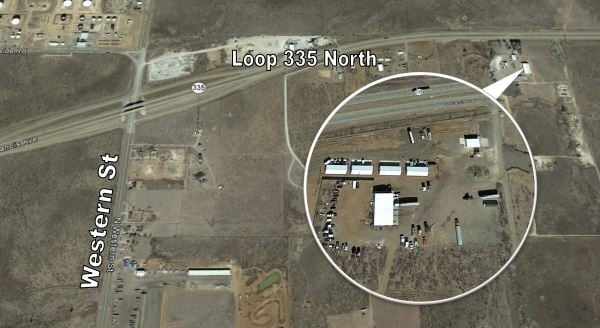
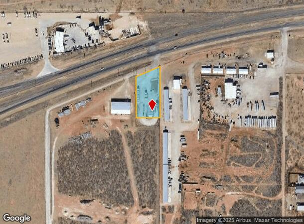
0 W Loop 335 N, Amarillo, TX 79108
NEARBY LISTINGS FOR SALE OR LEASE
-
-
View all Amarillo listings for lease on LoopNet.com
Property Detail
0 W Loop 335 N
Amarillo, TX
A B & M
R-200-2220-0500-0
SECT 222 A B & M BLK 0002, IRREG TR BEG 2799.35FT W & 304.15FT S OF NE COR OF SECT, 1.0400 ACRES
Vacantlandnec
Potter
X
Texas
48375C0369C
1.04 AC
2024
Amarillo
2025
Other Market Areas
015100
DEMOGRAPHICS near 0 W Loop 335 N
1 Mile
3 Mile
5 Mile
2024 Total Population
49
11,150
62,658
2029 Population
48
10,900
60,988
Pop Growth 2024-2029
(2.04%)
(2.24%)
(2.67%)
Average Age
42
39
37
2024 Total Households
19
4,215
23,883
HH Growth 2024-2029
0.00%
(2.56%)
(3.01%)
Median Household Inc
$67,500
$57,378
$43,627
Avg Household Size
2.50
2.60
2.50
2024 Avg HH Vehicles
2.00
2.00
2.00
Median Home Value
$181,249
$156,057
$113,069
Median Year Built
1986
1980
1962
Nearby Places
Map Layers
Map Styles
 Street
 Aerial
- Restaurants
- Banks
- Shops
- Fitness
- Groceries
PUBLIC TRANSPORTATION
AIRPORT
Rick Husband Amarillo International
DRIVE
WALK
Distance
Rick Husband Amarillo International
20 min
15.6 mi
Freight Ports
Tulsa Port Of Catoosa
DRIVE
WALK
Distance
Tulsa Port Of Catoosa
402 min
382.3 mi
SALE & LEASE HISTORY
LISTING DATE
SALE/LEASE

Sep 25, 2016
For Lease
Nearby Properties
Address
Land Use
TOTAL SIZE
Lot Size
Zoning
Address
Land Use
TOTAL SIZE
Lot Size
Zoning
108,219 SF
21.87 AC
Address
Land Use
TOTAL SIZE
Lot Size
Zoning
54,962 SF
10.94 AC
R2
Address
Land Use
TOTAL SIZE
Lot Size
Zoning
95,337 SF
10.47 AC
I1
Address
Land Use
TOTAL SIZE
Lot Size
Zoning
82,601 SF
10.16 AC
Address
Land Use
TOTAL SIZE
Lot Size
Zoning
69,197 SF
617.85 AC
Address
Land Use
TOTAL SIZE
Lot Size
Zoning
76,799 SF
29.97 AC
MF1
Address
Land Use
TOTAL SIZE
Lot Size
Zoning
51,364 SF
9.37 AC
2F
Address
Land Use
TOTAL SIZE
Lot Size
Zoning
10,392 SF
5.01 AC
Address
Land Use
TOTAL SIZE
Lot Size
Zoning
46,416 SF
3.21 AC
LC
Address
Land Use
TOTAL SIZE
Lot Size
Zoning
18,417 SF
5 AC
R2
Address
Land Use
TOTAL SIZE
Lot Size
Zoning
16,830 SF
5.11 AC
A
Address
Land Use
TOTAL SIZE
Lot Size
Zoning
9,514 SF
3.13 AC
Address
Land Use
TOTAL SIZE
Lot Size
Zoning
32,115 SF
16.30 AC
Address
Land Use
TOTAL SIZE
Lot Size
Zoning
42,428 SF
9.21 AC
PD
Address
Land Use
TOTAL SIZE
Lot Size
Zoning
37,167 SF
4.48 AC
GR
Address
Land Use
TOTAL SIZE
Lot Size
Zoning
73,711 SF
2.91 AC
I1
Address
Land Use
TOTAL SIZE
Lot Size
Zoning
8,110 SF
2.70 AC
I1
Address
Land Use
TOTAL SIZE
Lot Size
Zoning
60,095 SF
12.66 AC
LC
Address
Land Use
TOTAL SIZE
Lot Size
Zoning
29,320 SF
7.44 AC
Address
Land Use
TOTAL SIZE
Lot Size
Zoning
26,593 SF
15 AC
Address
Land Use
TOTAL SIZE
Lot Size
Zoning
24,521 SF
2.96 AC
R2
Address
Land Use
TOTAL SIZE
Lot Size
Zoning
35,700 SF
46.25 AC
Address
Land Use
TOTAL SIZE
Lot Size
Zoning
34,344 SF
2.47 AC
I1
Address
Land Use
TOTAL SIZE
Lot Size
Zoning
26,068 SF
13.44 AC
Address
Land Use
TOTAL SIZE
Lot Size
Zoning
33,547 SF
10 AC
Address
Land Use
TOTAL SIZE
Lot Size
Zoning
7,121 SF
0.72 AC
I1
Address
Land Use
TOTAL SIZE
Lot Size
Zoning
24,104 SF
13.37 AC
Address
Land Use
TOTAL SIZE
Lot Size
Zoning
33,600 SF
3.42 AC
I1
Address
Land Use
TOTAL SIZE
Lot Size
Zoning
3,896 SF
0.98 AC
Address
Land Use
TOTAL SIZE
Lot Size
Zoning
11,322 SF
0.80 AC
I1
The World's #1 Commercial Real Estate Marketplace
Connect with us
© 2025 CoStar Group
The information above has been obtained from sources believed reliable. While we do not doubt its accuracy we have not verified it and make no guarantee, warranty or representation about it. It is your responsibility to independently confirm its accuracy and completeness. Any projections, opinions, assumptions, or estimates used are for example only and do not represent the current or future performance of the property. The value of this transaction to you depends on tax and other factors which should be evaluated by your tax, financial, and legal advisors. You and your advisors should conduct a careful, independent investigation of the property to determine to your satisfaction the suitability of the property for your needs.