Property Record
3165 Alpine Ave Nw, Grand Rapids, MI 49544
NEARBY LISTINGS FOR SALE OR LEASE
Property Detail
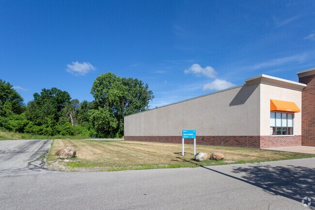
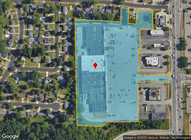
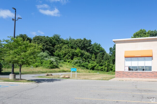
3165 Alpine Ave Nw
41-13-02-427-033
English Hills
Wholesaleoutletdiscountstore
411302427033 PART OF E 1/2 OF SEC COM AT E 1/4 COR TH N 85D 33M 41S W ALONG E&W 1/4 LINE 60.18 FT TO W LINE OF ALPINE AVE
X
Kent
26081C0289D
Michigan
2024
13.34 AC
2025
Comstock/Alpine
011502
West Michigan
136,468 SF
Grand Rapids-Wyoming, MI
DEMOGRAPHICS near 3165 Alpine Ave Nw
1 Mile
3 Mile
5 Mile
2024 Total Population
6,088
57,818
154,782
2029 Population
6,121
57,841
155,342
Pop Growth 2024-2029
+ 0.54%
+ 0.04%
+ 0.36%
Average Age
37
38
38
2024 Total Households
2,811
24,140
66,737
HH Growth 2024-2029
+ 0.60%
+ 0.09%
+ 0.44%
Median Household Inc
$53,175
$61,006
$63,907
Avg Household Size
2.10
2.30
2.20
2024 Avg HH Vehicles
1.00
2.00
2.00
Median Home Value
$230,602
$204,845
$223,308
Median Year Built
1981
1960
1962
Nearby Places
Map Layers
Map Styles
 Street
 Aerial
- Restaurants
- Banks
- Shops
- Fitness
- Groceries
PUBLIC TRANSPORTATION
COMMUTER RAIL
DRIVE
WALK
Distance
9 min
5.7 mi
AIRPORT
Gerald R Ford International
DRIVE
WALK
Distance
Gerald R Ford International
27 min
18.2 mi
SALE & LEASE HISTORY
LISTING DATE
SALE/LEASE

Oct 13, 2017
For Lease
Feb 28, 2017
For Lease
Nearby Properties
Address
Land Use
TOTAL SIZE
Lot Size
Zoning
Address
Land Use
TOTAL SIZE
Lot Size
Zoning
537,080 SF
46.61 AC
RPUD - 2
Address
Land Use
TOTAL SIZE
Lot Size
Zoning
352,362 SF
61.33 AC
IPUD
Address
Land Use
TOTAL SIZE
Lot Size
Zoning
546,366 SF
28.40 AC
MH
Address
Land Use
TOTAL SIZE
Lot Size
Zoning
451,792 SF
32.60 AC
ARM - MULT
Address
Land Use
TOTAL SIZE
Lot Size
Zoning
455,639 SF
42.06 AC
MH
Address
Land Use
TOTAL SIZE
Lot Size
Zoning
340,744 SF
69.50 AC
RPUD - 2
Address
Land Use
TOTAL SIZE
Lot Size
Zoning
337,324 SF
10.15 AC
C-3
Address
Land Use
TOTAL SIZE
Lot Size
Zoning
Address
Land Use
TOTAL SIZE
Lot Size
Zoning
278,832 SF
NOT APP
Address
Land Use
TOTAL SIZE
Lot Size
Zoning
68,560 SF
2.76 AC
TN-TCC
Address
Land Use
TOTAL SIZE
Lot Size
Zoning
33.06 AC
R-3
Address
Land Use
TOTAL SIZE
Lot Size
Zoning
183,517 SF
44.93 AC
ML
Address
Land Use
TOTAL SIZE
Lot Size
Zoning
190,882 SF
30.17 AC
MP
Address
Land Use
TOTAL SIZE
Lot Size
Zoning
113,016 SF
33.69 AC
IPUD
Address
Land Use
TOTAL SIZE
Lot Size
Zoning
670,966 SF
40.67 AC
C-3
Address
Land Use
TOTAL SIZE
Lot Size
Zoning
Address
Land Use
TOTAL SIZE
Lot Size
Zoning
165,184 SF
14.85 AC
CPUD
Address
Land Use
TOTAL SIZE
Lot Size
Zoning
32.63 AC
R-3
Address
Land Use
TOTAL SIZE
Lot Size
Zoning
214,046 SF
31.31 AC
C-2
Address
Land Use
TOTAL SIZE
Lot Size
Zoning
267,000 SF
15.63 AC
IPUD
Address
Land Use
TOTAL SIZE
Lot Size
Zoning
118,085 SF
10.94 AC
CPUD
Address
Land Use
TOTAL SIZE
Lot Size
Zoning
332,315 SF
17.71 AC
MP
Address
Land Use
TOTAL SIZE
Lot Size
Zoning
250,469 SF
14.11 AC
ML
Address
Land Use
TOTAL SIZE
Lot Size
Zoning
169,926 SF
8.52 AC
C-2
Address
Land Use
TOTAL SIZE
Lot Size
Zoning
Address
Land Use
TOTAL SIZE
Lot Size
Zoning
200,831 SF
11.69 AC
MH
Address
Land Use
TOTAL SIZE
Lot Size
Zoning
239,172 SF
25.79 AC
C-2
Address
Land Use
TOTAL SIZE
Lot Size
Zoning
9.11 AC
R-3
Address
Land Use
TOTAL SIZE
Lot Size
Zoning
8.77 AC
R-3
The World's #1 Commercial Real Estate Marketplace
Connect with us
© 2025 CoStar Group
The information above has been obtained from sources believed reliable. While we do not doubt its accuracy we have not verified it and make no guarantee, warranty or representation about it. It is your responsibility to independently confirm its accuracy and completeness. Any projections, opinions, assumptions, or estimates used are for example only and do not represent the current or future performance of the property. The value of this transaction to you depends on tax and other factors which should be evaluated by your tax, financial, and legal advisors. You and your advisors should conduct a careful, independent investigation of the property to determine to your satisfaction the suitability of the property for your needs.