Property Record
3165 Interstate 45 N, Conroe, TX 77304
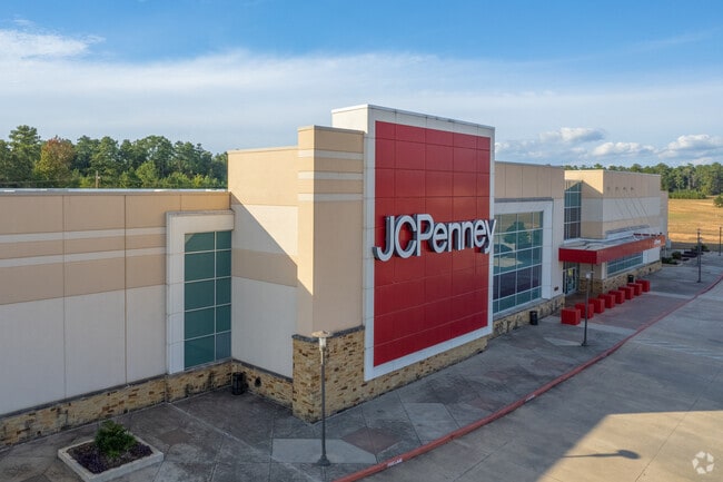

Property Detail
3165 Interstate 45 N
9217-00-00200
S921700 - TEAS TOWN CENTER 01, BLOCK 1, RES B, ACRES 10.071
Commercialnec
Montgomery
B and X Area of moderate flood hazard, usually the area between the limits of the 100-year and 500-year floods.
Texas
2024
10.07 AC
2025
Montgomery County
693702
Houston
103,800 SF
Houston-Pasadena-The Woodlands, TX
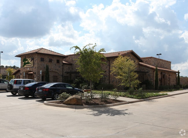
NEARBY LISTINGS FOR SALE OR LEASE
DEMOGRAPHICS near 3165 Interstate 45 N
1 mile
3 mile
5 mile
2025 Total Population
3,836
45,788
101,113
2030 Population
4,592
53,750
119,130
Pop Growth 2025-2030
+ 19.71%
+ 17.39%
+ 17.82%
Average Age
40
38
37
2025 Total Households
1,410
17,275
36,477
HH Growth 2025-2030
+ 20.21%
+ 18.66%
+ 18.71%
Median Household Inc
$98,777
$70,707
$71,947
Avg Household Size
2.70
2.50
2.70
2025 Avg HH Vehicles
2.00
2.00
2.00
Median Home Value
$462,638
$337,033
$295,455
Median Year Built
2010
2006
2005
Nearby Places
Map Layers
Map Styles
 Street
 Aerial
Transit
 Traffic
 Biking
Places
Listings with unknown addresses are not visible on the map
- Restaurants
- Banks
- Shops
- Fitness
- Groceries
PUBLIC TRANSPORTATION
AIRPORT
George Bush Intcntl/Houston
Drive
Walk
Distance
George Bush Intcntl/Houston
42 min
34.5 mi
Freight Ports
Port of Houston
Drive
Walk
Distance
Port of Houston
65 min
50.2 mi
Nearby Properties
Address
Land Use
TOTAL SIZE
Lot Size
Zoning
Address
Land Use
TOTAL SIZE
Lot Size
Zoning
322,082 SF
36.56 AC
1
Address
Land Use
TOTAL SIZE
Lot Size
Zoning
776,164 SF
71.74 AC
Address
Land Use
TOTAL SIZE
Lot Size
Zoning
419,016 SF
26 AC
Address
Land Use
TOTAL SIZE
Lot Size
Zoning
398,842 SF
23.75 AC
1
Address
Land Use
TOTAL SIZE
Lot Size
Zoning
354,000 SF
13.81 AC
Address
Land Use
TOTAL SIZE
Lot Size
Zoning
308,438 SF
14.35 AC
Address
Land Use
TOTAL SIZE
Lot Size
Zoning
322,588 SF
14.77 AC
Address
Land Use
TOTAL SIZE
Lot Size
Zoning
280,904 SF
12 AC
Address
Land Use
TOTAL SIZE
Lot Size
Zoning
361,388 SF
16.32 AC
Address
Land Use
TOTAL SIZE
Lot Size
Zoning
191,700 SF
19.41 AC
1
Address
Land Use
TOTAL SIZE
Lot Size
Zoning
294,336 SF
20.39 AC
Address
Land Use
TOTAL SIZE
Lot Size
Zoning
275,000 SF
13.65 AC
Address
Land Use
TOTAL SIZE
Lot Size
Zoning
366,709 SF
27.72 AC
Address
Land Use
TOTAL SIZE
Lot Size
Zoning
204,716 SF
15.51 AC
Address
Land Use
TOTAL SIZE
Lot Size
Zoning
206,841 SF
23.44 AC
Address
Land Use
TOTAL SIZE
Lot Size
Zoning
258,100 SF
12.04 AC
1
Address
Land Use
TOTAL SIZE
Lot Size
Zoning
399,360 SF
30 AC
Address
Land Use
TOTAL SIZE
Lot Size
Zoning
229,345 SF
12.36 AC
1
Address
Land Use
TOTAL SIZE
Lot Size
Zoning
134,935 SF
10.50 AC
1
Address
Land Use
TOTAL SIZE
Lot Size
Zoning
250,716 SF
11.17 AC
1
Address
Land Use
TOTAL SIZE
Lot Size
Zoning
211,275 SF
12.58 AC
Address
Land Use
TOTAL SIZE
Lot Size
Zoning
235,826 SF
15.29 AC
Address
Land Use
TOTAL SIZE
Lot Size
Zoning
134,621 SF
26.37 AC
Address
Land Use
TOTAL SIZE
Lot Size
Zoning
191,006 SF
9.19 AC
Address
Land Use
TOTAL SIZE
Lot Size
Zoning
142,800 SF
7.82 AC
Address
Land Use
TOTAL SIZE
Lot Size
Zoning
141,100 SF
25.34 AC
Address
Land Use
TOTAL SIZE
Lot Size
Zoning
590,471 SF
32.21 AC
Address
Land Use
TOTAL SIZE
Lot Size
Zoning
62,296 SF
20.62 AC
Address
Land Use
TOTAL SIZE
Lot Size
Zoning
157,996 SF
9 AC
The World's #1 Commercial Real Estate Marketplace
Connect with us
© 2026 CoStar Group
The information above has been obtained from sources believed reliable. While we do not doubt its accuracy we have not verified it and make no guarantee, warranty or representation about it. It is your responsibility to independently confirm its accuracy and completeness. Any projections, opinions, assumptions, or estimates used are for example only and do not represent the current or future performance of the property. The value of this transaction to you depends on tax and other factors which should be evaluated by your tax, financial, and legal advisors. You and your advisors should conduct a careful, independent investigation of the property to determine to your satisfaction the suitability of the property for your needs.