Property Record
3165 Mullins Ct, Oxford, MI 48371


NEARBY LISTINGS FOR SALE OR LEASE
-
-
View all Oxford listings for sale on LoopNet.com
Property Detail
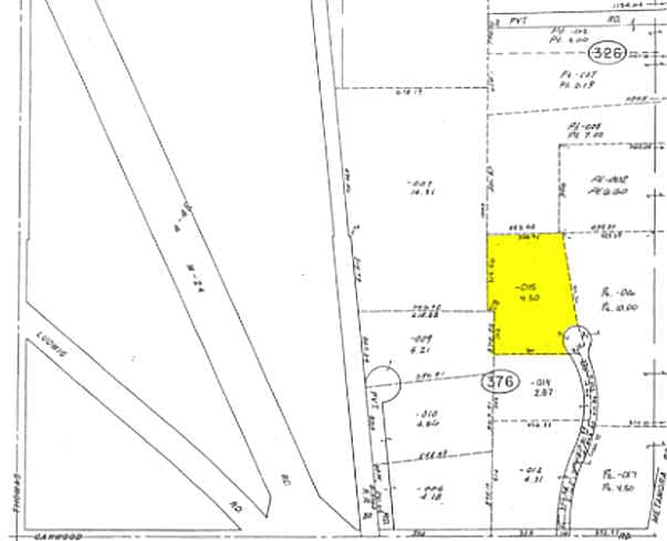
3165 Mullins Ct
04-04-376-015
S 01 2 Sec 04 T5n R10e
Manufacturinglight
T5N, R10E, SEC 4 PART OF S 1/2 OF SEC BEG AT PT DIST S 88-33-07 W 720.97 FT & N 01-26-53 W 810 FT FROM S 1/4 COR, TH N
X
Oakland
26125C0210F
Michigan
2024
4.30 AC
2025
Auburn Hills, Pontiac & Rochester
121000
Detroit
11,799 SF
Detroit-Warren-Dearborn, MI
DEMOGRAPHICS near 3165 Mullins Ct
1 Mile
3 Mile
5 Mile
2024 Total Population
707
5,917
26,347
2029 Population
696
5,904
26,195
Pop Growth 2024-2029
(1.56%)
(0.22%)
(0.58%)
Average Age
44
41
41
2024 Total Households
263
2,151
9,722
HH Growth 2024-2029
(1.52%)
(0.23%)
(0.59%)
Median Household Inc
$135,535
$122,489
$98,873
Avg Household Size
2.70
2.70
2.70
2024 Avg HH Vehicles
3.00
2.00
2.00
Median Home Value
$322,857
$364,440
$323,184
Median Year Built
1982
1998
1990
Nearby Places
Map Layers
Map Styles
 Street
 Aerial
- Restaurants
- Banks
- Shops
- Fitness
- Groceries
PUBLIC TRANSPORTATION
AIRPORT
Bishop International
DRIVE
WALK
Distance
Bishop International
56 min
38.9 mi
Freight Ports
Port of Toledo
DRIVE
WALK
Distance
Port of Toledo
133 min
105.1 mi
Nearby Properties
Address
Land Use
TOTAL SIZE
Lot Size
Zoning
Address
Land Use
TOTAL SIZE
Lot Size
Zoning
172,881 SF
16.51 AC
Address
Land Use
TOTAL SIZE
Lot Size
Zoning
148,898 SF
14.55 AC
BI
Address
Land Use
TOTAL SIZE
Lot Size
Zoning
188,367 SF
Address
Land Use
TOTAL SIZE
Lot Size
Zoning
188,367 SF
26.37 AC
Address
Land Use
TOTAL SIZE
Lot Size
Zoning
207,073 SF
19.74 AC
Address
Land Use
TOTAL SIZE
Lot Size
Zoning
78,297 SF
7.53 AC
II
Address
Land Use
TOTAL SIZE
Lot Size
Zoning
70,420 SF
4.49 AC
II
Address
Land Use
TOTAL SIZE
Lot Size
Zoning
61,936 SF
4.71 AC
II
Address
Land Use
TOTAL SIZE
Lot Size
Zoning
51,898 SF
3.56 AC
II
Address
Land Use
TOTAL SIZE
Lot Size
Zoning
60,600 SF
14.31 AC
II
Address
Land Use
TOTAL SIZE
Lot Size
Zoning
49,731 SF
5.75 AC
II
Address
Land Use
TOTAL SIZE
Lot Size
Zoning
26,073 SF
63.54 AC
MM
Address
Land Use
TOTAL SIZE
Lot Size
Zoning
52,000 SF
5.13 AC
II
Address
Land Use
TOTAL SIZE
Lot Size
Zoning
11,483 SF
10.56 AC
BI
Address
Land Use
TOTAL SIZE
Lot Size
Zoning
68,162 SF
4.97 AC
II
Address
Land Use
TOTAL SIZE
Lot Size
Zoning
52,336 SF
5.72 AC
II
Address
Land Use
TOTAL SIZE
Lot Size
Zoning
57,809 SF
6.61 AC
BI
Address
Land Use
TOTAL SIZE
Lot Size
Zoning
21,844 SF
3.82 AC
Address
Land Use
TOTAL SIZE
Lot Size
Zoning
17,936 SF
7.69 AC
IV
Address
Land Use
TOTAL SIZE
Lot Size
Zoning
45,554 SF
2.74 AC
II
Address
Land Use
TOTAL SIZE
Lot Size
Zoning
10 AC
IV
Address
Land Use
TOTAL SIZE
Lot Size
Zoning
46,838 SF
4.56 AC
II
Address
Land Use
TOTAL SIZE
Lot Size
Zoning
22,767 SF
4.60 AC
II
Address
Land Use
TOTAL SIZE
Lot Size
Zoning
44,019 SF
2.29 AC
Address
Land Use
TOTAL SIZE
Lot Size
Zoning
27,912 SF
9.11 AC
II
Address
Land Use
TOTAL SIZE
Lot Size
Zoning
2,827 SF
89 AC
MM
Address
Land Use
TOTAL SIZE
Lot Size
Zoning
14,571 SF
1.92 AC
BI
Address
Land Use
TOTAL SIZE
Lot Size
Zoning
11,120 SF
2.72 AC
BI
The World's #1 Commercial Real Estate Marketplace
Connect with us
© 2025 CoStar Group
The information above has been obtained from sources believed reliable. While we do not doubt its accuracy we have not verified it and make no guarantee, warranty or representation about it. It is your responsibility to independently confirm its accuracy and completeness. Any projections, opinions, assumptions, or estimates used are for example only and do not represent the current or future performance of the property. The value of this transaction to you depends on tax and other factors which should be evaluated by your tax, financial, and legal advisors. You and your advisors should conduct a careful, independent investigation of the property to determine to your satisfaction the suitability of the property for your needs.