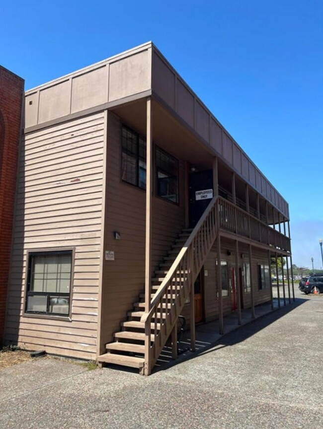
Property Record
317 2Nd St, Eureka, CA 95501


Current Lease Availabilities
Property Detail
317 2Nd St
001-052-010-000
PAR1 PM#1762 BK15 PAR MAPS PG93
Officebuilding
HUMBOLDT
CW
California
B and X Area of moderate flood hazard, usually the area between the limits of the 100-year and 500-year floods.
0.16 AC
2024
Eureka/Crescent City
2025
Other Market Areas
000100
Eureka-Arcata, CA
4,980 SF
NEARBY LISTINGS FOR SALE OR LEASE
DEMOGRAPHICS near 317 2Nd St
1 mile
3 mile
5 mile
2025 Total Population
8,890
37,432
45,421
2030 Population
8,806
36,965
44,725
Pop Growth 2025-2030
(0.94%)
(1.25%)
(1.53%)
Average Age
39
41
42
2025 Total Households
3,847
15,678
18,933
HH Growth 2025-2030
(0.83%)
(1.27%)
(1.58%)
Median Household Inc
$39,074
$61,230
$64,750
Avg Household Size
2.10
2.20
2.30
2025 Avg HH Vehicles
1.00
2.00
2.00
Median Home Value
$421,300
$439,946
$455,557
Median Year Built
1949
1958
1960
Nearby Places
Map Layers
Map Styles
 Street
 Aerial
Layers
 Traffic
 Biking
Places
Listings with unknown addresses are not visible on the map
- Restaurants
- Banks
- Shops
- Fitness
- Groceries
PUBLIC TRANSPORTATION
AIRPORT
California Redwood Coast-Humboldt County
Drive
Walk
Distance
California Redwood Coast-Humboldt County
26 min
16.7 mi
Freight Ports
Port of Coos Bay, OR
Drive
Walk
Distance
Port of Coos Bay, OR
293 min
216.8 mi
Nearby Properties
Address
Land Use
TOTAL SIZE
Lot Size
Zoning
Address
Land Use
TOTAL SIZE
Lot Size
Zoning
8.22 AC
HM,RS-6000
Address
Land Use
TOTAL SIZE
Lot Size
Zoning
126,563 SF
10.81 AC
CS
Address
Land Use
TOTAL SIZE
Lot Size
Zoning
10.57 AC
R-1
Address
Land Use
TOTAL SIZE
Lot Size
Zoning
45,840 SF
21.83 AC
MG
Address
Land Use
TOTAL SIZE
Lot Size
Zoning
9.39 AC
MG
Address
Land Use
TOTAL SIZE
Lot Size
Zoning
3.96 AC
RM-1000,NR
Address
Land Use
TOTAL SIZE
Lot Size
Zoning
11.29 AC
P
Address
Land Use
TOTAL SIZE
Lot Size
Zoning
2.11 AC
RM-1000
Address
Land Use
TOTAL SIZE
Lot Size
Zoning
3.72 AC
C-1/GO
Address
Land Use
TOTAL SIZE
Lot Size
Zoning
4.65 AC
HM
Address
Land Use
TOTAL SIZE
Lot Size
Zoning
1.19 AC
C-1-Q
Address
Land Use
TOTAL SIZE
Lot Size
Zoning
7.14 AC
CS
Address
Land Use
TOTAL SIZE
Lot Size
Zoning
1.86 AC
CS
Address
Land Use
TOTAL SIZE
Lot Size
Zoning
6.75 AC
CP
Address
Land Use
TOTAL SIZE
Lot Size
Zoning
7.64 AC
CP
Address
Land Use
TOTAL SIZE
Lot Size
Zoning
0.61 AC
Address
Land Use
TOTAL SIZE
Lot Size
Zoning
2.06 AC
R-4*;RM-30
Address
Land Use
TOTAL SIZE
Lot Size
Zoning
5.59 AC
NR,CP
Address
Land Use
TOTAL SIZE
Lot Size
Zoning
18.36 AC
MC/A
Address
Land Use
TOTAL SIZE
Lot Size
Zoning
41,346 SF
0.32 AC
Address
Land Use
TOTAL SIZE
Lot Size
Zoning
7,148 SF
0.46 AC
OR-AR
Address
Land Use
TOTAL SIZE
Lot Size
Zoning
55,552 SF
7.98 AC
A,AC,CS-PD
Address
Land Use
TOTAL SIZE
Lot Size
Zoning
26,829 SF
2.47 AC
C-1
Address
Land Use
TOTAL SIZE
Lot Size
Zoning
4.70 AC
MC
Address
Land Use
TOTAL SIZE
Lot Size
Zoning
0.62 AC
RM-1000
Address
Land Use
TOTAL SIZE
Lot Size
Zoning
0.45 AC
CC-LW
The World's #1 Commercial Real Estate Marketplace
Connect with us
© 2026 CoStar Group
The information above has been obtained from sources believed reliable. While we do not doubt its accuracy we have not verified it and make no guarantee, warranty or representation about it. It is your responsibility to independently confirm its accuracy and completeness. Any projections, opinions, assumptions, or estimates used are for example only and do not represent the current or future performance of the property. The value of this transaction to you depends on tax and other factors which should be evaluated by your tax, financial, and legal advisors. You and your advisors should conduct a careful, independent investigation of the property to determine to your satisfaction the suitability of the property for your needs.