Property Record
317 Casey Key Rd, Nokomis, FL 34275
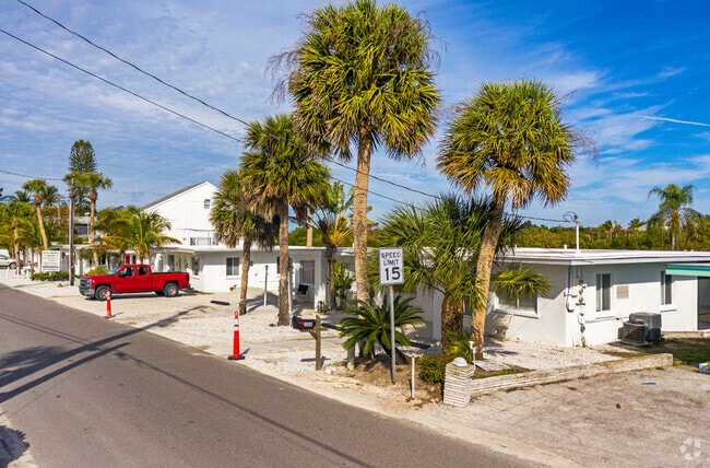
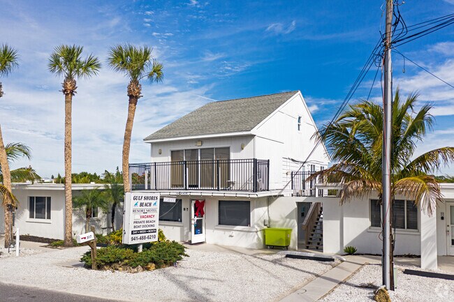
Property Detail
317 Casey Key Rd
0169-07-0010
COM AT PT ON GULF & N SEC LINE TH SELY ALG GULF 3795 FT FOR POB TH E 337 FT M/L TH S-13-40-E 4.96 FT TH E TO BAY TH BEGIN AGAIN AT POB TH SELY ALG GULF 142.5 FT TH E 426 FT M/L TO SEAWALL TH NLY
Hotel
Sarasota
RSF1
Florida
VE and V1-30 Coastal areas with a 1% or greater chance of flooding and an additional hazard associated with storm waves. These areas have a 26% chance of flooding over the life of a 30-year mortgage.
1.46 AC
2024
Sarasota/Beaches
2025
Tampa/St Petersburg
002205
North Port-Bradenton-Sarasota, FL
7,325 SF
NEARBY LISTINGS FOR SALE OR LEASE
-
-
View all Nokomis listings for sale on LoopNet.com
DEMOGRAPHICS near 317 Casey Key Rd
1 mile
3 mile
5 mile
2025 Total Population
2,583
27,451
58,275
2030 Population
2,819
29,948
63,280
Pop Growth 2025-2030
+ 9.14%
+ 9.10%
+ 8.59%
Average Age
57
59
60
2025 Total Households
1,329
14,327
30,450
HH Growth 2025-2030
+ 8.88%
+ 9.24%
+ 8.70%
Median Household Inc
$90,657
$71,786
$72,675
Avg Household Size
1.90
1.90
1.80
2025 Avg HH Vehicles
2.00
2.00
2.00
Median Home Value
$483,333
$509,106
$479,632
Median Year Built
1982
1978
1985
Nearby Places
Map Layers
Map Styles
 Street
 Aerial
Layers
 Traffic
 Biking
Places
Listings with unknown addresses are not visible on the map
- Restaurants
- Banks
- Shops
- Fitness
- Groceries
PUBLIC TRANSPORTATION
AIRPORT
Sarasota/Bradenton International
Drive
Walk
Distance
Sarasota/Bradenton International
41 min
22.3 mi
Punta Gorda
Drive
Walk
Distance
Punta Gorda
52 min
40.0 mi
Freight Ports
Port Manatee
Drive
Walk
Distance
Port Manatee
54 min
40.5 mi
Nearby Properties
Address
Land Use
TOTAL SIZE
Lot Size
Zoning
Address
Land Use
TOTAL SIZE
Lot Size
Zoning
26,265 SF
210.50 AC
RMH
Address
Land Use
TOTAL SIZE
Lot Size
Zoning
8,017 SF
56 AC
RMH
Address
Land Use
TOTAL SIZE
Lot Size
Zoning
181,657 SF
56.90 AC
GU
Address
Land Use
TOTAL SIZE
Lot Size
Zoning
8,562 SF
58.92 AC
RMH
Address
Land Use
TOTAL SIZE
Lot Size
Zoning
23,348 SF
77.03 AC
RMH
Address
Land Use
TOTAL SIZE
Lot Size
Zoning
190,485 SF
5.81 AC
NTG
Address
Land Use
TOTAL SIZE
Lot Size
Zoning
133,773 SF
6.29 AC
OPI
Address
Land Use
TOTAL SIZE
Lot Size
Zoning
425,768 SF
18.41 AC
RMF2
Address
Land Use
TOTAL SIZE
Lot Size
Zoning
5,396 SF
33.59 AC
RMH
Address
Land Use
TOTAL SIZE
Lot Size
Zoning
5,208 SF
38.03 AC
CG
Address
Land Use
TOTAL SIZE
Lot Size
Zoning
12,552 SF
6.73 AC
RE2
Address
Land Use
TOTAL SIZE
Lot Size
Zoning
17,028 SF
3.57 AC
RE2
Address
Land Use
TOTAL SIZE
Lot Size
Zoning
12,263 SF
3.38 AC
RE2
Address
Land Use
TOTAL SIZE
Lot Size
Zoning
127,135 SF
12.37 AC
CG
Address
Land Use
TOTAL SIZE
Lot Size
Zoning
45,837 SF
3.06 AC
G
Address
Land Use
TOTAL SIZE
Lot Size
Zoning
139,551 SF
14.60 AC
CSC
Address
Land Use
TOTAL SIZE
Lot Size
Zoning
112,788 SF
3.06 AC
CG
Address
Land Use
TOTAL SIZE
Lot Size
Zoning
40.20 AC
RMH
Address
Land Use
TOTAL SIZE
Lot Size
Zoning
55,417 SF
5.64 AC
CG
Address
Land Use
TOTAL SIZE
Lot Size
Zoning
59,645 SF
2.68 AC
CG
Address
Land Use
TOTAL SIZE
Lot Size
Zoning
18.76 AC
CG
Address
Land Use
TOTAL SIZE
Lot Size
Zoning
30,553 SF
5.03 AC
G
Address
Land Use
TOTAL SIZE
Lot Size
Zoning
100,001 SF
5.14 AC
CG
Address
Land Use
TOTAL SIZE
Lot Size
Zoning
22,826 SF
1.15 AC
RTR
Address
Land Use
TOTAL SIZE
Lot Size
Zoning
131,489 SF
13.95 AC
CSC
Address
Land Use
TOTAL SIZE
Lot Size
Zoning
2,259 SF
19.28 AC
GU
Address
Land Use
TOTAL SIZE
Lot Size
Zoning
109,581 SF
11.36 AC
ST2
Address
Land Use
TOTAL SIZE
Lot Size
Zoning
68,666 SF
4.54 AC
DE
Address
Land Use
TOTAL SIZE
Lot Size
Zoning
21,385 SF
9.23 AC
CI
Address
Land Use
TOTAL SIZE
Lot Size
Zoning
32,464 SF
4.58 AC
DE
The World's #1 Commercial Real Estate Marketplace
Connect with us
© 2026 CoStar Group
The information above has been obtained from sources believed reliable. While we do not doubt its accuracy we have not verified it and make no guarantee, warranty or representation about it. It is your responsibility to independently confirm its accuracy and completeness. Any projections, opinions, assumptions, or estimates used are for example only and do not represent the current or future performance of the property. The value of this transaction to you depends on tax and other factors which should be evaluated by your tax, financial, and legal advisors. You and your advisors should conduct a careful, independent investigation of the property to determine to your satisfaction the suitability of the property for your needs.