Property Record
317 E Amherst St, Buffalo, NY 14215
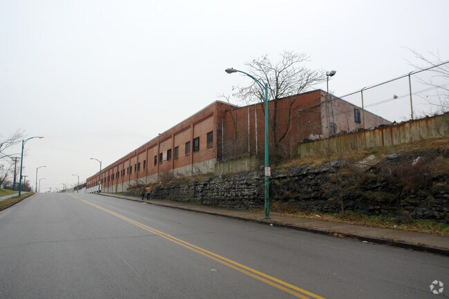

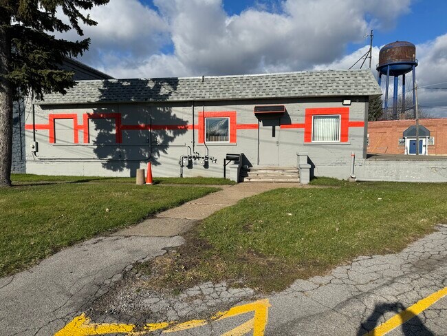
Property Detail
317 E Amherst St
140200 90.23-6-2.1
ERIE
Manufacturinglight
New York
D-IL
2.100
B and X Area of moderate flood hazard, usually the area between the limits of the 100-year and 500-year floods.
14.55 AC
2025
Greater Buffalo
2025
Buffalo/Niagara Falls
004401
Buffalo-Cheektowaga, NY
49,785 SF
NEARBY LISTINGS FOR SALE OR LEASE
DEMOGRAPHICS near 317 E Amherst St
1 mile
3 mile
5 mile
2025 Total Population
31,710
191,746
404,739
2030 Population
31,651
189,000
399,968
Pop Growth 2025-2030
(0.19%)
(1.43%)
(1.18%)
Average Age
37
39
39
2025 Total Households
12,497
80,909
174,119
HH Growth 2025-2030
+ 0.01%
(1.45%)
(1.14%)
Median Household Inc
$43,548
$57,444
$57,091
Avg Household Size
2.40
2.20
2.20
2025 Avg HH Vehicles
1.00
1.00
1.00
Median Home Value
$139,596
$213,404
$206,013
Median Year Built
1947
1947
1949
Nearby Places
Map Layers
Map Styles
 Street
 Aerial
Layers
 Traffic
 Biking
Places
Listings with unknown addresses are not visible on the map
- Restaurants
- Banks
- Shops
- Fitness
- Groceries
PUBLIC TRANSPORTATION
TRANSIT/SUBWAY
Amherst Street (Buffalo Metro Rail - Niagara Frontier Transportation Authority Light Rail (Buffalo Metro Rail))
Drive
Walk
Distance
Amherst Street (Buffalo Metro Rail - Niagara Frontier Transportation Authority Light Rail (Buffalo Metro Rail))
2 min
18 min
0.8 mi
Lasalle (Buffalo Metro Rail - Niagara Frontier Transportation Authority Light Rail (Buffalo Metro Rail))
Drive
Walk
Distance
Lasalle (Buffalo Metro Rail - Niagara Frontier Transportation Authority Light Rail (Buffalo Metro Rail))
3 min
17 min
0.9 mi
COMMUTER RAIL
Buffalo (Empire Service - Amtrak, Maple Leaf - Amtrak)
Drive
Walk
Distance
Buffalo (Empire Service - Amtrak, Maple Leaf - Amtrak)
11 min
5.5 mi
Buffalo Depew Station (Empire Service - Amtrak, Lake Shore Limited - Amtrak, Maple Leaf - Amtrak)
Drive
Walk
Distance
Buffalo Depew Station (Empire Service - Amtrak, Lake Shore Limited - Amtrak, Maple Leaf - Amtrak)
13 min
6.6 mi
AIRPORT
Buffalo Niagara International
Drive
Walk
Distance
Buffalo Niagara International
14 min
5.5 mi
Niagara Falls International
Drive
Walk
Distance
Niagara Falls International
30 min
15.2 mi
Freight Ports
Port of Toledo
Drive
Walk
Distance
Port of Toledo
366 min
309.3 mi
SALE & LEASE HISTORY
LISTING DATE
SALE/LEASE

Sep 25, 2016
For Lease
Sep 23, 2016
For Sale
Dec 13, 2023
For Lease
Nearby Properties
Address
Land Use
TOTAL SIZE
Lot Size
Zoning
Address
Land Use
TOTAL SIZE
Lot Size
Zoning
22,010 SF
D-M
Address
Land Use
TOTAL SIZE
Lot Size
Zoning
121,015 SF
92.60 AC
D-E
Address
Land Use
TOTAL SIZE
Lot Size
Zoning
135,396 SF
146.32 AC
D-E
Address
Land Use
TOTAL SIZE
Lot Size
Zoning
646,259 SF
16.31 AC
D-M
Address
Land Use
TOTAL SIZE
Lot Size
Zoning
8,317 SF
39.03 AC
SPLIT ZONE
Address
Land Use
TOTAL SIZE
Lot Size
Zoning
561,196 SF
16 AC
D-M
Address
Land Use
TOTAL SIZE
Lot Size
Zoning
132,940 SF
41.50 AC
CF
Address
Land Use
TOTAL SIZE
Lot Size
Zoning
12,641 SF
0.56 AC
N-2C
Address
Land Use
TOTAL SIZE
Lot Size
Zoning
19,608 SF
0.45 AC
N-3C
Address
Land Use
TOTAL SIZE
Lot Size
Zoning
7,408 SF
45.80 AC
D-R
Address
Land Use
TOTAL SIZE
Lot Size
Zoning
4,312 SF
4.68 AC
N-1C
Address
Land Use
TOTAL SIZE
Lot Size
Zoning
262,560 SF
26.40 AC
05C
Address
Land Use
TOTAL SIZE
Lot Size
Zoning
94,680 SF
175.90 AC
D-OG
Address
Land Use
TOTAL SIZE
Lot Size
Zoning
120,954 SF
9.74 AC
D-S
Address
Land Use
TOTAL SIZE
Lot Size
Zoning
36,325 SF
12.50 AC
D-E
Address
Land Use
TOTAL SIZE
Lot Size
Zoning
119,851 SF
1.35 AC
N-2R
Address
Land Use
TOTAL SIZE
Lot Size
Zoning
540,154 SF
7.06 AC
D-E
Address
Land Use
TOTAL SIZE
Lot Size
Zoning
7,753 SF
1 AC
N-1C
Address
Land Use
TOTAL SIZE
Lot Size
Zoning
148,344 SF
11.14 AC
D-R
Address
Land Use
TOTAL SIZE
Lot Size
Zoning
61,327 SF
175 AC
D-OG
Address
Land Use
TOTAL SIZE
Lot Size
Zoning
171,589 SF
55.49 AC
D-OG
Address
Land Use
TOTAL SIZE
Lot Size
Zoning
9,999 SF
27.02 AC
05C
Address
Land Use
TOTAL SIZE
Lot Size
Zoning
97,298 SF
15.28 AC
D-S
Address
Land Use
TOTAL SIZE
Lot Size
Zoning
17,778 SF
14 AC
GB
Address
Land Use
TOTAL SIZE
Lot Size
Zoning
3,456 SF
6.90 AC
MFR-5
Address
Land Use
TOTAL SIZE
Lot Size
Zoning
151,641 SF
1.53 AC
N-1S
Address
Land Use
TOTAL SIZE
Lot Size
Zoning
679,645 SF
3.20 AC
N-1S
Address
Land Use
TOTAL SIZE
Lot Size
Zoning
191,420 SF
59.30 AC
Address
Land Use
TOTAL SIZE
Lot Size
Zoning
192,811 SF
3.30 AC
D-E
Address
Land Use
TOTAL SIZE
Lot Size
Zoning
3,712 SF
36.08 AC
03RA
The World's #1 Commercial Real Estate Marketplace
Connect with us
© 2026 CoStar Group
The information above has been obtained from sources believed reliable. While we do not doubt its accuracy we have not verified it and make no guarantee, warranty or representation about it. It is your responsibility to independently confirm its accuracy and completeness. Any projections, opinions, assumptions, or estimates used are for example only and do not represent the current or future performance of the property. The value of this transaction to you depends on tax and other factors which should be evaluated by your tax, financial, and legal advisors. You and your advisors should conduct a careful, independent investigation of the property to determine to your satisfaction the suitability of the property for your needs.