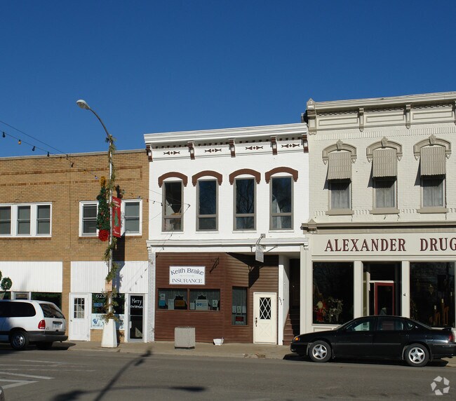
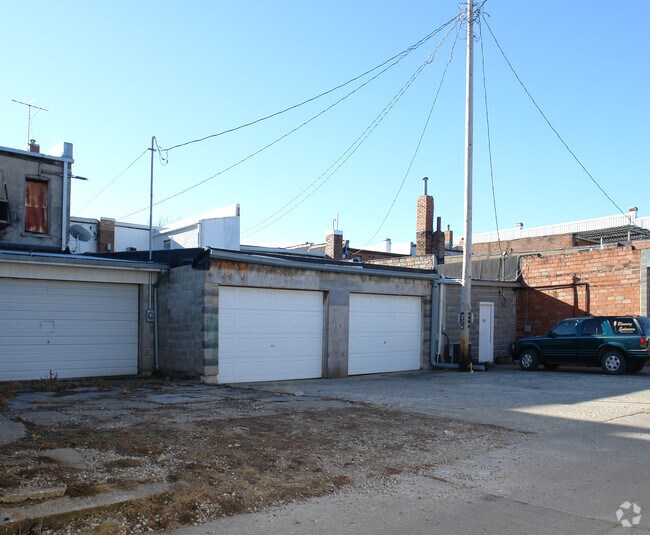
Property Record
317 E Main St, Montezuma, IA 50171

Property Detail
317 E Main St
450-1427600
MONTEZUMA E 30' LOT 7 BLOCK 8
Commercialofficeresidentialmixeduse
POWESHIEK
B and X Area of moderate flood hazard, usually the area between the limits of the 100-year and 500-year floods.
Iowa
2024
7
2025
0.09 AC
370500
Iowa Southeast Area
3,464 SF
Other Market Areas
NEARBY LISTINGS FOR SALE OR LEASE
-
-
View all Montezuma listings for sale on LoopNet.com
DEMOGRAPHICS near 317 E Main St
1 mile
3 mile
5 mile
2025 Total Population
1,219
1,724
2,565
2030 Population
1,153
1,675
2,553
Pop Growth 2025-2030
(5.41%)
(2.84%)
(0.47%)
Average Age
41
44
46
2025 Total Households
511
754
1,166
HH Growth 2025-2030
(5.87%)
(2.79%)
(0.17%)
Median Household Inc
$63,246
$58,863
$55,294
Avg Household Size
2.30
2.20
2.20
2025 Avg HH Vehicles
2.00
2.00
2.00
Median Home Value
$169,426
$194,973
$268,691
Median Year Built
1970
1976
1981
Nearby Places
Map Layers
Map Styles
 Street
 Aerial
Transit
 Traffic
 Biking
Places
Listings with unknown addresses are not visible on the map
- Restaurants
- Banks
- Shops
- Fitness
- Groceries
Nearby Properties
Address
Land Use
TOTAL SIZE
Lot Size
Zoning
Address
Land Use
TOTAL SIZE
Lot Size
Zoning
24,659 SF
27.99 AC
Address
Land Use
TOTAL SIZE
Lot Size
Zoning
6.66 AC
Address
Land Use
TOTAL SIZE
Lot Size
Zoning
145,105 SF
24.20 AC
Address
Land Use
TOTAL SIZE
Lot Size
Zoning
95,602 SF
5.72 AC
Address
Land Use
TOTAL SIZE
Lot Size
Zoning
102,976 SF
8.33 AC
Address
Land Use
TOTAL SIZE
Lot Size
Zoning
748 SF
3.26 AC
Address
Land Use
TOTAL SIZE
Lot Size
Zoning
3,220 SF
2.36 AC
Address
Land Use
TOTAL SIZE
Lot Size
Zoning
61,424 SF
3.72 AC
Address
Land Use
TOTAL SIZE
Lot Size
Zoning
32,625 SF
2.25 AC
Address
Land Use
TOTAL SIZE
Lot Size
Zoning
4,376 SF
1.57 AC
Address
Land Use
TOTAL SIZE
Lot Size
Zoning
16,916 SF
2.98 AC
Address
Land Use
TOTAL SIZE
Lot Size
Zoning
Address
Land Use
TOTAL SIZE
Lot Size
Zoning
Address
Land Use
TOTAL SIZE
Lot Size
Zoning
Address
Land Use
TOTAL SIZE
Lot Size
Zoning
Address
Land Use
TOTAL SIZE
Lot Size
Zoning
Address
Land Use
TOTAL SIZE
Lot Size
Zoning
Address
Land Use
TOTAL SIZE
Lot Size
Zoning
Address
Land Use
TOTAL SIZE
Lot Size
Zoning
Address
Land Use
TOTAL SIZE
Lot Size
Zoning
Address
Land Use
TOTAL SIZE
Lot Size
Zoning
Address
Land Use
TOTAL SIZE
Lot Size
Zoning
Address
Land Use
TOTAL SIZE
Lot Size
Zoning
Address
Land Use
TOTAL SIZE
Lot Size
Zoning
Address
Land Use
TOTAL SIZE
Lot Size
Zoning
Address
Land Use
TOTAL SIZE
Lot Size
Zoning
Address
Land Use
TOTAL SIZE
Lot Size
Zoning
Address
Land Use
TOTAL SIZE
Lot Size
Zoning
Address
Land Use
TOTAL SIZE
Lot Size
Zoning
Address
Land Use
TOTAL SIZE
Lot Size
Zoning
The World's #1 Commercial Real Estate Marketplace
Connect with us
© 2026 CoStar Group
The information above has been obtained from sources believed reliable. While we do not doubt its accuracy we have not verified it and make no guarantee, warranty or representation about it. It is your responsibility to independently confirm its accuracy and completeness. Any projections, opinions, assumptions, or estimates used are for example only and do not represent the current or future performance of the property. The value of this transaction to you depends on tax and other factors which should be evaluated by your tax, financial, and legal advisors. You and your advisors should conduct a careful, independent investigation of the property to determine to your satisfaction the suitability of the property for your needs.