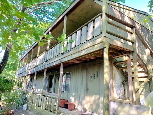
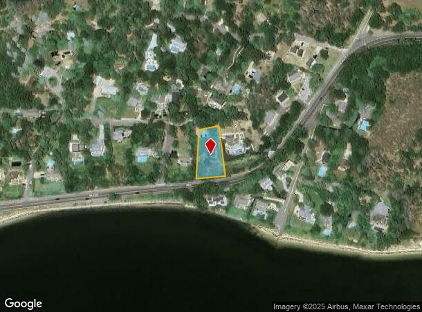
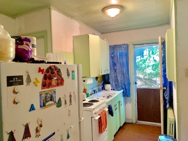
Property Record
317 E Montauk Hwy, Hampton Bays, NY 11946

NEARBY LISTINGS FOR SALE OR LEASE
-
-
View all Hampton Bays listings for sale on LoopNet.com
Property Detail
317 E Montauk Hwy
0900-231-00-03-00-021-000
N-HIGH RD E-HAVENS S-MONTAUK HWY W-ROSATO SR
Motel
Suffolk
X
New York
36103C0513H
21
0
0.49 AC
2024
Outlying Eastern Suffolk
190710
Long Island (New York)
7,959 SF
Nassau County-Suffolk County, NY
DEMOGRAPHICS near 317 E Montauk Hwy
1 Mile
3 Mile
5 Mile
2024 Total Population
2,769
19,901
36,313
2029 Population
2,899
20,606
37,758
Pop Growth 2024-2029
+ 4.69%
+ 3.54%
+ 3.98%
Average Age
42
42
43
2024 Total Households
1,070
7,339
13,582
HH Growth 2024-2029
+ 4.58%
+ 3.52%
+ 3.96%
Median Household Inc
$128,947
$122,589
$117,261
Avg Household Size
2.60
2.60
2.60
2024 Avg HH Vehicles
2.00
2.00
2.00
Median Home Value
$768,716
$754,340
$809,773
Median Year Built
1976
1975
1976
Nearby Places
- Restaurants
- Banks
- Shops
- Fitness
- Groceries
PUBLIC TRANSPORTATION
COMMUTER RAIL
Hampton Bays Station (Montauk Branch - Long Island Rail Road)
DRIVE
WALK
Distance
Hampton Bays Station (Montauk Branch - Long Island Rail Road)
4 min
2.4 mi
Southampton Station (Montauk Branch - Long Island Rail Road)
DRIVE
WALK
Distance
Southampton Station (Montauk Branch - Long Island Rail Road)
12 min
6.0 mi
Freight Ports
Port of New Haven
DRIVE
WALK
Distance
Port of New Haven
165 min
70.8 mi
SALE & LEASE HISTORY
LISTING DATE
SALE/LEASE

Sep 26, 2019
For Sale
Nearby Properties
Address
Land Use
TOTAL SIZE
Lot Size
Zoning
Address
Land Use
TOTAL SIZE
Lot Size
Zoning
30.90 AC
VILLA
Address
Land Use
TOTAL SIZE
Lot Size
Zoning
16,677 SF
25.40 AC
R20
Address
Land Use
TOTAL SIZE
Lot Size
Zoning
47,996 SF
19.50 AC
R20
Address
Land Use
TOTAL SIZE
Lot Size
Zoning
200,320 SF
7.34 AC
MUPDD
Address
Land Use
TOTAL SIZE
Lot Size
Zoning
4,670 SF
238.30 AC
SMUPD
Address
Land Use
TOTAL SIZE
Lot Size
Zoning
2.75 AC
VILLA
Address
Land Use
TOTAL SIZE
Lot Size
Zoning
41 AC
IND-R
Address
Land Use
TOTAL SIZE
Lot Size
Zoning
2.72 AC
VILLA
Address
Land Use
TOTAL SIZE
Lot Size
Zoning
2.76 AC
VILLA
Address
Land Use
TOTAL SIZE
Lot Size
Zoning
2.64 AC
B3
Address
Land Use
TOTAL SIZE
Lot Size
Zoning
23,316 SF
202.05 AC
R120
Address
Land Use
TOTAL SIZE
Lot Size
Zoning
1.67 AC
VILLA
Address
Land Use
TOTAL SIZE
Lot Size
Zoning
660,340 SF
8.50 AC
MF44
Address
Land Use
TOTAL SIZE
Lot Size
Zoning
23,691 SF
5.65 AC
MPDD
Address
Land Use
TOTAL SIZE
Lot Size
Zoning
6.55 AC
VILLA
Address
Land Use
TOTAL SIZE
Lot Size
Zoning
70,960 SF
8.29 AC
SCB
Address
Land Use
TOTAL SIZE
Lot Size
Zoning
123,212 SF
185.30 AC
R120
Address
Land Use
TOTAL SIZE
Lot Size
Zoning
2,568 SF
17.10 AC
HB
Address
Land Use
TOTAL SIZE
Lot Size
Zoning
10,152 SF
0.80 AC
R15
Address
Land Use
TOTAL SIZE
Lot Size
Zoning
55.20 AC
R80
Address
Land Use
TOTAL SIZE
Lot Size
Zoning
5.90 AC
VILLA
Address
Land Use
TOTAL SIZE
Lot Size
Zoning
61,751 SF
37 AC
U25
Address
Land Use
TOTAL SIZE
Lot Size
Zoning
217 AC
H2O
Address
Land Use
TOTAL SIZE
Lot Size
Zoning
216.10 AC
H2O
Address
Land Use
TOTAL SIZE
Lot Size
Zoning
126,936 SF
41 AC
OSC
Address
Land Use
TOTAL SIZE
Lot Size
Zoning
16,249 SF
7.40 AC
R40
Address
Land Use
TOTAL SIZE
Lot Size
Zoning
6.60 AC
VILLA
Address
Land Use
TOTAL SIZE
Lot Size
Zoning
3.30 AC
VILLA
Address
Land Use
TOTAL SIZE
Lot Size
Zoning
3.20 AC
VILLA
Address
Land Use
TOTAL SIZE
Lot Size
Zoning
3.10 AC
VILLA
The World's #1 Commercial Real Estate Marketplace
Connect with us
© 2025 CoStar Group
The information above has been obtained from sources believed reliable. While we do not doubt its accuracy we have not verified it and make no guarantee, warranty or representation about it. It is your responsibility to independently confirm its accuracy and completeness. Any projections, opinions, assumptions, or estimates used are for example only and do not represent the current or future performance of the property. The value of this transaction to you depends on tax and other factors which should be evaluated by your tax, financial, and legal advisors. You and your advisors should conduct a careful, independent investigation of the property to determine to your satisfaction the suitability of the property for your needs.