Property Record
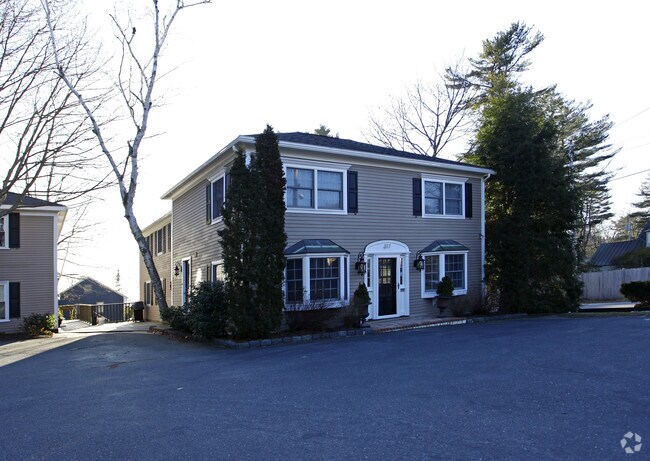
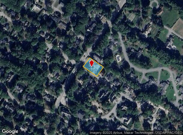
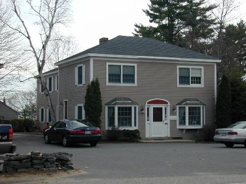
317 Foreside Rd, Falmouth, ME 04105
NEARBY LISTINGS FOR SALE OR LEASE
-
-
View all Falmouth listings for sale on LoopNet.com
Property Detail
317 Foreside Rd
Commercialofficeresidentialmixeduse
Cumberland
X
Maine
23005C0702F
0.36 AC
2024
NE Cumberland County
2024
Portland/South Portland
002501
Portland-South Portland, ME
2,836 SF
FMTH-000018U-000000-000013
DEMOGRAPHICS near 317 Foreside Rd
1 Mile
3 Mile
5 Mile
2024 Total Population
2,281
8,558
33,933
2029 Population
2,411
8,954
35,286
Pop Growth 2024-2029
+ 5.70%
+ 4.63%
+ 3.99%
Average Age
48
47
44
2024 Total Households
858
3,524
13,836
HH Growth 2024-2029
+ 5.94%
+ 4.68%
+ 4.08%
Median Household Inc
$156,451
$132,870
$99,513
Avg Household Size
2.40
2.30
2.40
2024 Avg HH Vehicles
2.00
2.00
2.00
Median Home Value
$714,572
$647,110
$525,092
Median Year Built
1974
1979
1972
Nearby Places
Map Layers
Map Styles
 Street
 Aerial
- Restaurants
- Banks
- Shops
- Fitness
- Groceries
PUBLIC TRANSPORTATION
COMMUTER RAIL
Portland (Downeaster - Amtrak)
DRIVE
WALK
Distance
Portland (Downeaster - Amtrak)
14 min
7.8 mi
AIRPORT
Portland International Jetport
DRIVE
WALK
Distance
Portland International Jetport
19 min
10.0 mi
Freight Ports
Portland, ME
DRIVE
WALK
Distance
Portland, ME
13 min
7.0 mi
Nearby Properties
Address
Land Use
TOTAL SIZE
Lot Size
Zoning
Address
Land Use
TOTAL SIZE
Lot Size
Zoning
220,494 SF
28.05 AC
SB
Address
Land Use
TOTAL SIZE
Lot Size
Zoning
117.24 AC
31
Address
Land Use
TOTAL SIZE
Lot Size
Zoning
39,946 SF
48.10 AC
RB
Address
Land Use
TOTAL SIZE
Lot Size
Zoning
66.50 AC
RR2
Address
Land Use
TOTAL SIZE
Lot Size
Zoning
106,940 SF
13.96 AC
SB
Address
Land Use
TOTAL SIZE
Lot Size
Zoning
23,614 SF
142 AC
RC
Address
Land Use
TOTAL SIZE
Lot Size
Zoning
6,246 SF
6 AC
SSB
Address
Land Use
TOTAL SIZE
Lot Size
Zoning
68,068 SF
6.02 AC
BP
Address
Land Use
TOTAL SIZE
Lot Size
Zoning
39,260 SF
3.50 AC
RB
Address
Land Use
TOTAL SIZE
Lot Size
Zoning
43,700 SF
8.36 AC
RA
Address
Land Use
TOTAL SIZE
Lot Size
Zoning
23,811 SF
5.85 AC
RA
Address
Land Use
TOTAL SIZE
Lot Size
Zoning
19.25 AC
RA
Address
Land Use
TOTAL SIZE
Lot Size
Zoning
1,896 SF
10.58 AC
LDR
Address
Land Use
TOTAL SIZE
Lot Size
Zoning
22,941 SF
7.11 AC
SB
Address
Land Use
TOTAL SIZE
Lot Size
Zoning
44,274 SF
17.70 AC
FF
Address
Land Use
TOTAL SIZE
Lot Size
Zoning
Address
Land Use
TOTAL SIZE
Lot Size
Zoning
37,746 SF
3.16 AC
LDR
Address
Land Use
TOTAL SIZE
Lot Size
Zoning
36,280 SF
1.21 AC
ESRD
Address
Land Use
TOTAL SIZE
Lot Size
Zoning
37,148 SF
3.30 AC
SB
Address
Land Use
TOTAL SIZE
Lot Size
Zoning
31,293 SF
7.20 AC
OC
Address
Land Use
TOTAL SIZE
Lot Size
Zoning
32,861 SF
RB
Address
Land Use
TOTAL SIZE
Lot Size
Zoning
3,000 SF
5.77 AC
BP
Address
Land Use
TOTAL SIZE
Lot Size
Zoning
23,376 SF
37.04 AC
LDR
Address
Land Use
TOTAL SIZE
Lot Size
Zoning
39,991 SF
4 AC
SB1
Address
Land Use
TOTAL SIZE
Lot Size
Zoning
18,950 SF
1.70 AC
RA
Address
Land Use
TOTAL SIZE
Lot Size
Zoning
25,493 SF
1.66 AC
ESRD
Address
Land Use
TOTAL SIZE
Lot Size
Zoning
28,586 SF
4.86 AC
SB
Address
Land Use
TOTAL SIZE
Lot Size
Zoning
12,000 SF
10.49 AC
BP
Address
Land Use
TOTAL SIZE
Lot Size
Zoning
2,634 SF
4.40 AC
RA
Address
Land Use
TOTAL SIZE
Lot Size
Zoning
2.33 AC
The World's #1 Commercial Real Estate Marketplace
Connect with us
© 2025 CoStar Group
The information above has been obtained from sources believed reliable. While we do not doubt its accuracy we have not verified it and make no guarantee, warranty or representation about it. It is your responsibility to independently confirm its accuracy and completeness. Any projections, opinions, assumptions, or estimates used are for example only and do not represent the current or future performance of the property. The value of this transaction to you depends on tax and other factors which should be evaluated by your tax, financial, and legal advisors. You and your advisors should conduct a careful, independent investigation of the property to determine to your satisfaction the suitability of the property for your needs.