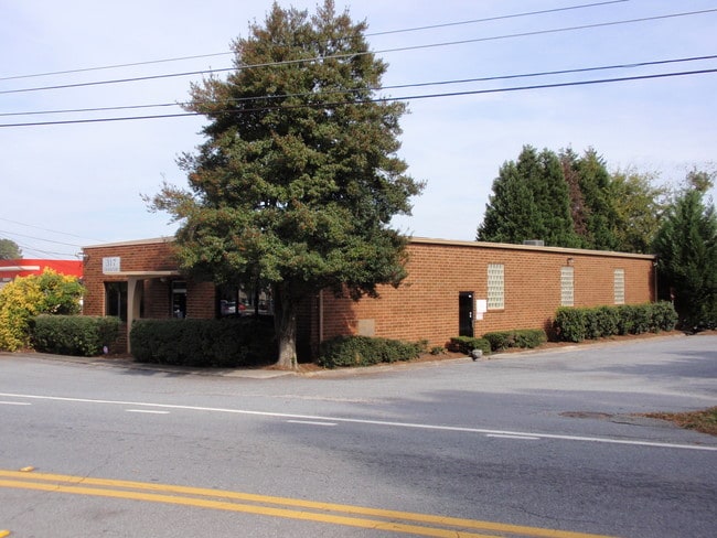
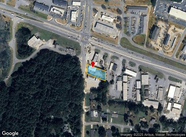
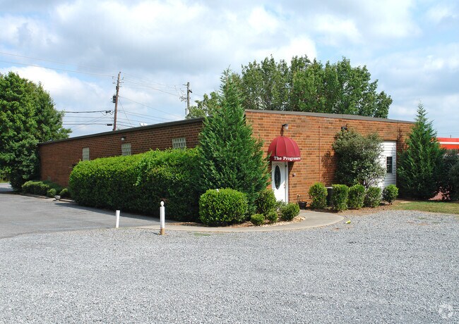
Property Record
317 Grassdale Rd, Cartersville, GA 30120
NEARBY LISTINGS FOR SALE OR LEASE
Property Detail
317 Grassdale Rd
0071C-0005-009
Com - Hwy 41/Grassdale
Officebuilding
LL55 LD4
X
Bartow
13015C0254H
Georgia
2024
0.60 AC
2024
Bartow County
960501
Atlanta
3,402 SF
Atlanta-Sandy Springs-Roswell, GA
DEMOGRAPHICS near 317 Grassdale Rd
1 Mile
3 Mile
5 Mile
2024 Total Population
7,099
34,151
57,471
2029 Population
7,730
37,391
62,849
Pop Growth 2024-2029
+ 8.89%
+ 9.49%
+ 9.36%
Average Age
38
38
39
2024 Total Households
2,998
12,751
21,535
HH Growth 2024-2029
+ 8.64%
+ 9.25%
+ 9.12%
Median Household Inc
$57,725
$61,779
$68,182
Avg Household Size
2.30
2.60
2.60
2024 Avg HH Vehicles
2.00
2.00
2.00
Median Home Value
$176,944
$205,997
$231,747
Median Year Built
1987
1991
1992
Nearby Places
Map Layers
Map Styles
 Street
 Aerial
- Restaurants
- Banks
- Shops
- Fitness
- Groceries
Nearby Properties
Address
Land Use
TOTAL SIZE
Lot Size
Zoning
Address
Land Use
TOTAL SIZE
Lot Size
Zoning
141,651 SF
181.89 AC
I1
Address
Land Use
TOTAL SIZE
Lot Size
Zoning
7,488 SF
38.49 AC
IN
Address
Land Use
TOTAL SIZE
Lot Size
Zoning
67,428 SF
36.96 AC
Address
Land Use
TOTAL SIZE
Lot Size
Zoning
998,421 SF
85.80 AC
I1
Address
Land Use
TOTAL SIZE
Lot Size
Zoning
134,528 SF
4.71 AC
IN
Address
Land Use
TOTAL SIZE
Lot Size
Zoning
Address
Land Use
TOTAL SIZE
Lot Size
Zoning
250,701 SF
15.17 AC
C1
Address
Land Use
TOTAL SIZE
Lot Size
Zoning
244,800 SF
17.44 AC
Address
Land Use
TOTAL SIZE
Lot Size
Zoning
Address
Land Use
TOTAL SIZE
Lot Size
Zoning
194,306 SF
126.40 AC
A1
Address
Land Use
TOTAL SIZE
Lot Size
Zoning
33,096 SF
15.80 AC
Address
Land Use
TOTAL SIZE
Lot Size
Zoning
Address
Land Use
TOTAL SIZE
Lot Size
Zoning
766,373 SF
267.91 AC
I2
Address
Land Use
TOTAL SIZE
Lot Size
Zoning
84,852 SF
6.78 AC
A1
Address
Land Use
TOTAL SIZE
Lot Size
Zoning
151,571 SF
25.82 AC
Address
Land Use
TOTAL SIZE
Lot Size
Zoning
3,696 SF
12 AC
IN
Address
Land Use
TOTAL SIZE
Lot Size
Zoning
211,708 SF
20.32 AC
Address
Land Use
TOTAL SIZE
Lot Size
Zoning
144,416 SF
40.01 AC
A1
Address
Land Use
TOTAL SIZE
Lot Size
Zoning
51,681 SF
16 AC
Address
Land Use
TOTAL SIZE
Lot Size
Zoning
91,110 SF
17.09 AC
Address
Land Use
TOTAL SIZE
Lot Size
Zoning
Address
Land Use
TOTAL SIZE
Lot Size
Zoning
8,760 SF
151.31 AC
IN
Address
Land Use
TOTAL SIZE
Lot Size
Zoning
59,880 SF
12.83 AC
C1
Address
Land Use
TOTAL SIZE
Lot Size
Zoning
20,000 SF
9.63 AC
C1
Address
Land Use
TOTAL SIZE
Lot Size
Zoning
12,769 SF
4.44 AC
C1
Address
Land Use
TOTAL SIZE
Lot Size
Zoning
9,560 SF
12 AC
R3
Address
Land Use
TOTAL SIZE
Lot Size
Zoning
13.86 AC
IN
Address
Land Use
TOTAL SIZE
Lot Size
Zoning
64,691 SF
6.95 AC
Address
Land Use
TOTAL SIZE
Lot Size
Zoning
60,361 SF
13.66 AC
A1
Address
Land Use
TOTAL SIZE
Lot Size
Zoning
36.25 AC
RESIDENTIA
The World's #1 Commercial Real Estate Marketplace
Connect with us
© 2025 CoStar Group
The information above has been obtained from sources believed reliable. While we do not doubt its accuracy we have not verified it and make no guarantee, warranty or representation about it. It is your responsibility to independently confirm its accuracy and completeness. Any projections, opinions, assumptions, or estimates used are for example only and do not represent the current or future performance of the property. The value of this transaction to you depends on tax and other factors which should be evaluated by your tax, financial, and legal advisors. You and your advisors should conduct a careful, independent investigation of the property to determine to your satisfaction the suitability of the property for your needs.