Property Record
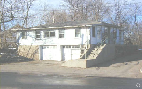
317 Haverhill St, Rowley, MA 01969


NEARBY LISTINGS FOR SALE OR LEASE
Property Detail
317 Haverhill St
Commercialofficeresidentialmixeduse
Essex
A
Massachusetts
25009C0258G
0.57 AC
2025
Amesbury/Ipswich
2025
Boston
270100
Boston-Cambridge-Newton, MA-NH
1,185 SF
ROWL-000016-000011
DEMOGRAPHICS near 317 Haverhill St
1 Mile
3 Mile
5 Mile
2024 Total Population
1,026
12,483
35,413
2029 Population
1,028
12,483
35,355
Pop Growth 2024-2029
+ 0.19%
0.00%
(0.16%)
Average Age
44
44
44
2024 Total Households
390
4,604
13,535
HH Growth 2024-2029
+ 0.26%
(0.17%)
(0.32%)
Median Household Inc
$137,500
$137,866
$130,091
Avg Household Size
2.60
2.70
2.60
2024 Avg HH Vehicles
2.00
2.00
2.00
Median Home Value
$707,468
$683,238
$671,693
Median Year Built
1983
1984
1974
Nearby Places
Map Layers
Map Styles
 Street
 Aerial
- Restaurants
- Banks
- Shops
- Fitness
- Groceries
PUBLIC TRANSPORTATION
COMMUTER RAIL
Rowley (Newburyport/Rockport Line - Massachusetts Bay Transportation Authority Commuter Rail (Purple Line))
DRIVE
WALK
Distance
Rowley (Newburyport/Rockport Line - Massachusetts Bay Transportation Authority Commuter Rail (Purple Line))
8 min
3.2 mi
Ipswich (Newburyport/Rockport Line - Massachusetts Bay Transportation Authority Commuter Rail (Purple Line))
DRIVE
WALK
Distance
Ipswich (Newburyport/Rockport Line - Massachusetts Bay Transportation Authority Commuter Rail (Purple Line))
11 min
5.1 mi
AIRPORT
General Edward Lawrence Logan International
DRIVE
WALK
Distance
General Edward Lawrence Logan International
44 min
27.2 mi
Portsmouth International at Pease
DRIVE
WALK
Distance
Portsmouth International at Pease
44 min
31.7 mi
Manchester Boston Regional
DRIVE
WALK
Distance
Manchester Boston Regional
70 min
42.8 mi
Nearby Properties
Address
Land Use
TOTAL SIZE
Lot Size
Zoning
Address
Land Use
TOTAL SIZE
Lot Size
Zoning
1,520 AC
RRA
Address
Land Use
TOTAL SIZE
Lot Size
Zoning
Address
Land Use
TOTAL SIZE
Lot Size
Zoning
374,714 SF
98 AC
AR4
Address
Land Use
TOTAL SIZE
Lot Size
Zoning
86,812 SF
27.80 AC
Address
Land Use
TOTAL SIZE
Lot Size
Zoning
385,746 SF
7.79 AC
Address
Land Use
TOTAL SIZE
Lot Size
Zoning
106,342 SF
22.38 AC
Address
Land Use
TOTAL SIZE
Lot Size
Zoning
2,394 SF
63.04 AC
Address
Land Use
TOTAL SIZE
Lot Size
Zoning
130,204 SF
40.90 AC
Address
Land Use
TOTAL SIZE
Lot Size
Zoning
55,946 SF
20.50 AC
Address
Land Use
TOTAL SIZE
Lot Size
Zoning
108,934 SF
7.64 AC
LI
Address
Land Use
TOTAL SIZE
Lot Size
Zoning
36,838 SF
13.93 AC
HB
Address
Land Use
TOTAL SIZE
Lot Size
Zoning
1,863 SF
9.67 AC
RRA
Address
Land Use
TOTAL SIZE
Lot Size
Zoning
90,855 SF
16.19 AC
Address
Land Use
TOTAL SIZE
Lot Size
Zoning
65,044 SF
10.74 AC
Address
Land Use
TOTAL SIZE
Lot Size
Zoning
78,740 SF
14.54 AC
Address
Land Use
TOTAL SIZE
Lot Size
Zoning
10,255 SF
6.39 AC
Address
Land Use
TOTAL SIZE
Lot Size
Zoning
83.80 AC
AR4
Address
Land Use
TOTAL SIZE
Lot Size
Zoning
14,240 SF
51.38 AC
PC
Address
Land Use
TOTAL SIZE
Lot Size
Zoning
3.70 AC
PC
Address
Land Use
TOTAL SIZE
Lot Size
Zoning
64,500 SF
6.93 AC
PC
Address
Land Use
TOTAL SIZE
Lot Size
Zoning
212.80 AC
RRA
Address
Land Use
TOTAL SIZE
Lot Size
Zoning
264 SF
232.27 AC
PC
Address
Land Use
TOTAL SIZE
Lot Size
Zoning
46,186 SF
9.08 AC
RRA
Address
Land Use
TOTAL SIZE
Lot Size
Zoning
56,998 SF
17.23 AC
RRA
Address
Land Use
TOTAL SIZE
Lot Size
Zoning
57,400 SF
7.79 AC
LI
Address
Land Use
TOTAL SIZE
Lot Size
Zoning
83,743 SF
6 AC
Address
Land Use
TOTAL SIZE
Lot Size
Zoning
49,730 SF
6.61 AC
Address
Land Use
TOTAL SIZE
Lot Size
Zoning
5.10 AC
Address
Land Use
TOTAL SIZE
Lot Size
Zoning
2,286 SF
3.82 AC
Address
Land Use
TOTAL SIZE
Lot Size
Zoning
19,665 SF
17.01 AC
PC
The World's #1 Commercial Real Estate Marketplace
Connect with us
© 2026 CoStar Group
The information above has been obtained from sources believed reliable. While we do not doubt its accuracy we have not verified it and make no guarantee, warranty or representation about it. It is your responsibility to independently confirm its accuracy and completeness. Any projections, opinions, assumptions, or estimates used are for example only and do not represent the current or future performance of the property. The value of this transaction to you depends on tax and other factors which should be evaluated by your tax, financial, and legal advisors. You and your advisors should conduct a careful, independent investigation of the property to determine to your satisfaction the suitability of the property for your needs.