Property Record
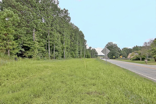
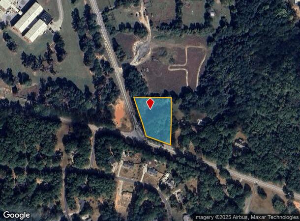
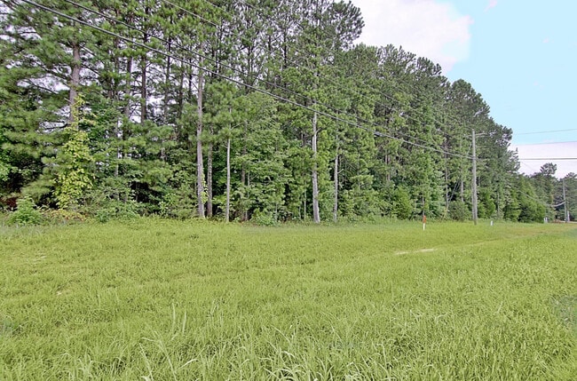
317 Highway 154, Sharpsburg, GA 30277
This Property Is For Sale
NEARBY LISTINGS FOR SALE OR LEASE
Property Detail
317 Highway 154
Atlanta-Sandy Springs-Roswell, GA
Larry M Harper
136-1088-007
Coweta
Sfr
Georgia
X
1 AC
13077C0257D
Fayette/Coweta County
1,482 SF
Atlanta
DEMOGRAPHICS near 317 Highway 154
1 Mile
3 Mile
5 Mile
2024 Total Population
1,477
10,348
36,501
2029 Population
1,629
11,462
40,177
Pop Growth 2024-2029
+ 10.29%
+ 10.77%
+ 10.07%
Average Age
41
41
41
2024 Total Households
545
3,694
13,184
HH Growth 2024-2029
+ 10.46%
+ 10.86%
+ 10.15%
Median Household Inc
$71,432
$91,236
$98,524
Avg Household Size
2.70
2.80
2.70
2024 Avg HH Vehicles
2.00
2.00
2.00
Median Home Value
$249,090
$284,295
$286,338
Median Year Built
1991
1994
1997
Nearby Places
- Restaurants
- Banks
- Shops
- Fitness
- Groceries
PUBLIC TRANSPORTATION
AIRPORT
Hartsfield - Jackson Atlanta International
DRIVE
WALK
Distance
Hartsfield - Jackson Atlanta International
41 min
31.5 mi
Freight Ports
Georgia Ports - Savannah
DRIVE
WALK
Distance
Georgia Ports - Savannah
283 min
243.5 mi
Nearby Properties
Address
Land Use
TOTAL SIZE
Lot Size
Zoning
Address
Land Use
TOTAL SIZE
Lot Size
Zoning
166,866 SF
85.16 AC
R1
Address
Land Use
TOTAL SIZE
Lot Size
Zoning
112,934 SF
108.27 AC
R1
Address
Land Use
TOTAL SIZE
Lot Size
Zoning
91,629 SF
23.51 AC
R1
Address
Land Use
TOTAL SIZE
Lot Size
Zoning
784 SF
517.26 AC
RFA
Address
Land Use
TOTAL SIZE
Lot Size
Zoning
25,600 SF
131.86 AC
R1
Address
Land Use
TOTAL SIZE
Lot Size
Zoning
98,838 SF
8.18 AC
R1
Address
Land Use
TOTAL SIZE
Lot Size
Zoning
59,753 SF
8.77 AC
R1
Address
Land Use
TOTAL SIZE
Lot Size
Zoning
31,546 SF
31.32 AC
001
Address
Land Use
TOTAL SIZE
Lot Size
Zoning
24,300 SF
24.76 AC
R1
Address
Land Use
TOTAL SIZE
Lot Size
Zoning
18,136 SF
7.89 AC
R1
Address
Land Use
TOTAL SIZE
Lot Size
Zoning
24,421 SF
22.74 AC
001
Address
Land Use
TOTAL SIZE
Lot Size
Zoning
35,100 SF
5.26 AC
M
Address
Land Use
TOTAL SIZE
Lot Size
Zoning
23,822 SF
10.09 AC
R1
Address
Land Use
TOTAL SIZE
Lot Size
Zoning
14,198 SF
14.68 AC
R1
Address
Land Use
TOTAL SIZE
Lot Size
Zoning
6,273 SF
241.53 AC
R1
Address
Land Use
TOTAL SIZE
Lot Size
Zoning
11,875 SF
33.91 AC
R1
Address
Land Use
TOTAL SIZE
Lot Size
Zoning
8,641 SF
3.31 AC
M
Address
Land Use
TOTAL SIZE
Lot Size
Zoning
93.01 AC
RFA
Address
Land Use
TOTAL SIZE
Lot Size
Zoning
8,118 SF
10 AC
RFA
Address
Land Use
TOTAL SIZE
Lot Size
Zoning
7,168 SF
2 AC
R1
Address
Land Use
TOTAL SIZE
Lot Size
Zoning
12,780 SF
2.38 AC
001
Address
Land Use
TOTAL SIZE
Lot Size
Zoning
19,400 SF
5 AC
M
Address
Land Use
TOTAL SIZE
Lot Size
Zoning
26,898 SF
2.42 AC
M
Address
Land Use
TOTAL SIZE
Lot Size
Zoning
156.65 AC
RFA
Address
Land Use
TOTAL SIZE
Lot Size
Zoning
104.06 AC
RFA
Address
Land Use
TOTAL SIZE
Lot Size
Zoning
7,000 SF
1.61 AC
R1
Address
Land Use
TOTAL SIZE
Lot Size
Zoning
9,786 SF
7.36 AC
R1
Address
Land Use
TOTAL SIZE
Lot Size
Zoning
5,000 SF
7.18 AC
R1
Address
Land Use
TOTAL SIZE
Lot Size
Zoning
9,504 SF
2.03 AC
R1
Address
Land Use
TOTAL SIZE
Lot Size
Zoning
6,335 SF
36.46 AC
R1
The World's #1 Commercial Real Estate Marketplace
Connect with us
© 2025 CoStar Group
The information above has been obtained from sources believed reliable. While we do not doubt its accuracy we have not verified it and make no guarantee, warranty or representation about it. It is your responsibility to independently confirm its accuracy and completeness. Any projections, opinions, assumptions, or estimates used are for example only and do not represent the current or future performance of the property. The value of this transaction to you depends on tax and other factors which should be evaluated by your tax, financial, and legal advisors. You and your advisors should conduct a careful, independent investigation of the property to determine to your satisfaction the suitability of the property for your needs.