Property Record
317 North Ave, Council Bluffs, IA 51503


NEARBY LISTINGS FOR SALE OR LEASE
-
-
View all Council Bluffs listings for sale on LoopNet.com
Property Detail
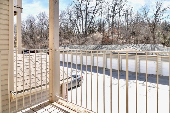
317 North Ave
Omaha-Council Bluffs, NE-IA
Aud Sub
7543-30-204-008
AUD SUB NW NE 30-75-43 PT LT 1 COMM NE COR LT 1 JAKSHA SUB TH N25' E35.64' N25' E707.95'SLY483.03'~W100' N65.94' W541.14' N TO POB & JAKSHA SUB LTS 1 THRU 3 & O/L 1
Apartment
Pottawattamie
X
Iowa
31055C0275H
1
2025
6.98 AC
2025
Council Bluffs
030100
Omaha/Council Bluffs
8,076 SF
DEMOGRAPHICS near 317 North Ave
1 Mile
3 Mile
5 Mile
2024 Total Population
8,258
42,851
71,286
2029 Population
8,200
42,620
70,961
Pop Growth 2024-2029
(0.70%)
(0.54%)
(0.46%)
Average Age
41
41
41
2024 Total Households
3,276
17,165
28,062
HH Growth 2024-2029
(0.76%)
(0.57%)
(0.51%)
Median Household Inc
$63,210
$64,190
$63,162
Avg Household Size
2.30
2.30
2.40
2024 Avg HH Vehicles
2.00
2.00
2.00
Median Home Value
$167,803
$175,078
$171,283
Median Year Built
1966
1961
1965
Nearby Places
Map Layers
Map Styles
 Street
 Aerial
- Restaurants
- Banks
- Shops
- Fitness
- Groceries
PUBLIC TRANSPORTATION
COMMUTER RAIL
Omaha Amtrak Station (California Zephyr - Amtrak)
DRIVE
WALK
Distance
Omaha Amtrak Station (California Zephyr - Amtrak)
15 min
6.4 mi
Omaha Amtrak Station (California Zephyr - Amtrak)
DRIVE
WALK
Distance
Omaha Amtrak Station (California Zephyr - Amtrak)
16 min
6.6 mi
AIRPORT
Eppley Airfield
DRIVE
WALK
Distance
Eppley Airfield
23 min
9.3 mi
Freight Ports
Tulsa Port Of Catoosa
DRIVE
WALK
Distance
Tulsa Port Of Catoosa
461 min
416.4 mi
Nearby Properties
Address
Land Use
TOTAL SIZE
Lot Size
Zoning
Address
Land Use
TOTAL SIZE
Lot Size
Zoning
185.50 AC
A-2
Address
Land Use
TOTAL SIZE
Lot Size
Zoning
11.85 AC
R-3
Address
Land Use
TOTAL SIZE
Lot Size
Zoning
16.87 AC
P-C
Address
Land Use
TOTAL SIZE
Lot Size
Zoning
17.49 AC
R-3
Address
Land Use
TOTAL SIZE
Lot Size
Zoning
2.91 AC
A-P
Address
Land Use
TOTAL SIZE
Lot Size
Zoning
17.40 AC
A-P
Address
Land Use
TOTAL SIZE
Lot Size
Zoning
37.25 AC
I-2
Address
Land Use
TOTAL SIZE
Lot Size
Zoning
4,216 SF
17.29 AC
R-4
Address
Land Use
TOTAL SIZE
Lot Size
Zoning
14 AC
I-2
Address
Land Use
TOTAL SIZE
Lot Size
Zoning
30.64 AC
R-1
Address
Land Use
TOTAL SIZE
Lot Size
Zoning
8.34 AC
R-3
Address
Land Use
TOTAL SIZE
Lot Size
Zoning
1.99 AC
C-3
Address
Land Use
TOTAL SIZE
Lot Size
Zoning
21.72 AC
I-2
Address
Land Use
TOTAL SIZE
Lot Size
Zoning
14.54 AC
P-C
Address
Land Use
TOTAL SIZE
Lot Size
Zoning
18.68 AC
C-2
Address
Land Use
TOTAL SIZE
Lot Size
Zoning
18.41 AC
R-3
Address
Land Use
TOTAL SIZE
Lot Size
Zoning
9.06 AC
R-3
Address
Land Use
TOTAL SIZE
Lot Size
Zoning
4.48 AC
R-4
Address
Land Use
TOTAL SIZE
Lot Size
Zoning
7.72 AC
P-C
Address
Land Use
TOTAL SIZE
Lot Size
Zoning
7.17 AC
R-3
Address
Land Use
TOTAL SIZE
Lot Size
Zoning
67,671 SF
5.52 AC
C-2
Address
Land Use
TOTAL SIZE
Lot Size
Zoning
8.42 AC
R-3
Address
Land Use
TOTAL SIZE
Lot Size
Zoning
4.87 AC
C-2
Address
Land Use
TOTAL SIZE
Lot Size
Zoning
864 SF
7.37 AC
C-2
Address
Land Use
TOTAL SIZE
Lot Size
Zoning
81.55 AC
A-2
Address
Land Use
TOTAL SIZE
Lot Size
Zoning
201,260 SF
10.65 AC
C-4
Address
Land Use
TOTAL SIZE
Lot Size
Zoning
1,034 SF
14.99 AC
R-3
Address
Land Use
TOTAL SIZE
Lot Size
Zoning
5.66 AC
R-3
Address
Land Use
TOTAL SIZE
Lot Size
Zoning
15.91 AC
R-3
Address
Land Use
TOTAL SIZE
Lot Size
Zoning
1.57 AC
C-3
The World's #1 Commercial Real Estate Marketplace
Connect with us
© 2026 CoStar Group
The information above has been obtained from sources believed reliable. While we do not doubt its accuracy we have not verified it and make no guarantee, warranty or representation about it. It is your responsibility to independently confirm its accuracy and completeness. Any projections, opinions, assumptions, or estimates used are for example only and do not represent the current or future performance of the property. The value of this transaction to you depends on tax and other factors which should be evaluated by your tax, financial, and legal advisors. You and your advisors should conduct a careful, independent investigation of the property to determine to your satisfaction the suitability of the property for your needs.