Property Record
3171 Guerneville Rd, Santa Rosa, CA 95401


NEARBY LISTINGS FOR SALE OR LEASE
Property Detail
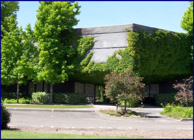
3171 Guerneville Rd
034-081-046
91 FM 34-080-85 # CHG PER MD PM 6250 PARCEL 1
Lightindustrial
Sonoma
X
California
06097C0708E
3.77 AC
2024
Santa Rosa
2025
North Bay/Santa Rosa
152906
Santa Rosa, CA
21,294 SF
DEMOGRAPHICS near 3171 Guerneville Rd
1 Mile
3 Mile
5 Mile
2024 Total Population
878
51,869
145,573
2029 Population
840
51,118
144,080
Pop Growth 2024-2029
(4.33%)
(1.45%)
(1.03%)
Average Age
46
40
41
2024 Total Households
339
18,147
53,106
HH Growth 2024-2029
(4.42%)
(1.50%)
(1.00%)
Median Household Inc
$137,500
$104,147
$89,099
Avg Household Size
2.60
2.80
2.60
2024 Avg HH Vehicles
2.00
2.00
2.00
Median Home Value
$803,892
$692,434
$710,260
Median Year Built
1978
1983
1979
Nearby Places
Map Layers
Map Styles
 Street
 Aerial
- Restaurants
- Banks
- Shops
- Fitness
- Groceries
PUBLIC TRANSPORTATION
COMMUTER RAIL
Santa Rosa North Smart (Main Line - Sonoma Marin Area Rail Transit)
DRIVE
WALK
Distance
Santa Rosa North Smart (Main Line - Sonoma Marin Area Rail Transit)
6 min
3.2 mi
Santa Rosa Downtown Smart (Main Line - Sonoma Marin Area Rail Transit)
DRIVE
WALK
Distance
Santa Rosa Downtown Smart (Main Line - Sonoma Marin Area Rail Transit)
9 min
4.7 mi
AIRPORT
Charles M Schulz - Sonoma County
DRIVE
WALK
Distance
Charles M Schulz - Sonoma County
14 min
7.3 mi
Freight Ports
Port of Richmond
DRIVE
WALK
Distance
Port of Richmond
70 min
52.9 mi
Nearby Properties
Address
Land Use
TOTAL SIZE
Lot Size
Zoning
Address
Land Use
TOTAL SIZE
Lot Size
Zoning
8.06 AC
Address
Land Use
TOTAL SIZE
Lot Size
Zoning
136,609 SF
9.33 AC
CITYSR
Address
Land Use
TOTAL SIZE
Lot Size
Zoning
71,800 SF
7.76 AC
CIPD
Address
Land Use
TOTAL SIZE
Lot Size
Zoning
85,920 SF
5.69 AC
CITYSR
Address
Land Use
TOTAL SIZE
Lot Size
Zoning
205,776 SF
9.96 AC
CITYSR
Address
Land Use
TOTAL SIZE
Lot Size
Zoning
144,066 SF
0.52 AC
Address
Land Use
TOTAL SIZE
Lot Size
Zoning
Address
Land Use
TOTAL SIZE
Lot Size
Zoning
98,358 SF
8.02 AC
CITYSR
Address
Land Use
TOTAL SIZE
Lot Size
Zoning
Address
Land Use
TOTAL SIZE
Lot Size
Zoning
71,564 SF
5.74 AC
CITYSR
Address
Land Use
TOTAL SIZE
Lot Size
Zoning
49,892 SF
5.05 AC
CITYSR
Address
Land Use
TOTAL SIZE
Lot Size
Zoning
48,951 SF
1.77 AC
R4
Address
Land Use
TOTAL SIZE
Lot Size
Zoning
64,235 SF
5.61 AC
CITYSR
Address
Land Use
TOTAL SIZE
Lot Size
Zoning
53,599 SF
3.51 AC
Address
Land Use
TOTAL SIZE
Lot Size
Zoning
195,308 SF
8.33 AC
PC
Address
Land Use
TOTAL SIZE
Lot Size
Zoning
44,861 SF
3.76 AC
CITYSR
Address
Land Use
TOTAL SIZE
Lot Size
Zoning
67,840 SF
2.36 AC
Address
Land Use
TOTAL SIZE
Lot Size
Zoning
22,493 SF
40.24 AC
Address
Land Use
TOTAL SIZE
Lot Size
Zoning
207,548 SF
4.79 AC
CITYSR
Address
Land Use
TOTAL SIZE
Lot Size
Zoning
2,029 SF
121.99 AC
Address
Land Use
TOTAL SIZE
Lot Size
Zoning
124,672 SF
7.74 AC
Address
Land Use
TOTAL SIZE
Lot Size
Zoning
21,971 SF
9 AC
Address
Land Use
TOTAL SIZE
Lot Size
Zoning
83,004 SF
0.15 AC
CITYSR
Address
Land Use
TOTAL SIZE
Lot Size
Zoning
50,552 SF
2.87 AC
CITYSR
Address
Land Use
TOTAL SIZE
Lot Size
Zoning
23,164 SF
2.70 AC
CITYSR
Address
Land Use
TOTAL SIZE
Lot Size
Zoning
40,546 SF
1.51 AC
CITYSR
Address
Land Use
TOTAL SIZE
Lot Size
Zoning
45,606 SF
3.18 AC
CITYSR
Address
Land Use
TOTAL SIZE
Lot Size
Zoning
13,800 SF
12.17 AC
LIA40
Address
Land Use
TOTAL SIZE
Lot Size
Zoning
53,766 SF
20 AC
Address
Land Use
TOTAL SIZE
Lot Size
Zoning
5.10 AC
CITYSR
The World's #1 Commercial Real Estate Marketplace
Connect with us
© 2026 CoStar Group
The information above has been obtained from sources believed reliable. While we do not doubt its accuracy we have not verified it and make no guarantee, warranty or representation about it. It is your responsibility to independently confirm its accuracy and completeness. Any projections, opinions, assumptions, or estimates used are for example only and do not represent the current or future performance of the property. The value of this transaction to you depends on tax and other factors which should be evaluated by your tax, financial, and legal advisors. You and your advisors should conduct a careful, independent investigation of the property to determine to your satisfaction the suitability of the property for your needs.