Property Record
3174 Poplar Rd E, Sharpsburg, GA 30277
NEARBY LISTINGS FOR SALE OR LEASE
-
-
View all Sharpsburg listings for sale on LoopNet.com
Property Detail
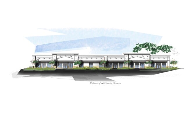
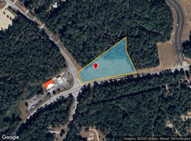
3174 Poplar Rd E
Atlanta-Sandy Springs-Roswell, GA
Paul Bass & James A Williams
124-1049-008
ACC/ 3 AC LL 49 1LD E HWY 16
Commercialnec
Coweta
X
Georgia
13077C0258D
0
2025
3 AC
2025
Coweta County
170405
Atlanta
1,600 SF
DEMOGRAPHICS near 3174 Poplar Rd E
1 Mile
3 Mile
5 Mile
2024 Total Population
823
13,990
44,793
2029 Population
913
15,645
50,091
Pop Growth 2024-2029
+ 10.94%
+ 11.83%
+ 11.83%
Average Age
41
40
40
2024 Total Households
299
5,049
16,506
HH Growth 2024-2029
+ 11.04%
+ 11.88%
+ 11.90%
Median Household Inc
$78,863
$91,272
$94,872
Avg Household Size
2.70
2.80
2.70
2024 Avg HH Vehicles
2.00
2.00
2.00
Median Home Value
$282,236
$273,044
$275,075
Median Year Built
1991
1998
1999
Nearby Places
Map Layers
Map Styles
 Street
 Aerial
- Restaurants
- Banks
- Shops
- Fitness
- Groceries
PUBLIC TRANSPORTATION
AIRPORT
Hartsfield - Jackson Atlanta International
DRIVE
WALK
Distance
Hartsfield - Jackson Atlanta International
45 min
33.3 mi
Freight Ports
Georgia Ports - Savannah
DRIVE
WALK
Distance
Georgia Ports - Savannah
284 min
244.7 mi
Nearby Properties
Address
Land Use
TOTAL SIZE
Lot Size
Zoning
Address
Land Use
TOTAL SIZE
Lot Size
Zoning
166,866 SF
85.16 AC
R1
Address
Land Use
TOTAL SIZE
Lot Size
Zoning
112,934 SF
108.27 AC
R1
Address
Land Use
TOTAL SIZE
Lot Size
Zoning
90,675 SF
20.42 AC
001
Address
Land Use
TOTAL SIZE
Lot Size
Zoning
91,629 SF
23.51 AC
R1
Address
Land Use
TOTAL SIZE
Lot Size
Zoning
25,600 SF
131.86 AC
R1
Address
Land Use
TOTAL SIZE
Lot Size
Zoning
89,260 SF
10.26 AC
001
Address
Land Use
TOTAL SIZE
Lot Size
Zoning
98,838 SF
8.18 AC
R1
Address
Land Use
TOTAL SIZE
Lot Size
Zoning
59,753 SF
8.77 AC
R1
Address
Land Use
TOTAL SIZE
Lot Size
Zoning
10,100 SF
23.26 AC
ND
Address
Land Use
TOTAL SIZE
Lot Size
Zoning
24,300 SF
24.76 AC
R1
Address
Land Use
TOTAL SIZE
Lot Size
Zoning
18,136 SF
7.89 AC
R1
Address
Land Use
TOTAL SIZE
Lot Size
Zoning
35,100 SF
5.26 AC
M
Address
Land Use
TOTAL SIZE
Lot Size
Zoning
14,198 SF
14.68 AC
R1
Address
Land Use
TOTAL SIZE
Lot Size
Zoning
6,273 SF
241.53 AC
R1
Address
Land Use
TOTAL SIZE
Lot Size
Zoning
11,875 SF
33.91 AC
R1
Address
Land Use
TOTAL SIZE
Lot Size
Zoning
8,641 SF
3.31 AC
M
Address
Land Use
TOTAL SIZE
Lot Size
Zoning
8,350 SF
4.18 AC
R1
Address
Land Use
TOTAL SIZE
Lot Size
Zoning
7,168 SF
2 AC
R1
Address
Land Use
TOTAL SIZE
Lot Size
Zoning
12,780 SF
2.38 AC
001
Address
Land Use
TOTAL SIZE
Lot Size
Zoning
19,400 SF
5 AC
M
Address
Land Use
TOTAL SIZE
Lot Size
Zoning
26,898 SF
2.42 AC
M
Address
Land Use
TOTAL SIZE
Lot Size
Zoning
104.06 AC
RFA
Address
Land Use
TOTAL SIZE
Lot Size
Zoning
7,000 SF
1.61 AC
R1
Address
Land Use
TOTAL SIZE
Lot Size
Zoning
5,000 SF
7.18 AC
R1
Address
Land Use
TOTAL SIZE
Lot Size
Zoning
9,504 SF
2.03 AC
R1
Address
Land Use
TOTAL SIZE
Lot Size
Zoning
6,335 SF
36.46 AC
R1
Address
Land Use
TOTAL SIZE
Lot Size
Zoning
15,750 SF
2 AC
R1
Address
Land Use
TOTAL SIZE
Lot Size
Zoning
48.77 AC
001
Address
Land Use
TOTAL SIZE
Lot Size
Zoning
12.25 AC
R1
Address
Land Use
TOTAL SIZE
Lot Size
Zoning
124.03 AC
R1
The World's #1 Commercial Real Estate Marketplace
Connect with us
© 2025 CoStar Group
The information above has been obtained from sources believed reliable. While we do not doubt its accuracy we have not verified it and make no guarantee, warranty or representation about it. It is your responsibility to independently confirm its accuracy and completeness. Any projections, opinions, assumptions, or estimates used are for example only and do not represent the current or future performance of the property. The value of this transaction to you depends on tax and other factors which should be evaluated by your tax, financial, and legal advisors. You and your advisors should conduct a careful, independent investigation of the property to determine to your satisfaction the suitability of the property for your needs.