Property Record
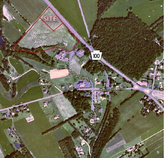
3176 Route 100, Orefield, PA 18069

NEARBY LISTINGS FOR SALE OR LEASE
Property Detail
3176 Route 100
Allentown-Bethlehem-Easton, PA-NJ
4 Lot Subdivision
544784495327-1
LOTS: 004, A
Publicstorage
Lehigh
X
Pennsylvania
42011C0210G
4 a
2025
3 AC
2025
Lehigh Valley
006002
Philadelphia
14,250 SF
DEMOGRAPHICS near 3176 Route 100
1 Mile
3 Mile
5 Mile
2024 Total Population
581
7,585
27,159
2029 Population
583
7,688
27,319
Pop Growth 2024-2029
+ 0.34%
+ 1.36%
+ 0.59%
Average Age
43
43
42
2024 Total Households
214
2,837
10,123
HH Growth 2024-2029
+ 0.47%
+ 1.41%
+ 0.55%
Median Household Inc
$129,911
$127,903
$114,268
Avg Household Size
2.70
2.70
2.70
2024 Avg HH Vehicles
3.00
3.00
2.00
Median Home Value
$405,263
$422,122
$366,157
Median Year Built
1982
1988
1987
Nearby Places
Map Layers
Map Styles
 Street
 Aerial
- Restaurants
- Banks
- Shops
- Fitness
- Groceries
PUBLIC TRANSPORTATION
AIRPORT
Lehigh Valley International
DRIVE
WALK
Distance
Lehigh Valley International
25 min
15.4 mi
Freight Ports
Port of Philadelphia
DRIVE
WALK
Distance
Port of Philadelphia
83 min
63.7 mi
SALE & LEASE HISTORY
LISTING DATE
SALE/LEASE

Sep 24, 2016
For Sale
Nearby Properties
Address
Land Use
TOTAL SIZE
Lot Size
Zoning
Address
Land Use
TOTAL SIZE
Lot Size
Zoning
4,948 SF
51.05 AC
R3
Address
Land Use
TOTAL SIZE
Lot Size
Zoning
336,000 SF
20.34 AC
GC
Address
Land Use
TOTAL SIZE
Lot Size
Zoning
266,850 SF
41.93 AC
LI
Address
Land Use
TOTAL SIZE
Lot Size
Zoning
299,399 SF
17.32 AC
LI
Address
Land Use
TOTAL SIZE
Lot Size
Zoning
81.45 AC
LIL
Address
Land Use
TOTAL SIZE
Lot Size
Zoning
153,188 SF
9.20 AC
LI
Address
Land Use
TOTAL SIZE
Lot Size
Zoning
187,342 SF
11.87 AC
LI
Address
Land Use
TOTAL SIZE
Lot Size
Zoning
80,527 SF
10.71 AC
NC
Address
Land Use
TOTAL SIZE
Lot Size
Zoning
174,300 SF
11 AC
LI
Address
Land Use
TOTAL SIZE
Lot Size
Zoning
134,000 SF
13.91 AC
LI
Address
Land Use
TOTAL SIZE
Lot Size
Zoning
107,888 SF
9.59 AC
LI
Address
Land Use
TOTAL SIZE
Lot Size
Zoning
40,900 SF
6.09 AC
NC
Address
Land Use
TOTAL SIZE
Lot Size
Zoning
60,065 SF
6.14 AC
LI
Address
Land Use
TOTAL SIZE
Lot Size
Zoning
41,897 SF
0.95 AC
R
Address
Land Use
TOTAL SIZE
Lot Size
Zoning
154,636 SF
11.70 AC
LI
Address
Land Use
TOTAL SIZE
Lot Size
Zoning
158,822 SF
11.83 AC
LI
Address
Land Use
TOTAL SIZE
Lot Size
Zoning
113,735 SF
8.72 AC
LI
Address
Land Use
TOTAL SIZE
Lot Size
Zoning
11,604 SF
2.04 AC
NC
Address
Land Use
TOTAL SIZE
Lot Size
Zoning
32 AC
LIL
Address
Land Use
TOTAL SIZE
Lot Size
Zoning
22,992 SF
2.64 AC
NC
Address
Land Use
TOTAL SIZE
Lot Size
Zoning
34,753 SF
1.59 AC
HC
Address
Land Use
TOTAL SIZE
Lot Size
Zoning
29,600 SF
3.13 AC
HC
Address
Land Use
TOTAL SIZE
Lot Size
Zoning
84,080 SF
8.91 AC
LI
Address
Land Use
TOTAL SIZE
Lot Size
Zoning
55,350 SF
7.15 AC
LI
Address
Land Use
TOTAL SIZE
Lot Size
Zoning
4,635 SF
386.70 AC
RC
Address
Land Use
TOTAL SIZE
Lot Size
Zoning
14,790 SF
2.42 AC
NC
Address
Land Use
TOTAL SIZE
Lot Size
Zoning
10,096 SF
2.72 AC
HC
Address
Land Use
TOTAL SIZE
Lot Size
Zoning
11.93 AC
NC
Address
Land Use
TOTAL SIZE
Lot Size
Zoning
9,675 SF
2.45 AC
NC
The World's #1 Commercial Real Estate Marketplace
Connect with us
© 2026 CoStar Group
The information above has been obtained from sources believed reliable. While we do not doubt its accuracy we have not verified it and make no guarantee, warranty or representation about it. It is your responsibility to independently confirm its accuracy and completeness. Any projections, opinions, assumptions, or estimates used are for example only and do not represent the current or future performance of the property. The value of this transaction to you depends on tax and other factors which should be evaluated by your tax, financial, and legal advisors. You and your advisors should conduct a careful, independent investigation of the property to determine to your satisfaction the suitability of the property for your needs.