Property Record
3179 S Harrah Rd, Harrah, OK 73045

Property Detail
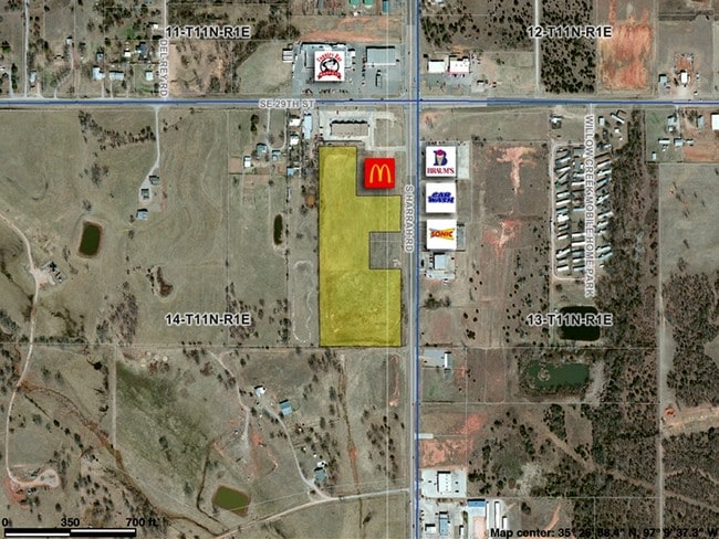
3179 S Harrah Rd
Oklahoma City, OK
POTTAWATOMIE TOWNSHIP PT NE4 SEC 14 11N 1E BEG 896.14FT S OF NE/C NE4 TH S420.03FT W499.94FT N1096.97FT E251.81FT S262FT E23.13FT S414.14FT E225FT TO BEG AKA TR B CONT 8.95ACRS MORE OR LESS SUBJ TO ESMTS OF RECORD
267141025
OKLAHOMA
Commercialnec
Oklahoma
B and X Area of moderate flood hazard, usually the area between the limits of the 100-year and 500-year floods.
2
2024
9.44 AC
2025
East Oklahoma County
109004
Oklahoma City
NEARBY LISTINGS FOR SALE OR LEASE
DEMOGRAPHICS near 3179 S Harrah Rd
1 mile
3 mile
5 mile
2025 Total Population
1,280
9,563
22,080
2030 Population
1,326
9,844
22,635
Pop Growth 2025-2030
+ 3.59%
+ 2.94%
+ 2.51%
Average Age
39
39
41
2025 Total Households
466
3,289
7,833
HH Growth 2025-2030
+ 3.65%
+ 3.25%
+ 2.74%
Median Household Inc
$95,440
$87,096
$85,526
Avg Household Size
2.70
2.60
2.60
2025 Avg HH Vehicles
2.00
2.00
2.00
Median Home Value
$286,301
$264,587
$262,902
Median Year Built
1998
1993
1990
Nearby Places
Map Layers
Map Styles
 Street
 Aerial
Layers
 Traffic
 Biking
Places
Listings with unknown addresses are not visible on the map
- Restaurants
- Banks
- Shops
- Fitness
- Groceries
PUBLIC TRANSPORTATION
AIRPORT
Will Rogers World
Drive
Walk
Distance
Will Rogers World
46 min
32.0 mi
Freight Ports
Tulsa Port Of Catoosa
Drive
Walk
Distance
Tulsa Port Of Catoosa
125 min
114.3 mi
SALE & LEASE HISTORY
LISTING DATE
SALE/LEASE

Jan 18, 2017
For Sale
Nearby Properties
Address
Land Use
TOTAL SIZE
Lot Size
Zoning
Address
Land Use
TOTAL SIZE
Lot Size
Zoning
28,054 SF
2.01 AC
Address
Land Use
TOTAL SIZE
Lot Size
Zoning
52,620 SF
2.48 AC
Address
Land Use
TOTAL SIZE
Lot Size
Zoning
54,140 SF
2 AC
Address
Land Use
TOTAL SIZE
Lot Size
Zoning
42,340 SF
8.07 AC
Address
Land Use
TOTAL SIZE
Lot Size
Zoning
15,180 SF
1.84 AC
Address
Land Use
TOTAL SIZE
Lot Size
Zoning
21,660 SF
2.70 AC
Address
Land Use
TOTAL SIZE
Lot Size
Zoning
77,668 SF
4.98 AC
Address
Land Use
TOTAL SIZE
Lot Size
Zoning
21,348 SF
1.34 AC
Address
Land Use
TOTAL SIZE
Lot Size
Zoning
28,800 SF
12.10 AC
Address
Land Use
TOTAL SIZE
Lot Size
Zoning
7,410 SF
1.10 AC
Address
Land Use
TOTAL SIZE
Lot Size
Zoning
15,624 SF
1.59 AC
Address
Land Use
TOTAL SIZE
Lot Size
Zoning
1,344 SF
0.14 AC
Address
Land Use
TOTAL SIZE
Lot Size
Zoning
10,140 SF
1.24 AC
Address
Land Use
TOTAL SIZE
Lot Size
Zoning
10,650 SF
9.98 AC
C-3
Address
Land Use
TOTAL SIZE
Lot Size
Zoning
Address
Land Use
TOTAL SIZE
Lot Size
Zoning
32,200 SF
13.45 AC
Address
Land Use
TOTAL SIZE
Lot Size
Zoning
12,000 SF
10.02 AC
Address
Land Use
TOTAL SIZE
Lot Size
Zoning
14,080 SF
31.57 AC
Address
Land Use
TOTAL SIZE
Lot Size
Zoning
7,560 SF
0.65 AC
Address
Land Use
TOTAL SIZE
Lot Size
Zoning
6,840 SF
1.11 AC
Address
Land Use
TOTAL SIZE
Lot Size
Zoning
3,492 SF
1.28 AC
Address
Land Use
TOTAL SIZE
Lot Size
Zoning
24,240 SF
3.36 AC
Address
Land Use
TOTAL SIZE
Lot Size
Zoning
9,220 SF
9.99 AC
Address
Land Use
TOTAL SIZE
Lot Size
Zoning
4,544 SF
1.12 AC
Address
Land Use
TOTAL SIZE
Lot Size
Zoning
6,161 SF
1.02 AC
Address
Land Use
TOTAL SIZE
Lot Size
Zoning
6,724 SF
1.03 AC
Address
Land Use
TOTAL SIZE
Lot Size
Zoning
12,040 SF
6.59 AC
Address
Land Use
TOTAL SIZE
Lot Size
Zoning
1,406 SF
0.88 AC
Address
Land Use
TOTAL SIZE
Lot Size
Zoning
11,264 SF
1.90 AC
The World's #1 Commercial Real Estate Marketplace
Connect with us
© 2026 CoStar Group
The information above has been obtained from sources believed reliable. While we do not doubt its accuracy we have not verified it and make no guarantee, warranty or representation about it. It is your responsibility to independently confirm its accuracy and completeness. Any projections, opinions, assumptions, or estimates used are for example only and do not represent the current or future performance of the property. The value of this transaction to you depends on tax and other factors which should be evaluated by your tax, financial, and legal advisors. You and your advisors should conduct a careful, independent investigation of the property to determine to your satisfaction the suitability of the property for your needs.