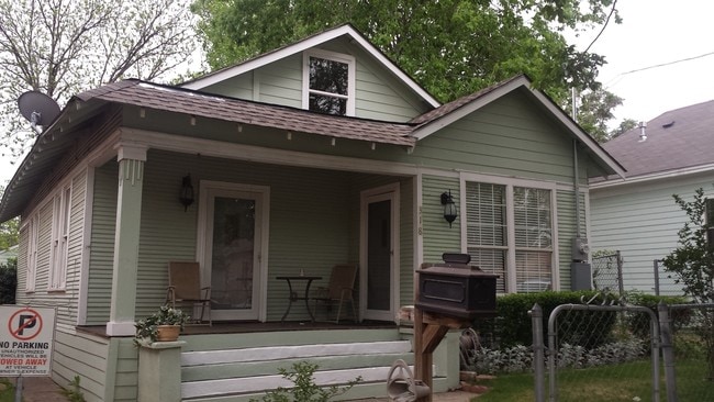
Property Record
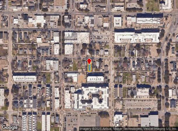
318 W 8Th St, Dallas, TX 75208
Current Lease Availabilities
NEARBY LISTINGS FOR SALE OR LEASE
Property Detail
318 W 8Th St
Dallas-Fort Worth-Arlington, TX
Dallas Land And Loan 2
00000255010000000
DALLAS LAND AND LOAN 2 BLK 27/3147 W35 FT LT 15 INT201400190329 DD07282014 CO-DC 3147 027 01500 2003147 027
Commercialnec
Dallas
X
Texas
48113C0480K
15
2024
0.09 AC
2025
SW Dallas County
004700
Dallas/Ft Worth
1,352 SF
DEMOGRAPHICS near 318 W 8Th St
1 Mile
3 Mile
5 Mile
2024 Total Population
20,445
142,132
374,769
2029 Population
20,760
142,734
376,669
Pop Growth 2024-2029
+ 1.54%
+ 0.42%
+ 0.51%
Average Age
36
36
36
2024 Total Households
7,727
51,876
154,304
HH Growth 2024-2029
+ 1.31%
+ 0.80%
+ 0.74%
Median Household Inc
$53,350
$55,867
$57,886
Avg Household Size
2.60
2.60
2.30
2024 Avg HH Vehicles
2.00
2.00
2.00
Median Home Value
$402,782
$242,723
$222,977
Median Year Built
1958
1961
1983
Nearby Places
- Restaurants
- Banks
- Shops
- Fitness
- Groceries
PUBLIC TRANSPORTATION
TRANSIT/SUBWAY
Bishop Arts Station (DALLAS STREETCAR - Dallas Area Rapid Transit (DART))
DRIVE
WALK
Distance
Bishop Arts Station (DALLAS STREETCAR - Dallas Area Rapid Transit (DART))
1 min
4 min
0.3 mi
6Th Streetcar Station (DALLAS STREETCAR - Dallas Area Rapid Transit (DART))
DRIVE
WALK
Distance
6Th Streetcar Station (DALLAS STREETCAR - Dallas Area Rapid Transit (DART))
1 min
11 min
0.6 mi
Beckley Streetcar Station (DALLAS STREETCAR - Dallas Area Rapid Transit (DART))
DRIVE
WALK
Distance
Beckley Streetcar Station (DALLAS STREETCAR - Dallas Area Rapid Transit (DART))
3 min
18 min
1.0 mi
COMMUTER RAIL
Victory Station (DART LIGHT RAIL - GREEN LINE - Dallas Area Rapid Transit (DART), DART LIGHT RAIL - ORANGE LINE - Dallas Area Rapid Transit (DART), TRINITY RAILWAY - Dallas Area Rapid Transit (DART))
DRIVE
WALK
Distance
Victory Station (DART LIGHT RAIL - GREEN LINE - Dallas Area Rapid Transit (DART), DART LIGHT RAIL - ORANGE LINE - Dallas Area Rapid Transit (DART), TRINITY RAILWAY - Dallas Area Rapid Transit (DART))
8 min
3.8 mi
Medical/Market Ctr Station (TRINITY RAILWAY - Dallas Area Rapid Transit (DART))
DRIVE
WALK
Distance
Medical/Market Ctr Station (TRINITY RAILWAY - Dallas Area Rapid Transit (DART))
12 min
6.4 mi
AIRPORT
Dallas Love Field
DRIVE
WALK
Distance
Dallas Love Field
18 min
8.8 mi
Dallas-Fort Worth International
DRIVE
WALK
Distance
Dallas-Fort Worth International
31 min
23.0 mi
Freight Ports
Port of Shreveport
DRIVE
WALK
Distance
Port of Shreveport
216 min
199.2 mi
Nearby Properties
Address
Land Use
TOTAL SIZE
Lot Size
Zoning
Address
Land Use
TOTAL SIZE
Lot Size
Zoning
1,298,826 SF
33.16 AC
Z163
Address
Land Use
TOTAL SIZE
Lot Size
Zoning
1,308,710 SF
8.42 AC
Z21
Address
Land Use
TOTAL SIZE
Lot Size
Zoning
1,480,246 SF
1.86 AC
Z21
Address
Land Use
TOTAL SIZE
Lot Size
Zoning
1,424,070 SF
1.36 AC
Z21
Address
Land Use
TOTAL SIZE
Lot Size
Zoning
893,159 SF
1.17 AC
Z21
Address
Land Use
TOTAL SIZE
Lot Size
Zoning
784,725 SF
2.33 AC
Z239
Address
Land Use
TOTAL SIZE
Lot Size
Zoning
180,000 SF
4.66 AC
Z116
Address
Land Use
TOTAL SIZE
Lot Size
Zoning
858,120 SF
2.21 AC
Z21
Address
Land Use
TOTAL SIZE
Lot Size
Zoning
2,326,857 SF
4.43 AC
Z21
Address
Land Use
TOTAL SIZE
Lot Size
Zoning
1,912,762 SF
1.54 AC
Z21
Address
Land Use
TOTAL SIZE
Lot Size
Zoning
1,979,594 SF
1.81 AC
Z21
Address
Land Use
TOTAL SIZE
Lot Size
Zoning
307,597 SF
15.21 AC
Z116
Address
Land Use
TOTAL SIZE
Lot Size
Zoning
1,173,721 SF
1.22 AC
Z21
Address
Land Use
TOTAL SIZE
Lot Size
Zoning
1,018,066 SF
1.20 AC
Z21
Address
Land Use
TOTAL SIZE
Lot Size
Zoning
741,673 SF
1.30 AC
Z21
Address
Land Use
TOTAL SIZE
Lot Size
Zoning
732,117 SF
5 AC
Z239
Address
Land Use
TOTAL SIZE
Lot Size
Zoning
600,907 SF
3.88 AC
Z239
Address
Land Use
TOTAL SIZE
Lot Size
Zoning
724,888 SF
2.59 AC
Address
Land Use
TOTAL SIZE
Lot Size
Zoning
26,896 SF
3.56 AC
Z239
Address
Land Use
TOTAL SIZE
Lot Size
Zoning
466,620 SF
1.52 AC
Z239
Address
Land Use
TOTAL SIZE
Lot Size
Zoning
316,447 SF
12.61 AC
Z164
Address
Land Use
TOTAL SIZE
Lot Size
Zoning
1,974,033 SF
1.67 AC
Z21
Address
Land Use
TOTAL SIZE
Lot Size
Zoning
510,277 SF
1.67 AC
Z239
Address
Land Use
TOTAL SIZE
Lot Size
Zoning
1,083,196 SF
6.13 AC
Z21
Address
Land Use
TOTAL SIZE
Lot Size
Zoning
179,370 SF
13.18 AC
Z248
Address
Land Use
TOTAL SIZE
Lot Size
Zoning
419,729 SF
3.62 AC
Z115
Address
Land Use
TOTAL SIZE
Lot Size
Zoning
452,834 SF
2.76 AC
Z21
Address
Land Use
TOTAL SIZE
Lot Size
Zoning
1,137,345 SF
0.83 AC
Z21
Address
Land Use
TOTAL SIZE
Lot Size
Zoning
506,299 SF
4.24 AC
Z116
Address
Land Use
TOTAL SIZE
Lot Size
Zoning
859,038 SF
0.92 AC
Z21
The World's #1 Commercial Real Estate Marketplace
Connect with us
© 2025 CoStar Group
The information above has been obtained from sources believed reliable. While we do not doubt its accuracy we have not verified it and make no guarantee, warranty or representation about it. It is your responsibility to independently confirm its accuracy and completeness. Any projections, opinions, assumptions, or estimates used are for example only and do not represent the current or future performance of the property. The value of this transaction to you depends on tax and other factors which should be evaluated by your tax, financial, and legal advisors. You and your advisors should conduct a careful, independent investigation of the property to determine to your satisfaction the suitability of the property for your needs.