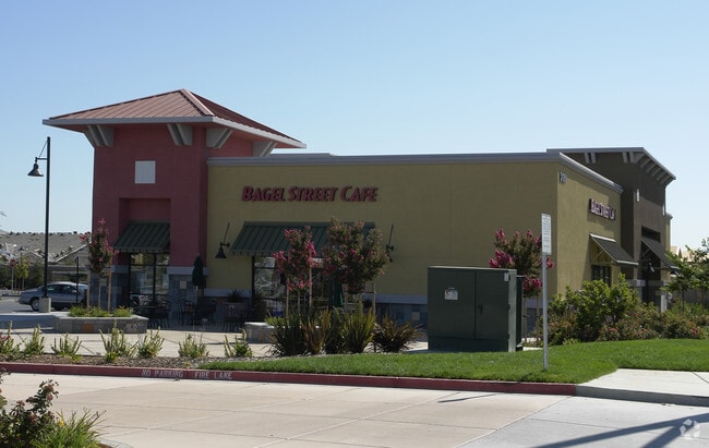
Property Record
3181 Balfour Rd, Brentwood, CA 94513

Property Detail
3181 Balfour Rd
012-020-021-7
T197PM26 PCL 7
Regionalshoppingcenterormallwithanchorstore
Contra Costa
B and X Area of moderate flood hazard, usually the area between the limits of the 100-year and 500-year floods.
California
2025
0.86 AC
2025
Antioch/Pittsburg
303204
East Bay/Oakland
7,415 SF
Oakland-Fremont-Berkeley, CA
NEARBY LISTINGS FOR SALE OR LEASE
DEMOGRAPHICS near 3181 Balfour Rd
1 mile
3 mile
5 mile
2025 Total Population
14,105
71,460
140,890
2030 Population
14,229
72,732
143,226
Pop Growth 2025-2030
+ 0.88%
+ 1.78%
+ 1.66%
Average Age
46
40
40
2025 Total Households
5,385
23,146
43,335
HH Growth 2025-2030
+ 1.10%
+ 1.87%
+ 1.73%
Median Household Inc
$139,465
$141,660
$135,638
Avg Household Size
2.60
3.10
3.20
2025 Avg HH Vehicles
2.00
2.00
2.00
Median Home Value
$767,340
$789,649
$755,717
Median Year Built
1998
2003
2000
Nearby Places
Map Layers
Map Styles
 Street
 Aerial
Layers
 Traffic
 Biking
Places
Listings with unknown addresses are not visible on the map
- Restaurants
- Banks
- Shops
- Fitness
- Groceries
PUBLIC TRANSPORTATION
AIRPORT
Stockton Metro
Drive
Walk
Distance
Stockton Metro
49 min
32.2 mi
Freight Ports
Port of Stockton
Drive
Walk
Distance
Port of Stockton
45 min
29.7 mi
SALE & LEASE HISTORY
LISTING DATE
SALE/LEASE

Jun 03, 2026
For Lease
Dec 09, 2025
For Lease
Nearby Properties
Address
Land Use
TOTAL SIZE
Lot Size
Zoning
Address
Land Use
TOTAL SIZE
Lot Size
Zoning
39,038 SF
14.43 AC
Address
Land Use
TOTAL SIZE
Lot Size
Zoning
14,968 SF
7.07 AC
Address
Land Use
TOTAL SIZE
Lot Size
Zoning
129,450 SF
6.69 AC
Address
Land Use
TOTAL SIZE
Lot Size
Zoning
67,691 SF
28.26 AC
Address
Land Use
TOTAL SIZE
Lot Size
Zoning
67,133 SF
8.65 AC
Address
Land Use
TOTAL SIZE
Lot Size
Zoning
117,486 SF
7.26 AC
Address
Land Use
TOTAL SIZE
Lot Size
Zoning
220,840 SF
13.67 AC
Address
Land Use
TOTAL SIZE
Lot Size
Zoning
15,000 SF
17.17 AC
Address
Land Use
TOTAL SIZE
Lot Size
Zoning
59,066 SF
3.89 AC
Address
Land Use
TOTAL SIZE
Lot Size
Zoning
113,902 SF
9.71 AC
Address
Land Use
TOTAL SIZE
Lot Size
Zoning
157,933 SF
19.04 AC
Address
Land Use
TOTAL SIZE
Lot Size
Zoning
141,367 SF
4.72 AC
Address
Land Use
TOTAL SIZE
Lot Size
Zoning
107,230 SF
1.54 AC
Address
Land Use
TOTAL SIZE
Lot Size
Zoning
12,410 SF
5.38 AC
Address
Land Use
TOTAL SIZE
Lot Size
Zoning
24,156 SF
14.47 AC
Address
Land Use
TOTAL SIZE
Lot Size
Zoning
112,715 SF
4.48 AC
Address
Land Use
TOTAL SIZE
Lot Size
Zoning
51,980 SF
3.70 AC
Address
Land Use
TOTAL SIZE
Lot Size
Zoning
62,441 SF
5.65 AC
Address
Land Use
TOTAL SIZE
Lot Size
Zoning
13,468 SF
8.77 AC
Address
Land Use
TOTAL SIZE
Lot Size
Zoning
65,898 SF
8.72 AC
Address
Land Use
TOTAL SIZE
Lot Size
Zoning
147,868 SF
7.83 AC
Address
Land Use
TOTAL SIZE
Lot Size
Zoning
23,822 SF
7.16 AC
Address
Land Use
TOTAL SIZE
Lot Size
Zoning
10.44 AC
Address
Land Use
TOTAL SIZE
Lot Size
Zoning
40,995 SF
10.59 AC
Address
Land Use
TOTAL SIZE
Lot Size
Zoning
159.39 AC
Address
Land Use
TOTAL SIZE
Lot Size
Zoning
96,956 SF
10.49 AC
Address
Land Use
TOTAL SIZE
Lot Size
Zoning
32,198 SF
1.08 AC
Address
Land Use
TOTAL SIZE
Lot Size
Zoning
141,267 SF
12.75 AC
Address
Land Use
TOTAL SIZE
Lot Size
Zoning
150,783 SF
5.79 AC
Address
Land Use
TOTAL SIZE
Lot Size
Zoning
47,642 SF
3.10 AC
The World's #1 Commercial Real Estate Marketplace
Connect with us
© 2026 CoStar Group
The information above has been obtained from sources believed reliable. While we do not doubt its accuracy we have not verified it and make no guarantee, warranty or representation about it. It is your responsibility to independently confirm its accuracy and completeness. Any projections, opinions, assumptions, or estimates used are for example only and do not represent the current or future performance of the property. The value of this transaction to you depends on tax and other factors which should be evaluated by your tax, financial, and legal advisors. You and your advisors should conduct a careful, independent investigation of the property to determine to your satisfaction the suitability of the property for your needs.