Property Record
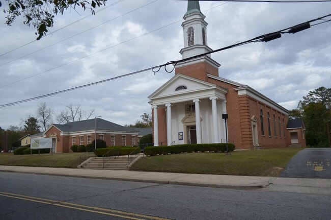
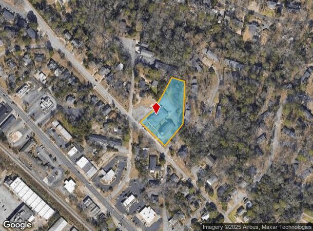
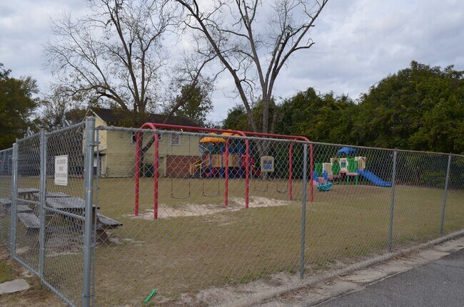
3187 Ridge Ave, Macon, GA 31204
NEARBY LISTINGS FOR SALE OR LEASE
Property Detail
3187 Ridge Ave
Religious
Bibb
X
Georgia
13021C0131G
1.50 AC
2025
Suburban Macon
2025
Atlanta
011800
Macon-Bibb County, GA
5,550 SF
O063-0196
DEMOGRAPHICS near 3187 Ridge Ave
1 Mile
3 Mile
5 Mile
2024 Total Population
7,035
50,703
101,276
2029 Population
6,962
50,337
100,921
Pop Growth 2024-2029
(1.04%)
(0.72%)
(0.35%)
Average Age
39
38
38
2024 Total Households
3,176
21,252
41,508
HH Growth 2024-2029
(1.04%)
(0.56%)
(0.33%)
Median Household Inc
$50,262
$42,837
$40,833
Avg Household Size
2.20
2.20
2.30
2024 Avg HH Vehicles
1.00
1.00
1.00
Median Home Value
$162,694
$141,790
$137,357
Median Year Built
1961
1964
1970
Nearby Places
Map Layers
Map Styles
 Street
 Aerial
- Restaurants
- Banks
- Shops
- Fitness
- Groceries
SALE & LEASE HISTORY
LISTING DATE
SALE/LEASE

Jan 23, 2023
For Sale
Nearby Properties
Address
Land Use
TOTAL SIZE
Lot Size
Zoning
Address
Land Use
TOTAL SIZE
Lot Size
Zoning
55,368 SF
9.53 AC
CBD-2
Address
Land Use
TOTAL SIZE
Lot Size
Zoning
213,690 SF
2.25 AC
CBD-1
Address
Land Use
TOTAL SIZE
Lot Size
Zoning
196,702 SF
37.72 AC
PDE
Address
Land Use
TOTAL SIZE
Lot Size
Zoning
63,394 SF
5.30 AC
M-1/R-3
Address
Land Use
TOTAL SIZE
Lot Size
Zoning
100,599 SF
0.43 AC
CBD-1
Address
Land Use
TOTAL SIZE
Lot Size
Zoning
158,480 SF
0.90 AC
CBD-2
Address
Land Use
TOTAL SIZE
Lot Size
Zoning
127,536 SF
3.56 AC
PDE
Address
Land Use
TOTAL SIZE
Lot Size
Zoning
71,021 SF
8.94 AC
PDC
Address
Land Use
TOTAL SIZE
Lot Size
Zoning
231,774 SF
21.27 AC
R-1AAA
Address
Land Use
TOTAL SIZE
Lot Size
Zoning
199,096 SF
22.03 AC
R-2
Address
Land Use
TOTAL SIZE
Lot Size
Zoning
92,712 SF
2.93 AC
CBD-2
Address
Land Use
TOTAL SIZE
Lot Size
Zoning
1,039 SF
14.79 AC
PDR
Address
Land Use
TOTAL SIZE
Lot Size
Zoning
1,452 SF
12.16 AC
R-3
Address
Land Use
TOTAL SIZE
Lot Size
Zoning
6,720 SF
16.69 AC
PDR
Address
Land Use
TOTAL SIZE
Lot Size
Zoning
98,928 SF
12.32 AC
R-3
Address
Land Use
TOTAL SIZE
Lot Size
Zoning
85,556 SF
10.50 AC
R-1A
Address
Land Use
TOTAL SIZE
Lot Size
Zoning
110,153 SF
22 AC
R-2
Address
Land Use
TOTAL SIZE
Lot Size
Zoning
141,816 SF
16.44 AC
C-2
Address
Land Use
TOTAL SIZE
Lot Size
Zoning
2,366 SF
14.46 AC
PDE
Address
Land Use
TOTAL SIZE
Lot Size
Zoning
46,288 SF
1.80 AC
PDE
Address
Land Use
TOTAL SIZE
Lot Size
Zoning
33,248 SF
10.18 AC
R-3
Address
Land Use
TOTAL SIZE
Lot Size
Zoning
69,260 SF
0.41 AC
CBD-1
Address
Land Use
TOTAL SIZE
Lot Size
Zoning
60,432 SF
0.98 AC
CBD-1
Address
Land Use
TOTAL SIZE
Lot Size
Zoning
40,560 SF
19.20 AC
R-2
Address
Land Use
TOTAL SIZE
Lot Size
Zoning
119,564 SF
3.89 AC
R-3
Address
Land Use
TOTAL SIZE
Lot Size
Zoning
96,512 SF
11.30 AC
PDE
Address
Land Use
TOTAL SIZE
Lot Size
Zoning
58,730 SF
3.42 AC
R-3
Address
Land Use
TOTAL SIZE
Lot Size
Zoning
46,174 SF
9.67 AC
R-2
Address
Land Use
TOTAL SIZE
Lot Size
Zoning
72,073 SF
0.96 AC
CBD-1
Address
Land Use
TOTAL SIZE
Lot Size
Zoning
133,862 SF
25.44 AC
C-2
The World's #1 Commercial Real Estate Marketplace
Connect with us
© 2025 CoStar Group
The information above has been obtained from sources believed reliable. While we do not doubt its accuracy we have not verified it and make no guarantee, warranty or representation about it. It is your responsibility to independently confirm its accuracy and completeness. Any projections, opinions, assumptions, or estimates used are for example only and do not represent the current or future performance of the property. The value of this transaction to you depends on tax and other factors which should be evaluated by your tax, financial, and legal advisors. You and your advisors should conduct a careful, independent investigation of the property to determine to your satisfaction the suitability of the property for your needs.