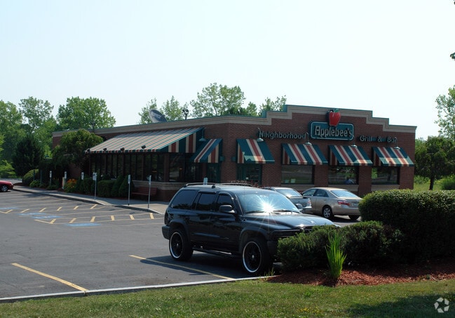
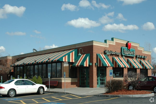
Property Record
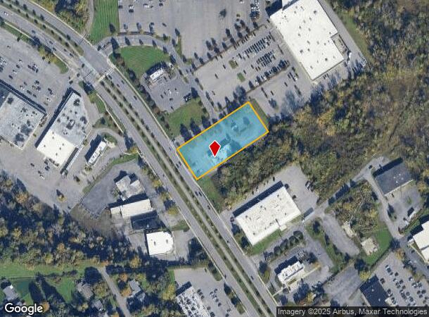
3189 Erie Blvd E, Syracuse, NY 13214
NEARBY LISTINGS FOR SALE OR LEASE
Property Detail
3189 Erie Blvd E
312689-044-000-0007-013-001-0000
FL 51
Restaurantbuilding
Onondaga
X
New York
36067C0237F
13.001
2025
1.20 AC
2024
SE Outer Onondaga County
014600
Syracuse
5,008 SF
Syracuse, NY
DEMOGRAPHICS near 3189 Erie Blvd E
1 Mile
3 Mile
5 Mile
2024 Total Population
7,220
68,946
178,481
2029 Population
7,052
67,154
174,886
Pop Growth 2024-2029
(2.33%)
(2.60%)
(2.01%)
Average Age
36
39
38
2024 Total Households
2,641
28,536
72,253
HH Growth 2024-2029
(1.97%)
(2.80%)
(2.05%)
Median Household Inc
$60,750
$61,463
$49,126
Avg Household Size
2.20
2.20
2.20
2024 Avg HH Vehicles
1.00
1.00
1.00
Median Home Value
$160,952
$166,848
$156,246
Median Year Built
1957
1953
1954
Nearby Places
- Restaurants
- Banks
- Shops
- Fitness
- Groceries
PUBLIC TRANSPORTATION
COMMUTER RAIL
DRIVE
WALK
Distance
12 min
6.5 mi
DRIVE
WALK
Distance
12 min
6.6 mi
AIRPORT
Syracuse Hancock International
DRIVE
WALK
Distance
Syracuse Hancock International
18 min
11.2 mi
Nearby Properties
Address
Land Use
TOTAL SIZE
Lot Size
Zoning
Address
Land Use
TOTAL SIZE
Lot Size
Zoning
38,693 SF
102.34 AC
05 - COMME
Address
Land Use
TOTAL SIZE
Lot Size
Zoning
2,709 SF
39.74 AC
06 - INDUS
Address
Land Use
TOTAL SIZE
Lot Size
Zoning
175,424 SF
7.85 AC
RA
Address
Land Use
TOTAL SIZE
Lot Size
Zoning
105,004 SF
2.81 AC
25
Address
Land Use
TOTAL SIZE
Lot Size
Zoning
569,463 SF
94.77 AC
06 - INDUS
Address
Land Use
TOTAL SIZE
Lot Size
Zoning
12,836 SF
148.95 AC
06 - INDUS
Address
Land Use
TOTAL SIZE
Lot Size
Zoning
25,646 SF
88.85 AC
02 - SINGL
Address
Land Use
TOTAL SIZE
Lot Size
Zoning
876,645 SF
51.07 AC
05 - COMME
Address
Land Use
TOTAL SIZE
Lot Size
Zoning
217,709 SF
34.53 AC
01 - NOT Z
Address
Land Use
TOTAL SIZE
Lot Size
Zoning
174,750 SF
10.40 AC
06 - INDUS
Address
Land Use
TOTAL SIZE
Lot Size
Zoning
104,400 SF
12.84 AC
06 - INDUS
Address
Land Use
TOTAL SIZE
Lot Size
Zoning
17,388 SF
26.51 AC
07 - MIXED
Address
Land Use
TOTAL SIZE
Lot Size
Zoning
102,905 SF
32 AC
01 - NOT Z
Address
Land Use
TOTAL SIZE
Lot Size
Zoning
115,000 SF
07 - MIXED
Address
Land Use
TOTAL SIZE
Lot Size
Zoning
157,497 SF
14.56 AC
06 - INDUS
Address
Land Use
TOTAL SIZE
Lot Size
Zoning
240,800 SF
23.01 AC
05 - COMME
Address
Land Use
TOTAL SIZE
Lot Size
Zoning
86,136 SF
0.80 AC
025
Address
Land Use
TOTAL SIZE
Lot Size
Zoning
163,518 SF
19.24 AC
07 - MIXED
Address
Land Use
TOTAL SIZE
Lot Size
Zoning
47,122 SF
42.77 AC
06 - INDUS
Address
Land Use
TOTAL SIZE
Lot Size
Zoning
141,151 SF
20.23 AC
06 - INDUS
Address
Land Use
TOTAL SIZE
Lot Size
Zoning
102,883 SF
23.29 AC
02 - SINGL
Address
Land Use
TOTAL SIZE
Lot Size
Zoning
95.24 AC
05 - COMME
Address
Land Use
TOTAL SIZE
Lot Size
Zoning
160,767 SF
20.52 AC
05 - COMME
Address
Land Use
TOTAL SIZE
Lot Size
Zoning
110,976 SF
42.31 AC
06 - INDUS
Address
Land Use
TOTAL SIZE
Lot Size
Zoning
165,954 SF
10.66 AC
06 - INDUS
Address
Land Use
TOTAL SIZE
Lot Size
Zoning
196,620 SF
11.73 AC
01 - NOT Z
Address
Land Use
TOTAL SIZE
Lot Size
Zoning
38,595 SF
0.67 AC
06 - INDUS
Address
Land Use
TOTAL SIZE
Lot Size
Zoning
21,882 SF
13.56 AC
05 - COMME
Address
Land Use
TOTAL SIZE
Lot Size
Zoning
110,811 SF
11.46 AC
06 - INDUS
Address
Land Use
TOTAL SIZE
Lot Size
Zoning
78,950 SF
14.52 AC
NS
The World's #1 Commercial Real Estate Marketplace
Connect with us
© 2025 CoStar Group
The information above has been obtained from sources believed reliable. While we do not doubt its accuracy we have not verified it and make no guarantee, warranty or representation about it. It is your responsibility to independently confirm its accuracy and completeness. Any projections, opinions, assumptions, or estimates used are for example only and do not represent the current or future performance of the property. The value of this transaction to you depends on tax and other factors which should be evaluated by your tax, financial, and legal advisors. You and your advisors should conduct a careful, independent investigation of the property to determine to your satisfaction the suitability of the property for your needs.