Property Record
319 Main St, Waterville, ME 04901
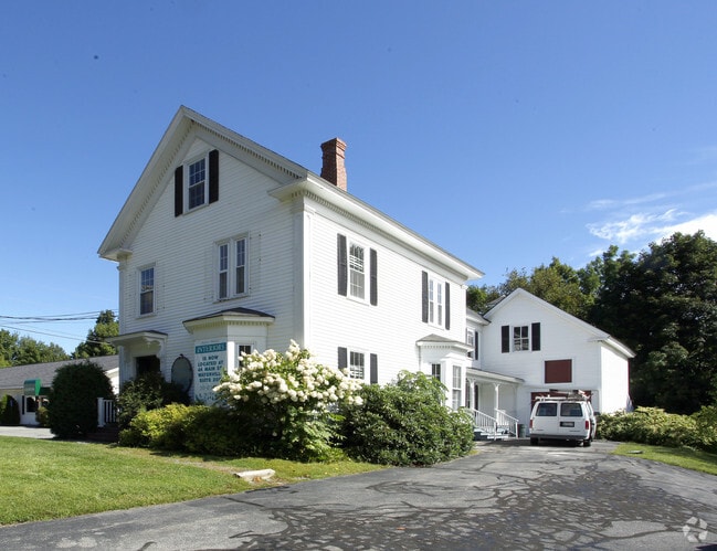


Property Detail
319 Main St
WAVL-000057-000100-000001
Kennebec
Officecondo
Maine
B and X Area of moderate flood hazard, usually the area between the limits of the 100-year and 500-year floods.
1
2025
0.67 AC
2025
Maine South & Augusta
024101
Other Market Areas
3,006 SF
Augusta-Waterville, ME
NEARBY LISTINGS FOR SALE OR LEASE
DEMOGRAPHICS near 319 Main St
1 mile
3 mile
5 mile
2025 Total Population
6,665
23,409
33,443
2030 Population
6,681
23,513
33,761
Pop Growth 2025-2030
+ 0.24%
+ 0.44%
+ 0.95%
Average Age
39
41
42
2025 Total Households
2,765
10,012
14,113
HH Growth 2025-2030
(0.07%)
+ 0.30%
+ 0.80%
Median Household Inc
$48,674
$54,745
$57,847
Avg Household Size
2.00
2.10
2.10
2025 Avg HH Vehicles
1.00
1.00
2.00
Median Home Value
$177,790
$203,825
$208,913
Median Year Built
1952
1957
1968
Nearby Places
Map Layers
Map Styles
 Street
 Aerial
Layers
 Traffic
 Biking
Places
Listings with unknown addresses are not visible on the map
- Restaurants
- Banks
- Shops
- Fitness
- Groceries
SALE & LEASE HISTORY
LISTING DATE
SALE/LEASE

Jun 06, 2017
For Lease
Nearby Properties
Address
Land Use
TOTAL SIZE
Lot Size
Zoning
Address
Land Use
TOTAL SIZE
Lot Size
Zoning
Address
Land Use
TOTAL SIZE
Lot Size
Zoning
Address
Land Use
TOTAL SIZE
Lot Size
Zoning
Address
Land Use
TOTAL SIZE
Lot Size
Zoning
167,845 SF
33 AC
Address
Land Use
TOTAL SIZE
Lot Size
Zoning
202,963 SF
25.73 AC
Address
Land Use
TOTAL SIZE
Lot Size
Zoning
21.41 AC
Address
Land Use
TOTAL SIZE
Lot Size
Zoning
35 AC
ID
Address
Land Use
TOTAL SIZE
Lot Size
Zoning
138,603 SF
42 AC
MU
Address
Land Use
TOTAL SIZE
Lot Size
Zoning
0.46 AC
Address
Land Use
TOTAL SIZE
Lot Size
Zoning
1.02 AC
Address
Land Use
TOTAL SIZE
Lot Size
Zoning
174,750 SF
17.60 AC
Address
Land Use
TOTAL SIZE
Lot Size
Zoning
38,304 SF
0.94 AC
Address
Land Use
TOTAL SIZE
Lot Size
Zoning
99,914 SF
8.36 AC
MU
Address
Land Use
TOTAL SIZE
Lot Size
Zoning
77,309 SF
27.04 AC
Address
Land Use
TOTAL SIZE
Lot Size
Zoning
26.20 AC
HIGHWA
Address
Land Use
TOTAL SIZE
Lot Size
Zoning
20.88 AC
Address
Land Use
TOTAL SIZE
Lot Size
Zoning
71,838 SF
Address
Land Use
TOTAL SIZE
Lot Size
Zoning
88,542 SF
24.50 AC
MU
Address
Land Use
TOTAL SIZE
Lot Size
Zoning
100 SF
16.24 AC
Address
Land Use
TOTAL SIZE
Lot Size
Zoning
31,845 SF
0.35 AC
Address
Land Use
TOTAL SIZE
Lot Size
Zoning
10.25 AC
Address
Land Use
TOTAL SIZE
Lot Size
Zoning
Address
Land Use
TOTAL SIZE
Lot Size
Zoning
90,966 SF
26.70 AC
Address
Land Use
TOTAL SIZE
Lot Size
Zoning
104,839 SF
0.77 AC
Address
Land Use
TOTAL SIZE
Lot Size
Zoning
238,560 SF
5.14 AC
Address
Land Use
TOTAL SIZE
Lot Size
Zoning
844,952 SF
40 AC
ID
Address
Land Use
TOTAL SIZE
Lot Size
Zoning
114,814 SF
10.37 AC
Address
Land Use
TOTAL SIZE
Lot Size
Zoning
49,536 SF
23.90 AC
COMMER
Address
Land Use
TOTAL SIZE
Lot Size
Zoning
Address
Land Use
TOTAL SIZE
Lot Size
Zoning
13,544 SF
6.67 AC
MU
The World's #1 Commercial Real Estate Marketplace
Connect with us
© 2026 CoStar Group
The information above has been obtained from sources believed reliable. While we do not doubt its accuracy we have not verified it and make no guarantee, warranty or representation about it. It is your responsibility to independently confirm its accuracy and completeness. Any projections, opinions, assumptions, or estimates used are for example only and do not represent the current or future performance of the property. The value of this transaction to you depends on tax and other factors which should be evaluated by your tax, financial, and legal advisors. You and your advisors should conduct a careful, independent investigation of the property to determine to your satisfaction the suitability of the property for your needs.