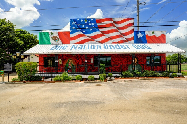
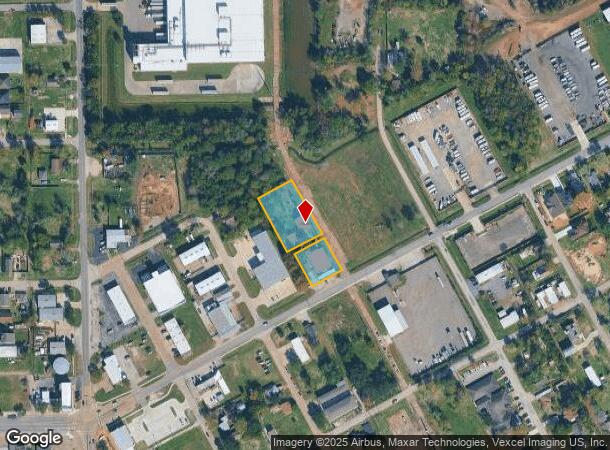
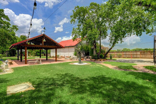
Property Record
319 E Main St, La Porte, TX 77571
NEARBY LISTINGS FOR SALE OR LEASE
Property Detail
319 E Main St
Houston-Pasadena-The Woodlands, TX
La Porte
0232570830014
LTS 14 THRU 25 BLK 183 LA PORTE
Storebuilding
Harris
X
Texas
48201C0945M
14-25
2024
0.91 AC
2025
NASA/Clear Lake
343602
Houston
10,520 SF
DEMOGRAPHICS near 319 E Main St
1 Mile
3 Mile
5 Mile
2024 Total Population
5,791
16,938
45,681
2029 Population
5,959
17,425
46,767
Pop Growth 2024-2029
+ 2.90%
+ 2.88%
+ 2.38%
Average Age
39
39
39
2024 Total Households
2,198
6,261
16,232
HH Growth 2024-2029
+ 2.46%
+ 2.65%
+ 2.27%
Median Household Inc
$63,008
$74,398
$73,876
Avg Household Size
2.60
2.70
2.80
2024 Avg HH Vehicles
2.00
2.00
2.00
Median Home Value
$161,861
$207,708
$191,079
Median Year Built
1977
1985
1981
Nearby Places
Map Layers
Map Styles
 Street
 Aerial
- Restaurants
- Banks
- Shops
- Fitness
- Groceries
PUBLIC TRANSPORTATION
AIRPORT
William P Hobby
DRIVE
WALK
Distance
William P Hobby
35 min
18.5 mi
George Bush Intcntl/Houston
DRIVE
WALK
Distance
George Bush Intcntl/Houston
47 min
37.0 mi
Freight Ports
Port of Houston
DRIVE
WALK
Distance
Port of Houston
29 min
19.9 mi
SALE & LEASE HISTORY
LISTING DATE
SALE/LEASE

Sep 01, 2018
For Sale
Aug 25, 2023
For Sale
Nearby Properties
Address
Land Use
TOTAL SIZE
Lot Size
Zoning
Address
Land Use
TOTAL SIZE
Lot Size
Zoning
45.75 AC
Address
Land Use
TOTAL SIZE
Lot Size
Zoning
45.78 AC
Address
Land Use
TOTAL SIZE
Lot Size
Zoning
38.27 AC
Address
Land Use
TOTAL SIZE
Lot Size
Zoning
Address
Land Use
TOTAL SIZE
Lot Size
Zoning
61.40 AC
Address
Land Use
TOTAL SIZE
Lot Size
Zoning
748,500 SF
42.13 AC
Address
Land Use
TOTAL SIZE
Lot Size
Zoning
610,402 SF
34.69 AC
Address
Land Use
TOTAL SIZE
Lot Size
Zoning
602,060 SF
34.15 AC
Address
Land Use
TOTAL SIZE
Lot Size
Zoning
348,294 SF
18.02 AC
Address
Land Use
TOTAL SIZE
Lot Size
Zoning
102.68 AC
Address
Land Use
TOTAL SIZE
Lot Size
Zoning
287,729 SF
20 AC
Address
Land Use
TOTAL SIZE
Lot Size
Zoning
416,005 SF
21.47 AC
Address
Land Use
TOTAL SIZE
Lot Size
Zoning
415,662 SF
21.49 AC
Address
Land Use
TOTAL SIZE
Lot Size
Zoning
45.18 AC
Address
Land Use
TOTAL SIZE
Lot Size
Zoning
306,482 SF
22.96 AC
Address
Land Use
TOTAL SIZE
Lot Size
Zoning
297,698 SF
19.14 AC
Address
Land Use
TOTAL SIZE
Lot Size
Zoning
289,475 SF
14.83 AC
Address
Land Use
TOTAL SIZE
Lot Size
Zoning
40.46 AC
Address
Land Use
TOTAL SIZE
Lot Size
Zoning
260,411 SF
12.11 AC
Address
Land Use
TOTAL SIZE
Lot Size
Zoning
297,671 SF
20.07 AC
Address
Land Use
TOTAL SIZE
Lot Size
Zoning
253,487 SF
14.40 AC
Address
Land Use
TOTAL SIZE
Lot Size
Zoning
251,516 SF
12.34 AC
Address
Land Use
TOTAL SIZE
Lot Size
Zoning
250,300 SF
11.38 AC
Address
Land Use
TOTAL SIZE
Lot Size
Zoning
258,486 SF
34.76 AC
Address
Land Use
TOTAL SIZE
Lot Size
Zoning
194,000 SF
12.32 AC
Address
Land Use
TOTAL SIZE
Lot Size
Zoning
425.97 AC
Address
Land Use
TOTAL SIZE
Lot Size
Zoning
267,540 SF
15.78 AC
Address
Land Use
TOTAL SIZE
Lot Size
Zoning
Address
Land Use
TOTAL SIZE
Lot Size
Zoning
6,000 SF
278.69 AC
Address
Land Use
TOTAL SIZE
Lot Size
Zoning
90,000 SF
12.45 AC
The World's #1 Commercial Real Estate Marketplace
Connect with us
© 2026 CoStar Group
The information above has been obtained from sources believed reliable. While we do not doubt its accuracy we have not verified it and make no guarantee, warranty or representation about it. It is your responsibility to independently confirm its accuracy and completeness. Any projections, opinions, assumptions, or estimates used are for example only and do not represent the current or future performance of the property. The value of this transaction to you depends on tax and other factors which should be evaluated by your tax, financial, and legal advisors. You and your advisors should conduct a careful, independent investigation of the property to determine to your satisfaction the suitability of the property for your needs.