Property Record
319 Farnsworth Ave, Bordentown, NJ 08505

NEARBY LISTINGS FOR SALE OR LEASE
-
-
View all Bordentown listings for sale on LoopNet.com
Property Detail
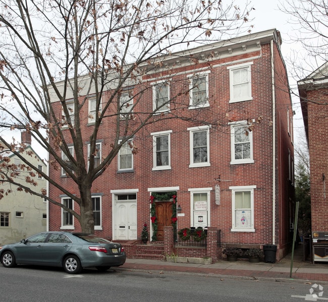
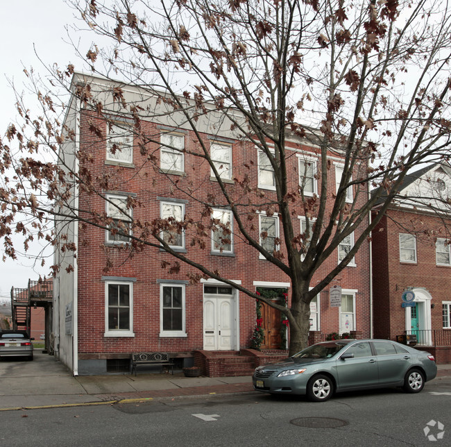
319 Farnsworth Ave
03-00702-0000-00034
Burlington
Retailwithmorethanonenonretailuse
New Jersey
X
34
34005C0039F
0.05 AC
2024
Burlington County
2025
Philadelphia
701700
Philadelphia-Camden-Wilmington, PA-NJ-DE-MD
2,640 SF
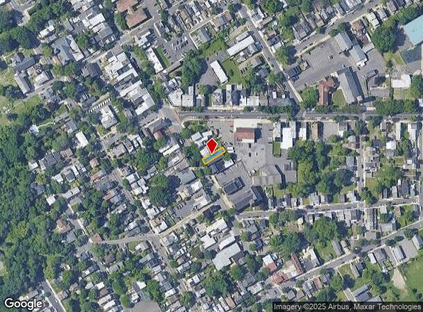
DEMOGRAPHICS near 319 Farnsworth Ave
1 Mile
3 Mile
5 Mile
2024 Total Population
5,930
28,138
111,421
2029 Population
6,060
28,547
110,905
Pop Growth 2024-2029
+ 2.19%
+ 1.45%
(0.46%)
Average Age
43
39
39
2024 Total Households
2,664
9,826
39,207
HH Growth 2024-2029
+ 2.44%
+ 1.64%
(0.45%)
Median Household Inc
$90,484
$100,330
$81,034
Avg Household Size
2.20
2.50
2.70
2024 Avg HH Vehicles
2.00
2.00
2.00
Median Home Value
$270,262
$303,677
$262,142
Median Year Built
1952
1968
1959
Nearby Places
Map Layers
Map Styles
 Street
 Aerial
- Restaurants
- Banks
- Shops
- Fitness
- Groceries
PUBLIC TRANSPORTATION
TRANSIT/SUBWAY
Bordentown (River LINE - River LINE (River LINE))
DRIVE
WALK
Distance
Bordentown (River LINE - River LINE (River LINE))
1 min
7 min
0.4 mi
COMMUTER RAIL
DRIVE
WALK
Distance
14 min
7.0 mi
Trenton Transit Center (NJT) (Northeast Corridor Line - NJ Transit Commuter Rail (NJ Transit), River LINE - River LINE (River LINE))
DRIVE
WALK
Distance
Trenton Transit Center (NJT) (Northeast Corridor Line - NJ Transit Commuter Rail (NJ Transit), River LINE - River LINE (River LINE))
16 min
7.8 mi
AIRPORT
Trenton Mercer
DRIVE
WALK
Distance
Trenton Mercer
25 min
14.2 mi
Philadelphia International
DRIVE
WALK
Distance
Philadelphia International
59 min
42.8 mi
Freight Ports
Port of Philadelphia
DRIVE
WALK
Distance
Port of Philadelphia
42 min
28.5 mi
Nearby Properties
Address
Land Use
TOTAL SIZE
Lot Size
Zoning
Address
Land Use
TOTAL SIZE
Lot Size
Zoning
561.91 AC
AG
Address
Land Use
TOTAL SIZE
Lot Size
Zoning
89.60 AC
REO
Address
Land Use
TOTAL SIZE
Lot Size
Zoning
0.13 AC
Address
Land Use
TOTAL SIZE
Lot Size
Zoning
51.10 AC
Address
Land Use
TOTAL SIZE
Lot Size
Zoning
44.33 AC
Address
Land Use
TOTAL SIZE
Lot Size
Zoning
Address
Land Use
TOTAL SIZE
Lot Size
Zoning
47.99 AC
Address
Land Use
TOTAL SIZE
Lot Size
Zoning
Address
Land Use
TOTAL SIZE
Lot Size
Zoning
32.71 AC
HC
Address
Land Use
TOTAL SIZE
Lot Size
Zoning
32.75 AC
Address
Land Use
TOTAL SIZE
Lot Size
Zoning
263,232 SF
39.16 AC
CI
Address
Land Use
TOTAL SIZE
Lot Size
Zoning
23.53 AC
AT
Address
Land Use
TOTAL SIZE
Lot Size
Zoning
154 AC
C-2
Address
Land Use
TOTAL SIZE
Lot Size
Zoning
1,128 SF
32.88 AC
REO
Address
Land Use
TOTAL SIZE
Lot Size
Zoning
2,350 SF
8.80 AC
PVD2
Address
Land Use
TOTAL SIZE
Lot Size
Zoning
Address
Land Use
TOTAL SIZE
Lot Size
Zoning
2,131 SF
19.76 AC
REO
Address
Land Use
TOTAL SIZE
Lot Size
Zoning
45.80 AC
Address
Land Use
TOTAL SIZE
Lot Size
Zoning
18,672 SF
9.10 AC
MFG
Address
Land Use
TOTAL SIZE
Lot Size
Zoning
11.50 AC
PUD
Address
Land Use
TOTAL SIZE
Lot Size
Zoning
15,096 SF
21.76 AC
AT
Address
Land Use
TOTAL SIZE
Lot Size
Zoning
145.03 AC
C
Address
Land Use
TOTAL SIZE
Lot Size
Zoning
Address
Land Use
TOTAL SIZE
Lot Size
Zoning
Address
Land Use
TOTAL SIZE
Lot Size
Zoning
17.28 AC
HC
Address
Land Use
TOTAL SIZE
Lot Size
Zoning
47.80 AC
Address
Land Use
TOTAL SIZE
Lot Size
Zoning
Address
Land Use
TOTAL SIZE
Lot Size
Zoning
20,192 SF
38.19 AC
CG2
Address
Land Use
TOTAL SIZE
Lot Size
Zoning
15.95 AC
Address
Land Use
TOTAL SIZE
Lot Size
Zoning
9.61 AC
R1
The World's #1 Commercial Real Estate Marketplace
Connect with us
© 2025 CoStar Group
The information above has been obtained from sources believed reliable. While we do not doubt its accuracy we have not verified it and make no guarantee, warranty or representation about it. It is your responsibility to independently confirm its accuracy and completeness. Any projections, opinions, assumptions, or estimates used are for example only and do not represent the current or future performance of the property. The value of this transaction to you depends on tax and other factors which should be evaluated by your tax, financial, and legal advisors. You and your advisors should conduct a careful, independent investigation of the property to determine to your satisfaction the suitability of the property for your needs.