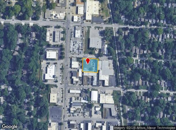
Property Record
319 W 79Th Ter, Kansas City, MO 64114


Current Lease Availabilities
NEARBY LISTINGS FOR SALE OR LEASE
Property Detail
319 W 79Th Ter
Kansas City, MO-KS
Broadland
47-830-05-02-00-0-00-000
BROADLAND LOTS 346-347-348 & 349
Industrialgeneral
Jackson
X
Missouri
29095C0376G
347
2024
0.52 AC
2025
Midtown South
009400
Kansas City
6,024 SF
DEMOGRAPHICS near 319 W 79Th Ter
1 Mile
3 Mile
5 Mile
2024 Total Population
12,443
91,471
237,786
2029 Population
12,369
92,702
242,595
Pop Growth 2024-2029
(0.59%)
+ 1.35%
+ 2.02%
Average Age
40
40
40
2024 Total Households
6,307
40,123
108,753
HH Growth 2024-2029
(0.79%)
+ 1.22%
+ 2.01%
Median Household Inc
$83,235
$82,474
$73,344
Avg Household Size
1.90
2.20
2.10
2024 Avg HH Vehicles
2.00
2.00
2.00
Median Home Value
$229,388
$317,875
$289,758
Median Year Built
1951
1954
1958
Nearby Places
- Restaurants
- Banks
- Shops
- Fitness
- Groceries
PUBLIC TRANSPORTATION
COMMUTER RAIL
Kansas City (Lincoln Service Missouri River Runner - Amtrak, Missouri River Runner - Amtrak, Southwest Chief - Amtrak)
DRIVE
WALK
Distance
Kansas City (Lincoln Service Missouri River Runner - Amtrak, Missouri River Runner - Amtrak, Southwest Chief - Amtrak)
17 min
7.4 mi
AIRPORT
Kansas City International
DRIVE
WALK
Distance
Kansas City International
44 min
27.6 mi
Freight Ports
Tulsa Port Of Catoosa
DRIVE
WALK
Distance
Tulsa Port Of Catoosa
260 min
229.4 mi
Nearby Properties
Address
Land Use
TOTAL SIZE
Lot Size
Zoning
Address
Land Use
TOTAL SIZE
Lot Size
Zoning
183,684 SF
36.94 AC
R-1A
Address
Land Use
TOTAL SIZE
Lot Size
Zoning
616,742 SF
13.59 AC
Address
Land Use
TOTAL SIZE
Lot Size
Zoning
188,248 SF
4.78 AC
C-2
Address
Land Use
TOTAL SIZE
Lot Size
Zoning
552,475 SF
Address
Land Use
TOTAL SIZE
Lot Size
Zoning
73,793 SF
9.21 AC
R-1A
Address
Land Use
TOTAL SIZE
Lot Size
Zoning
465,394 SF
16.63 AC
Address
Land Use
TOTAL SIZE
Lot Size
Zoning
99,812 SF
3.85 AC
R-1A
Address
Land Use
TOTAL SIZE
Lot Size
Zoning
120,225 SF
9.13 AC
R-1
Address
Land Use
TOTAL SIZE
Lot Size
Zoning
387,197 SF
Address
Land Use
TOTAL SIZE
Lot Size
Zoning
124,249 SF
6.13 AC
R-1B
Address
Land Use
TOTAL SIZE
Lot Size
Zoning
106,648 SF
16.93 AC
R-1A
Address
Land Use
TOTAL SIZE
Lot Size
Zoning
457,500 SF
Address
Land Use
TOTAL SIZE
Lot Size
Zoning
109,553 SF
3.08 AC
Address
Land Use
TOTAL SIZE
Lot Size
Zoning
67,981 SF
7.12 AC
R-1A
Address
Land Use
TOTAL SIZE
Lot Size
Zoning
785,016 SF
23.73 AC
Address
Land Use
TOTAL SIZE
Lot Size
Zoning
151,831 SF
12.93 AC
Address
Land Use
TOTAL SIZE
Lot Size
Zoning
36,324 SF
16.55 AC
R-1A
Address
Land Use
TOTAL SIZE
Lot Size
Zoning
257,979 SF
14.35 AC
C-2
Address
Land Use
TOTAL SIZE
Lot Size
Zoning
68,004 SF
7.75 AC
R-1B
Address
Land Use
TOTAL SIZE
Lot Size
Zoning
262,727 SF
16.81 AC
C-2
Address
Land Use
TOTAL SIZE
Lot Size
Zoning
194,371 SF
12.94 AC
R2A
Address
Land Use
TOTAL SIZE
Lot Size
Zoning
244,478 SF
26.69 AC
Address
Land Use
TOTAL SIZE
Lot Size
Zoning
62,625 SF
10.23 AC
R-1A
Address
Land Use
TOTAL SIZE
Lot Size
Zoning
431,078 SF
Address
Land Use
TOTAL SIZE
Lot Size
Zoning
64,582 SF
7.45 AC
R-1A
Address
Land Use
TOTAL SIZE
Lot Size
Zoning
423,342 SF
13 AC
Address
Land Use
TOTAL SIZE
Lot Size
Zoning
65,128 SF
8.70 AC
Address
Land Use
TOTAL SIZE
Lot Size
Zoning
260,629 SF
7.17 AC
Address
Land Use
TOTAL SIZE
Lot Size
Zoning
12,900 SF
1.05 AC
R-1A
Address
Land Use
TOTAL SIZE
Lot Size
Zoning
202,498 SF
The World's #1 Commercial Real Estate Marketplace
Connect with us
© 2025 CoStar Group
The information above has been obtained from sources believed reliable. While we do not doubt its accuracy we have not verified it and make no guarantee, warranty or representation about it. It is your responsibility to independently confirm its accuracy and completeness. Any projections, opinions, assumptions, or estimates used are for example only and do not represent the current or future performance of the property. The value of this transaction to you depends on tax and other factors which should be evaluated by your tax, financial, and legal advisors. You and your advisors should conduct a careful, independent investigation of the property to determine to your satisfaction the suitability of the property for your needs.