Property Record
3190 Furman Dr, Marylhurst, OR 97036
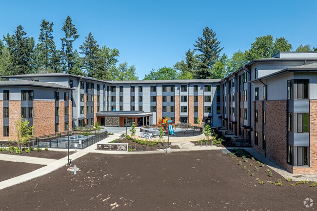


Property Detail
3190 Furman Dr
05033666
PARTITION PLAT 2022-044 PARCEL 4 SEE RELATED PROPERTY 00404A1
Multifamilydwelling
CLACKAMAS
CI
Oregon
B and X Area of moderate flood hazard, usually the area between the limits of the 100-year and 500-year floods.
4.30 AC
2025
Robinwood
2025
Portland
020505
Portland-Vancouver-Hillsboro, OR-WA
NEARBY LISTINGS FOR SALE OR LEASE
DEMOGRAPHICS near 3190 Furman Dr
1 mile
3 mile
5 mile
2025 Total Population
8,875
85,659
221,895
2030 Population
8,828
85,712
222,079
Pop Growth 2025-2030
(0.53%)
+ 0.06%
+ 0.08%
Average Age
48
44
43
2025 Total Households
3,668
34,355
88,850
HH Growth 2025-2030
(0.79%)
+ 0.04%
+ 0.03%
Median Household Inc
$126,758
$107,828
$105,009
Avg Household Size
2.30
2.40
2.40
2025 Avg HH Vehicles
2.00
2.00
2.00
Median Home Value
$717,592
$690,972
$681,038
Median Year Built
1977
1976
1977
Nearby Places
Map Layers
Map Styles
 Street
 Aerial
Transit
 Traffic
 Biking
Places
Listings with unknown addresses are not visible on the map
- Restaurants
- Banks
- Shops
- Fitness
- Groceries
PUBLIC TRANSPORTATION
COMMUTER RAIL
Oregon City Amtrak (Amtrak Cascades - Amtrak)
Drive
Walk
Distance
Oregon City Amtrak (Amtrak Cascades - Amtrak)
15 min
5.6 mi
Tualatin (Westside Express Service - Tri-County Metropolitan Transportation District of Oregon Rail (TriMet Rail))
Drive
Walk
Distance
Tualatin (Westside Express Service - Tri-County Metropolitan Transportation District of Oregon Rail (TriMet Rail))
19 min
9.5 mi
AIRPORT
Portland International
Drive
Walk
Distance
Portland International
39 min
22.7 mi
Freight Ports
Port of Portland
Drive
Walk
Distance
Port of Portland
27 min
13.2 mi
Nearby Properties
Address
Land Use
TOTAL SIZE
Lot Size
Zoning
Address
Land Use
TOTAL SIZE
Lot Size
Zoning
28.30 AC
EC/R-0
Address
Land Use
TOTAL SIZE
Lot Size
Zoning
1 SF
1 AC
PF
Address
Land Use
TOTAL SIZE
Lot Size
Zoning
3,550 SF
3.99 AC
DMU
Address
Land Use
TOTAL SIZE
Lot Size
Zoning
1 SF
0.14 AC
EC
Address
Land Use
TOTAL SIZE
Lot Size
Zoning
10.35 AC
PF
Address
Land Use
TOTAL SIZE
Lot Size
Zoning
0.26 AC
C3
Address
Land Use
TOTAL SIZE
Lot Size
Zoning
21.39 AC
CI
Address
Land Use
TOTAL SIZE
Lot Size
Zoning
11.35 AC
C3
Address
Land Use
TOTAL SIZE
Lot Size
Zoning
62,048 SF
8.58 AC
R20
Address
Land Use
TOTAL SIZE
Lot Size
Zoning
35.26 AC
PNA
Address
Land Use
TOTAL SIZE
Lot Size
Zoning
11.10 AC
HDR
Address
Land Use
TOTAL SIZE
Lot Size
Zoning
3.11 AC
GC
Address
Land Use
TOTAL SIZE
Lot Size
Zoning
1,008 SF
10 AC
R3
Address
Land Use
TOTAL SIZE
Lot Size
Zoning
2,482 SF
5.14 AC
MR
Address
Land Use
TOTAL SIZE
Lot Size
Zoning
16.49 AC
MUD
Address
Land Use
TOTAL SIZE
Lot Size
Zoning
3.45 AC
R-15
Address
Land Use
TOTAL SIZE
Lot Size
Zoning
3.18 AC
C3
Address
Land Use
TOTAL SIZE
Lot Size
Zoning
8.27 AC
MR
Address
Land Use
TOTAL SIZE
Lot Size
Zoning
Address
Land Use
TOTAL SIZE
Lot Size
Zoning
9.21 AC
R3
Address
Land Use
TOTAL SIZE
Lot Size
Zoning
980 SF
6.19 AC
GC
Address
Land Use
TOTAL SIZE
Lot Size
Zoning
6 AC
HDR
Address
Land Use
TOTAL SIZE
Lot Size
Zoning
2,031 SF
3.91 AC
R10
Address
Land Use
TOTAL SIZE
Lot Size
Zoning
9.67 AC
C3
Address
Land Use
TOTAL SIZE
Lot Size
Zoning
1.43 AC
C3
Address
Land Use
TOTAL SIZE
Lot Size
Zoning
6.16 AC
GC
Address
Land Use
TOTAL SIZE
Lot Size
Zoning
Address
Land Use
TOTAL SIZE
Lot Size
Zoning
1 SF
0.55 AC
EC
Address
Land Use
TOTAL SIZE
Lot Size
Zoning
5.43 AC
SHD
Address
Land Use
TOTAL SIZE
Lot Size
Zoning
4.56 AC
MR
The World's #1 Commercial Real Estate Marketplace
Connect with us
© 2026 CoStar Group
The information above has been obtained from sources believed reliable. While we do not doubt its accuracy we have not verified it and make no guarantee, warranty or representation about it. It is your responsibility to independently confirm its accuracy and completeness. Any projections, opinions, assumptions, or estimates used are for example only and do not represent the current or future performance of the property. The value of this transaction to you depends on tax and other factors which should be evaluated by your tax, financial, and legal advisors. You and your advisors should conduct a careful, independent investigation of the property to determine to your satisfaction the suitability of the property for your needs.