Property Record
31928 State Highway 100, Los Fresnos, TX 78566
NEARBY LISTINGS FOR SALE OR LEASE
-
-
View all Los Fresnos listings for sale on LoopNet.com
Property Detail
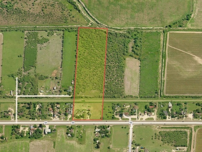
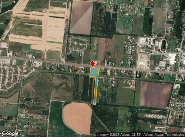
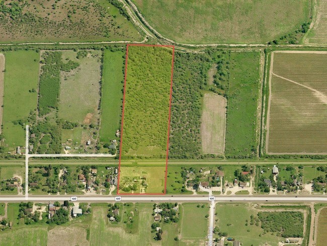
31928 State Highway 100
750181-0000-070000
Fresnos Land & Irrg Co Subdivision
Commercialnec
FRESNOS LAND & IRRG CO SUBDIVISION 9.0114 ACRES OF 1 ACS BLK 181 & EPT BLK 183
X
Cameron
48061C0435F
Texas
2024
9.01 AC
2025
Greater Brownsville
012404
Brownsville/Harlingen
2,042 SF
Brownsville-Harlingen, TX
DEMOGRAPHICS near 31928 State Highway 100
1 Mile
3 Mile
5 Mile
2024 Total Population
2,112
16,437
38,203
2029 Population
2,193
17,047
39,633
Pop Growth 2024-2029
+ 3.84%
+ 3.71%
+ 3.74%
Average Age
33
34
34
2024 Total Households
595
4,706
10,855
HH Growth 2024-2029
+ 3.87%
+ 3.72%
+ 3.87%
Median Household Inc
$59,807
$52,201
$62,311
Avg Household Size
3.60
3.40
3.40
2024 Avg HH Vehicles
2.00
2.00
2.00
Median Home Value
$163,157
$135,145
$154,914
Median Year Built
2002
1999
2001
Nearby Places
- Restaurants
- Banks
- Shops
- Fitness
- Groceries
PUBLIC TRANSPORTATION
AIRPORT
Brownsville/South Padre Island International
DRIVE
WALK
Distance
Brownsville/South Padre Island International
23 min
16.2 mi
Valley International
DRIVE
WALK
Distance
Valley International
25 min
18.0 mi
Freight Ports
Port of Brownsville
DRIVE
WALK
Distance
Port of Brownsville
15 min
12.4 mi
SALE & LEASE HISTORY
LISTING DATE
SALE/LEASE

Sep 24, 2016
For Sale
Nearby Properties
Address
Land Use
TOTAL SIZE
Lot Size
Zoning
Address
Land Use
TOTAL SIZE
Lot Size
Zoning
230,098 SF
12.01 AC
Address
Land Use
TOTAL SIZE
Lot Size
Zoning
218,765 SF
1.95 AC
Address
Land Use
TOTAL SIZE
Lot Size
Zoning
195,304 SF
33.09 AC
C
Address
Land Use
TOTAL SIZE
Lot Size
Zoning
123,695 SF
15.77 AC
Address
Land Use
TOTAL SIZE
Lot Size
Zoning
55.62 AC
Address
Land Use
TOTAL SIZE
Lot Size
Zoning
44,094 SF
2.09 AC
Address
Land Use
TOTAL SIZE
Lot Size
Zoning
6,834 SF
20.31 AC
C
Address
Land Use
TOTAL SIZE
Lot Size
Zoning
84,577 SF
15.05 AC
Address
Land Use
TOTAL SIZE
Lot Size
Zoning
12,049 SF
2.06 AC
Address
Land Use
TOTAL SIZE
Lot Size
Zoning
33,052 SF
3.01 AC
Address
Land Use
TOTAL SIZE
Lot Size
Zoning
25,984 SF
1.17 AC
Address
Land Use
TOTAL SIZE
Lot Size
Zoning
8,477 SF
0.57 AC
Address
Land Use
TOTAL SIZE
Lot Size
Zoning
17,730 SF
0.65 AC
Address
Land Use
TOTAL SIZE
Lot Size
Zoning
29,688 SF
7.27 AC
Address
Land Use
TOTAL SIZE
Lot Size
Zoning
21,656 SF
1.15 AC
Address
Land Use
TOTAL SIZE
Lot Size
Zoning
6,430 SF
1.66 AC
Address
Land Use
TOTAL SIZE
Lot Size
Zoning
27,148 SF
3.50 AC
A-C
Address
Land Use
TOTAL SIZE
Lot Size
Zoning
20,521 SF
4.58 AC
Address
Land Use
TOTAL SIZE
Lot Size
Zoning
38.50 AC
C
Address
Land Use
TOTAL SIZE
Lot Size
Zoning
17,312 SF
1.15 AC
Address
Land Use
TOTAL SIZE
Lot Size
Zoning
4,828 SF
0.92 AC
Address
Land Use
TOTAL SIZE
Lot Size
Zoning
12,984 SF
0.86 AC
Address
Land Use
TOTAL SIZE
Lot Size
Zoning
3,650 SF
1.58 AC
Address
Land Use
TOTAL SIZE
Lot Size
Zoning
4,888 SF
4.65 AC
Address
Land Use
TOTAL SIZE
Lot Size
Zoning
34,840 SF
2.78 AC
C
Address
Land Use
TOTAL SIZE
Lot Size
Zoning
1,200 SF
8.97 AC
A-R
Address
Land Use
TOTAL SIZE
Lot Size
Zoning
4,033 SF
8.53 AC
C
Address
Land Use
TOTAL SIZE
Lot Size
Zoning
12,646 SF
0.62 AC
Address
Land Use
TOTAL SIZE
Lot Size
Zoning
14,578 SF
0.93 AC
Address
Land Use
TOTAL SIZE
Lot Size
Zoning
4,785 SF
1.68 AC
A-R
The World's #1 Commercial Real Estate Marketplace
Connect with us
© 2025 CoStar Group
The information above has been obtained from sources believed reliable. While we do not doubt its accuracy we have not verified it and make no guarantee, warranty or representation about it. It is your responsibility to independently confirm its accuracy and completeness. Any projections, opinions, assumptions, or estimates used are for example only and do not represent the current or future performance of the property. The value of this transaction to you depends on tax and other factors which should be evaluated by your tax, financial, and legal advisors. You and your advisors should conduct a careful, independent investigation of the property to determine to your satisfaction the suitability of the property for your needs.