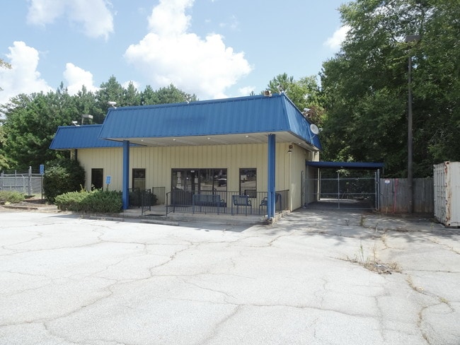
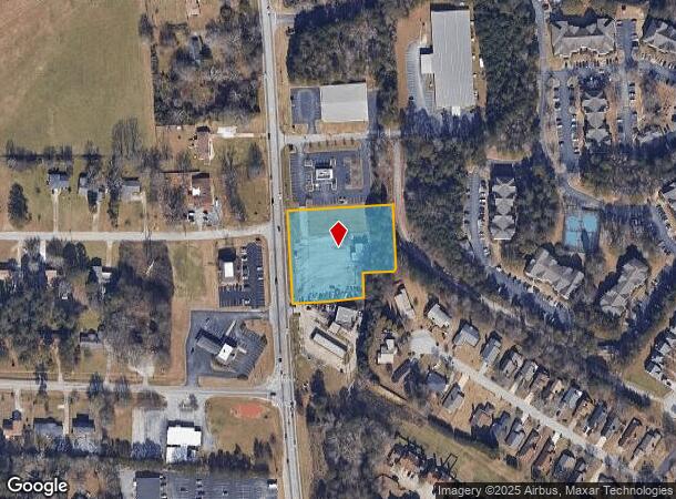
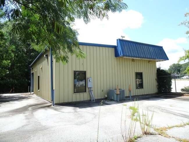
Property Record
3198 Salem Rd Se, Conyers, GA 30013
NEARBY LISTINGS FOR SALE OR LEASE
-
-
View all Conyers listings for sale on LoopNet.com
Property Detail
3198 Salem Rd Se
0012000000167A00
Salem Rd Corridor
Officebuilding
0.919 AC TR 3 SALEM RD
X
Newton
13247C0176D
Georgia
2025
0.92 AC
2025
Lithonia/Conyers
100504
Atlanta
1,800 SF
Atlanta-Sandy Springs-Roswell, GA
DEMOGRAPHICS near 3198 Salem Rd Se
1 Mile
3 Mile
5 Mile
2024 Total Population
10,703
48,769
95,907
2029 Population
11,582
52,292
102,627
Pop Growth 2024-2029
+ 8.21%
+ 7.22%
+ 7.01%
Average Age
37
38
38
2024 Total Households
3,962
16,902
33,797
HH Growth 2024-2029
+ 8.56%
+ 7.39%
+ 7.11%
Median Household Inc
$54,109
$72,928
$70,076
Avg Household Size
2.70
2.80
2.80
2024 Avg HH Vehicles
2.00
2.00
2.00
Median Home Value
$195,769
$208,844
$193,979
Median Year Built
1995
1996
1993
Nearby Places
Map Layers
Map Styles
 Street
 Aerial
- Restaurants
- Banks
- Shops
- Fitness
- Groceries
PUBLIC TRANSPORTATION
AIRPORT
Hartsfield - Jackson Atlanta International
DRIVE
WALK
Distance
Hartsfield - Jackson Atlanta International
44 min
33.1 mi
Freight Ports
Georgia Ports - Savannah
DRIVE
WALK
Distance
Georgia Ports - Savannah
274 min
237.8 mi
SALE & LEASE HISTORY
LISTING DATE
SALE/LEASE

Aug 25, 2019
For Sale
Nearby Properties
Address
Land Use
TOTAL SIZE
Lot Size
Zoning
Address
Land Use
TOTAL SIZE
Lot Size
Zoning
4,734 SF
35.19 AC
RMF
Address
Land Use
TOTAL SIZE
Lot Size
Zoning
4,162 SF
37.52 AC
R3
Address
Land Use
TOTAL SIZE
Lot Size
Zoning
306,886 SF
118.50 AC
R2
Address
Land Use
TOTAL SIZE
Lot Size
Zoning
1,648 SF
25.08 AC
C1
Address
Land Use
TOTAL SIZE
Lot Size
Zoning
882,960 SF
0.01 AC
Address
Land Use
TOTAL SIZE
Lot Size
Zoning
135,000 SF
24.77 AC
M1
Address
Land Use
TOTAL SIZE
Lot Size
Zoning
324,975 SF
35.98 AC
M1
Address
Land Use
TOTAL SIZE
Lot Size
Zoning
8,268 SF
46.94 AC
R3
Address
Land Use
TOTAL SIZE
Lot Size
Zoning
175,605 SF
39.99 AC
AR
Address
Land Use
TOTAL SIZE
Lot Size
Zoning
33,216 SF
8.26 AC
MXD/CID/MU
Address
Land Use
TOTAL SIZE
Lot Size
Zoning
163,807 SF
10.60 AC
M1
Address
Land Use
TOTAL SIZE
Lot Size
Zoning
17,056 SF
16.78 AC
C1
Address
Land Use
TOTAL SIZE
Lot Size
Zoning
131,111 SF
22.17 AC
R3
Address
Land Use
TOTAL SIZE
Lot Size
Zoning
372,762 SF
32.27 AC
A1
Address
Land Use
TOTAL SIZE
Lot Size
Zoning
5,160 SF
45.17 AC
C1
Address
Land Use
TOTAL SIZE
Lot Size
Zoning
28,472 SF
42.73 AC
OI
Address
Land Use
TOTAL SIZE
Lot Size
Zoning
882,960 SF
114.02 AC
M1
Address
Land Use
TOTAL SIZE
Lot Size
Zoning
154,980 SF
17.37 AC
M1
Address
Land Use
TOTAL SIZE
Lot Size
Zoning
8,156 SF
14.49 AC
C1
Address
Land Use
TOTAL SIZE
Lot Size
Zoning
8,832 SF
8.26 AC
C1
Address
Land Use
TOTAL SIZE
Lot Size
Zoning
8,632 SF
8.11 AC
C1
Address
Land Use
TOTAL SIZE
Lot Size
Zoning
42,540 SF
2.40 AC
MXD
Address
Land Use
TOTAL SIZE
Lot Size
Zoning
77,016 SF
15.68 AC
C2
Address
Land Use
TOTAL SIZE
Lot Size
Zoning
125,971 SF
23.84 AC
C1
Address
Land Use
TOTAL SIZE
Lot Size
Zoning
130,000 SF
33.48 AC
R1
Address
Land Use
TOTAL SIZE
Lot Size
Zoning
115,823 SF
14.20 AC
M1
Address
Land Use
TOTAL SIZE
Lot Size
Zoning
65,360 SF
75.51 AC
E6
Address
Land Use
TOTAL SIZE
Lot Size
Zoning
65,520 SF
35 AC
E6
Address
Land Use
TOTAL SIZE
Lot Size
Zoning
65,008 SF
23.81 AC
R2
Address
Land Use
TOTAL SIZE
Lot Size
Zoning
19,197 SF
9.72 AC
R3
The World's #1 Commercial Real Estate Marketplace
Connect with us
© 2025 CoStar Group
The information above has been obtained from sources believed reliable. While we do not doubt its accuracy we have not verified it and make no guarantee, warranty or representation about it. It is your responsibility to independently confirm its accuracy and completeness. Any projections, opinions, assumptions, or estimates used are for example only and do not represent the current or future performance of the property. The value of this transaction to you depends on tax and other factors which should be evaluated by your tax, financial, and legal advisors. You and your advisors should conduct a careful, independent investigation of the property to determine to your satisfaction the suitability of the property for your needs.